world.wikisort.org - Australia
Barron Gorge is a rural locality in the Cairns Region, Queensland, Australia.[2] In the 2016 census Barron Gorge had a population of 0 people.[1]
| Barron Gorge Queensland | |||||||||||||||
|---|---|---|---|---|---|---|---|---|---|---|---|---|---|---|---|
 Barron Gorge, 2017 | |||||||||||||||
 Barron Gorge | |||||||||||||||
| Coordinates | 16.8816°S 145.6644°E | ||||||||||||||
| Population | 0 (2016 census)[1] | ||||||||||||||
| • Density | 0.00/km2 (0.00/sq mi) | ||||||||||||||
| Postcode(s) | 4870 | ||||||||||||||
| Area | 13.3 km2 (5.1 sq mi) | ||||||||||||||
| Time zone | AEST (UTC+10:00) | ||||||||||||||
| Location |
| ||||||||||||||
| LGA(s) | Cairns Region | ||||||||||||||
| State electorate(s) | Barron River | ||||||||||||||
| Federal division(s) | Leichhardt | ||||||||||||||
| |||||||||||||||
Springs is a neighbourhood in the narrow centre part of the locality (16.8666°S 145.6666°E).[3]
Geography
Almost the entire area of the locality is undeveloped land within the Barron Gorge National Park which also extends into a number of neighbouring localities. The land rises from approximately 10 metres above sea level to the east of the locality up to a number of named peaks, including:[4]
- Red Peak, 590 metres (1,940 ft) above sea level in the north of the locality (16.8505°S 145.6722°E).[5]
- North Peak, 730 metres (2,400 ft) in the middle of the locality (16.8941°S 145.6736°E)[6]
- Mount Williams, also known as Tokim Peak, 1,010 metres (3,310 ft) in the south of the locality (16.9133°S 145.6633°E)[7]
- Red Bluff, a cliff (16.8666°S 145.6666°E)[8]
The name of the locality derives from the gorge created by the Barron River through the Macalister Range and the Lamb Range.[9][10]
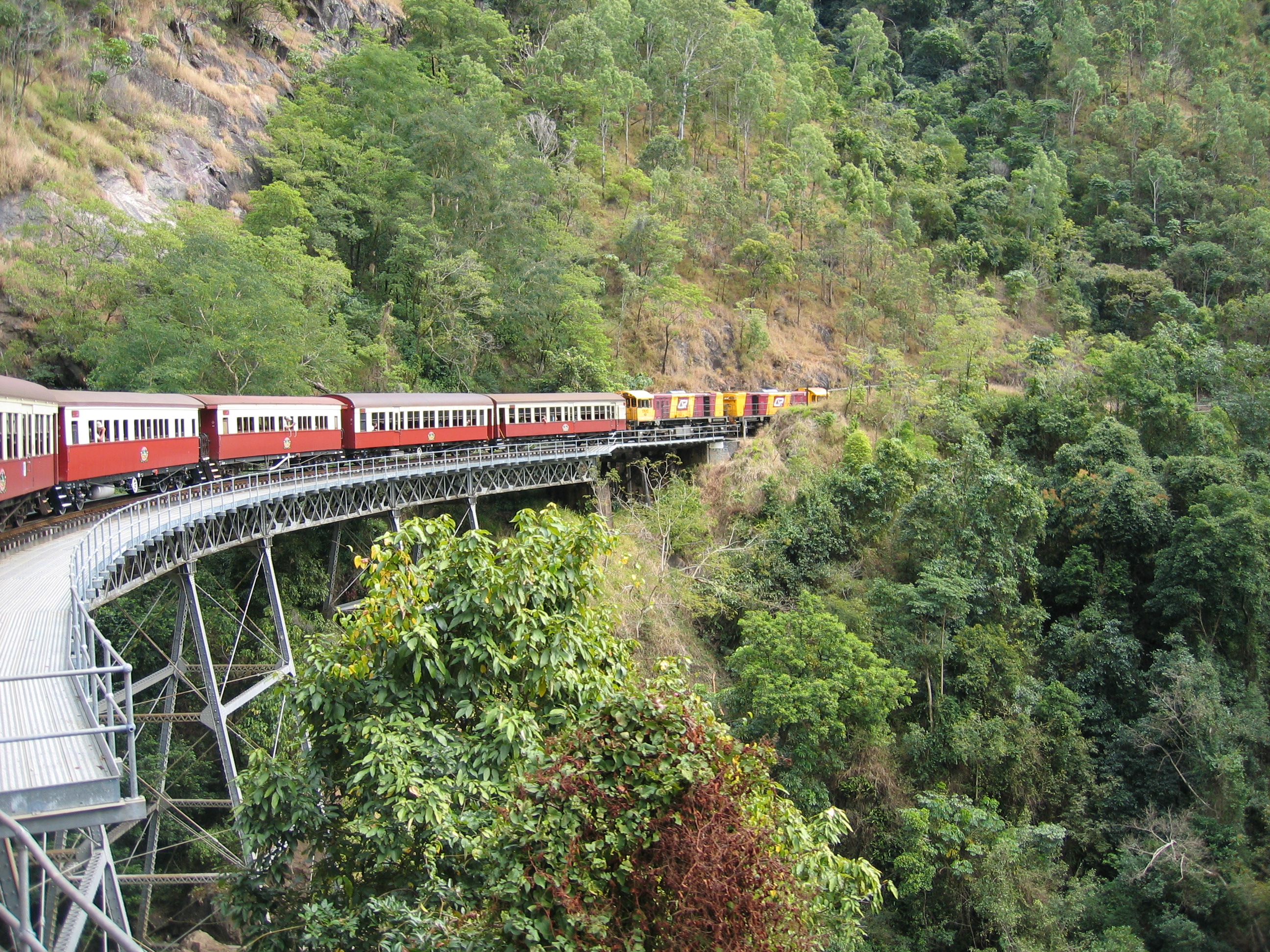
The Cairns-to-Kuranda railway line provides the north-western boundary of the locality and also part of the south-eastern locality. The railway line is used by the Kuranda Scenic Railway tourist service which includes stops at scenic lookouts.[10] There were two railway stations on this line within the locality:
- Springs railway station, now abandoned (16.8695°S 145.6650°E).[11]
- Stoney Creek railway station (16.8801°S 145.6533°E),[11] situated where the railway line crosses Stoney Creek (16.8651°S 145.6677°E), a tributary of the Barron River[12]
There is only one road through the locality, the Barron Gorge Road, which starts in Carvonica and Kamerunga and provides access to the Barron Gorge Hydroelectric Power Station.[10]
History
In the 2016 census Barron Gorge had a population of 0 people.[1]
Attractions
The Skyrail Rainforest Cableway passes through the locality with Red Peak Station (16.8493°S 145.6695°E),[13][14] a stopping point within the locality which features guided boardwalk tours through ancient tropical rainforests, featuring a 400-year-old Kauri pine tree. There is no entry to the cableway from the locality; its terminals are in Smithfield and Kuranda.[15]
References
- Australian Bureau of Statistics (27 June 2017). "Barron Gorge (SSC)". 2016 Census QuickStats. Retrieved 20 October 2018.
- "Barron Gorge – locality in Cairns Region (entry 48514)". Queensland Place Names. Queensland Government. Retrieved 26 December 2020.
- "Springs – locality unbounded in Cairns Regional (entry 31996)". Queensland Place Names. Queensland Government. Retrieved 26 December 2020.
- "Mountain peaks and capes - Queensland". Queensland Open Data. Queensland Government. 12 November 2020. Archived from the original on 25 November 2020. Retrieved 25 November 2020.
- "Red Peak – peak in Cairns Regional (entry 28180)". Queensland Place Names. Queensland Government. Retrieved 26 December 2020.
- "North Peak – peak in Cairns Regional (entry 24694)". Queensland Place Names. Queensland Government. Retrieved 26 December 2020.
- "Mount Williams – peak in Cairns Regional (entry 34731)". Queensland Place Names. Queensland Government. Retrieved 26 December 2020.
- "Red Bluff – cliff in Cairns Regional (entry 28126)". Queensland Place Names. Queensland Government. Retrieved 26 December 2020.
- "Barron Gorge National Park". Parks and forests. Queensland Government. 8 September 2006. Archived from the original on 26 March 2021. Retrieved 1 April 2021.
- "Queensland Globe". State of Queensland. Retrieved 4 March 2018.
- "Railway stations and sidings - Queensland". Queensland Open Data. Queensland Government. 2 October 2020. Archived from the original on 5 October 2020. Retrieved 5 October 2020.
- "Stony Creek – watercourse in Cairns Regional (entry 32552)". Queensland Place Names. Queensland Government. Retrieved 26 December 2020.
- "Aerial cableway - Queensland". Queensland Open Data. Queensland Government. 18 November 2020. Archived from the original on 24 November 2020. Retrieved 24 November 2020.
- "Tourist points - Queensland". Queensland Open Data. Queensland Government. 18 November 2020. Archived from the original on 24 November 2020. Retrieved 24 November 2020.
- "Skyrail Rainforest Cableway". Kuranda Info. Archived from the original on 5 March 2021. Retrieved 1 April 2021.
External links
![]() Media related to Barron Gorge at Wikimedia Commons
Media related to Barron Gorge at Wikimedia Commons
Другой контент может иметь иную лицензию. Перед использованием материалов сайта WikiSort.org внимательно изучите правила лицензирования конкретных элементов наполнения сайта.
WikiSort.org - проект по пересортировке и дополнению контента Википедии