world.wikisort.org - Australien
| City of Latrobe | |
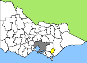 Lage von Latrobe City in Victoria | |
| Gliederung | |
| Staat: | |
| Bundesstaat: | |
| Verwaltungssitz: | Morwell |
| Daten und Zahlen | |
| Fläche: | 1.425,6 km² |
| Einwohner: | 73.257 (2016) [1] |
| Bevölkerungsdichte: | 51 Einwohner je km² |
| Wards: | 9 |
Latrobe City ist ein lokales Verwaltungsgebiet (LGA) im australischen Bundesstaat Victoria, das gleichzeitig Stadtstatus besitzt. Das Gebiet ist 1425,6 km² groß und hat etwa 73.000 Einwohner.[1]
Latrobe liegt etwa 150 km östlich der Hauptstadt Melbourne im Südosten von Victoria und umfasst sechs größere Ortschaften: Boolarra, Churchill, Yallourn North, Moe, Traralgon und Morwell. Der Sitz des City Councils befindet sich in Morwell im Zentrum von Latrobe.
Latrobe City liegt im Latrobe Valley, dem Zentrum des Braunkohleabbaus und der Energieerzeugung in Victoria. Die Kohlekraftwerke in Loy Yang, Hazelwood, Morwell und Yallourn gehören zu den größten Australiens. Allein Loy Yang deckt ein Drittel des Stromverbrauchs des Bundesstaats. Nachteil der Braunkohleverstromung ist allerdings der hohe CO2-Ausstoß. Das Kraftwerk Hazelwood ist laut WWF das Kraftwerk, bei dem im Vergleich der Kraftwerke aller führenden Industrienationen der größte Anteil CO2 anfällt[2]. Hazelwood ist alleine für über 5 % der Emissionen des Treibhausgases von ganz Australien verantwortlich.
Verwaltung
Der Latrobe City Council hat neun Mitglieder, die von den Bewohnern der neun Wards gewählt werden. Diese neun Bezirke sind: Burnett, Dunbar, Farley, Firmin, Galbraith, Gunyah, Merton, Rintoull und Tanjil. Aus dem Kreis der Councillor rekrutiert sich auch der Mayor (Bürgermeister) des Councils.
Weblinks
- Offizielle Seite (englisch)
Einzelnachweise
- Latrobe (C) (Vic.). 2016 Census Quickstat. Australian Bureau of Statistics, 27. Juni 2017, abgerufen am 12. Mai 2020 (englisch).
- Archivierte Kopie (Memento des Originals vom 13. Oktober 2008 im Internet Archive) Info: Der Archivlink wurde automatisch eingesetzt und noch nicht geprüft. Bitte prüfe Original- und Archivlink gemäß Anleitung und entferne dann diesen Hinweis.
На других языках
- [de] Latrobe City
[en] City of Latrobe
The City of Latrobe is a local government area in the Gippsland region in eastern Victoria, Australia, located in the eastern part of the state. It covers an area of 1,426 square kilometres (551 sq mi) and in June 2018 had a population of 75,211.[1] It is primarily urban with the vast majority of its population living within the four major urban areas of Moe, Morwell, Traralgon, and Churchill, and other significant settlements in the LGA include Boolarra, Callignee, Glengarry, Jeeralang, Newborough, Toongabbie, Tyers, Yallourn North and Yinnar. It was formed in 1994 from the amalgamation of the City of Moe, City of Morwell, City of Traralgon, Shire of Traralgon, and parts of the Shire of Narracan and Shire of Rosedale. The Yallourn Works Area was added in 1996.[3] When formed, the municipality was called the Shire of La Trobe, but on 6 April 2000, it adopted its current name.[2][4][ru] Латроб-Сити
Латроб-Сити (англ. Latrobe City) — город в Виктории, Австралия. Город был признан, как центр электроэнергетики Виктории.Другой контент может иметь иную лицензию. Перед использованием материалов сайта WikiSort.org внимательно изучите правила лицензирования конкретных элементов наполнения сайта.
WikiSort.org - проект по пересортировке и дополнению контента Википедии