world.wikisort.org - Armenia
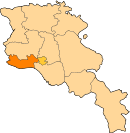
Merdzavan (Armenian: Մերձավան), is a village in the Armavir Province of Armenia, located at the western suburbs of the capital Yerevan, north of the Parakar village.
Merdzavan
Մերձավան | |
|---|---|
 Merdzavan | |
| Coordinates: 40°10′47″N 44°23′59″E | |
| Country | Armenia |
| Province | Armavir |
| Founded | 1947 |
| Elevation | 945 m (3,100 ft) |
| Population (2011) | |
| • Total | 3,303 |
As of the 2011 official census, Merdzavan has a population of 3,303.[1]
Geography
At a height of 945 meters above sea level, Merdzavan is located to the western edge of the Malatia-Sebastia District of the capital Yerevan. It is 40 km east of the provincial centre Armavir and 6 km east of Vagharshapat.
See also
References
На других языках
- [en] Merdzavan
[ru] Мердзаван
Мердзаван (арм. Մերձավան) — село в Армавирской области Армении. Основано в 1947 году[1].Текст в блоке "Читать" взят с сайта "Википедия" и доступен по лицензии Creative Commons Attribution-ShareAlike; в отдельных случаях могут действовать дополнительные условия.
Другой контент может иметь иную лицензию. Перед использованием материалов сайта WikiSort.org внимательно изучите правила лицензирования конкретных элементов наполнения сайта.
Другой контент может иметь иную лицензию. Перед использованием материалов сайта WikiSort.org внимательно изучите правила лицензирования конкретных элементов наполнения сайта.
2019-2025
WikiSort.org - проект по пересортировке и дополнению контента Википедии
WikiSort.org - проект по пересортировке и дополнению контента Википедии
