world.wikisort.org - Angola
Amboiva is a town and commune in the municipality of Seles, province of Cuanza Sul, Angola. It is roughly 55 kilometres east of Uku and 80 kilometres southeast of Gabela.[1] It lies at an altitude of 1244 metres.[2]
Amboiva | |
|---|---|
commune and town | |
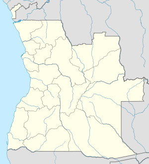  Amboiva Location in Angola | |
| Coordinates: 11°33′S 14°44′E | |
| Country |  Angola Angola |
| Province | Cuanza Sul |
| Municipality | Seles |
| Elevation | 4,081 ft (1,244 m) |
| Time zone | UTC+1 (WAT) |
The People's Armed Forces for the Liberation of Angola (FAPLA) and Cuban troops took the town on 1 February 1976 during the Angolan Civil War.[3]
References
- Instituto de Investigação Científica de Angola (1962). Boletim do Instituto de Investigaçao Científica de Angola. Instituto de Investigaçao Científica de Angola. p. 35. Retrieved 22 March 2012.
- Jessen, Otto (1936). Reisen und forschungen in Angola. Dieter Reimer Verlag. Retrieved 22 March 2012.
- George, Edward (2005). The Cuban Intervention in Angola, 1965-1991: from Che Guevara to Cuito Cuanavale. Frank Cass. p. 110. ISBN 978-0-415-35015-0. Retrieved 22 March 2012.
| Cuanza Sul Province | |
|---|---|
Capital: Sumbe | |
| Sumbe |
|
| Amboim |
|
| Cassongue |
|
| Cela |
|
| Conda |
|
| Ebo |
|
| Libolo | |
| Mussende |
|
| Seles |
|
| Quilenda |
|
| Porto Amboim |
|
| Quibala |
|
 | This Angola location article is a stub. You can help Wikipedia by expanding it. |
Текст в блоке "Читать" взят с сайта "Википедия" и доступен по лицензии Creative Commons Attribution-ShareAlike; в отдельных случаях могут действовать дополнительные условия.
Другой контент может иметь иную лицензию. Перед использованием материалов сайта WikiSort.org внимательно изучите правила лицензирования конкретных элементов наполнения сайта.
Другой контент может иметь иную лицензию. Перед использованием материалов сайта WikiSort.org внимательно изучите правила лицензирования конкретных элементов наполнения сайта.
2019-2026
WikiSort.org - проект по пересортировке и дополнению контента Википедии
WikiSort.org - проект по пересортировке и дополнению контента Википедии