world.wikisort.org - Algeria
Teniet El Abed (Arabic: نية العابد) is a town in the Aurès Mountains of north-eastern Algeria. As of 2008 it had a population of 11,338 people. It is located along National Route 49, 59 kilometres (37 mi) south of Batna, 76 kilometres (47 mi) northeast of Biskra, and 122 kilometres (76 mi) west of Khenchela.
Teniet El Abed
ثية العابد ⵜⵉⵙⵉⵏⵜ ⵍⵄⴻⴱⴷ | |
|---|---|
 | |
 | |
 Teniet El Abed | |
| Coordinates: 35°14′49″N 6°11′26″E | |
| Country | |
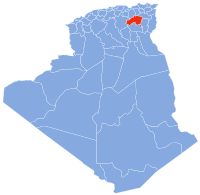
| Province | Batna |
| Population (2008) | |
| • Total | 11,338 |
| Time zone | UTC+1 (West Africa Time) |
History
On January 4, 2003. the Groupe Salafiste pour la Prédication et le Combat (GSPC) ambushed a military convoy at Teniet El-Abed, killing 43 soldiers and wounding 19.[1]
Villages
The commune of Teniet El Abed consists of 25 localities[2]
- Aïn Bendou
- Bali (or Baâli)
- Boughrara
- Draa Taga
- Guerza
- Halaoua Fedj El Kadi
- Khirbèche
- Hidous
- Lakhouada
- M'Zatra
- Moulia
- Ouassas
- Ouled Azzous
- Ouled Malem
- Ouled Si Abbès
- Sara
- Tafrount
- Tanakaret
- Taouzient El Kantara
- Tazourit
- Tchaghat
- Teniet El Abed
- Tizougaghine
- Tizribine
- Tleth
Notable people
- Omar Derdour, figure of the Algerian War of Independence (1913-2009)
- Jean Servier -ethnologist[3]
References
- Vinding, Diana (1 September 2003). The Indigenous World 2002-2003. IWGIA. p. 352. ISBN 978-87-90730-74-1. Retrieved 27 January 2013.
- "Décret n° 84-365, fixant la composition, la consistance et les limites territoriale des communes. Wilaya de Batna". Journal officiel de la République Algérienne. 19 December 1984. p. 1479.
- Horne, Alistair (25 January 1979). A savage war of peace: Algeria, 1954-1962. Penguin Books. p. 88. Retrieved 27 January 2013.
Capital: Batna | ||
| Districts |
|  |
| Communes |
| |
Wikimedia Commons has media related to Teniet El Abed.
This article about a location in Batna Province is a stub. You can help Wikipedia by expanding it. |
Текст в блоке "Читать" взят с сайта "Википедия" и доступен по лицензии Creative Commons Attribution-ShareAlike; в отдельных случаях могут действовать дополнительные условия.
Другой контент может иметь иную лицензию. Перед использованием материалов сайта WikiSort.org внимательно изучите правила лицензирования конкретных элементов наполнения сайта.
Другой контент может иметь иную лицензию. Перед использованием материалов сайта WikiSort.org внимательно изучите правила лицензирования конкретных элементов наполнения сайта.
2019-2026
WikiSort.org - проект по пересортировке и дополнению контента Википедии
WikiSort.org - проект по пересортировке и дополнению контента Википедии