world.wikisort.org - Algeria
Tamest (Arabic: تامست) is a commune in Fenoughil District, Adrar Province, south-central Algeria. According to the 2008 census it has a population of 8,266,[1] up from 6,658 in 1998,[2] with an annual growth rate of 2.2%.[1]
Tamest
ﺗﺄﻣﺎﺳﺖ | |
|---|---|
Commune | |
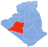
 Location of Tamest commune within Adrar Province | |
 Tamest Location of Tamest within Algeria | |
| Coordinates: 27°25′N 0°14′W | |
| Country | Algeria |
| Province | Adrar |
| District | Fenoughil |
| Elevation | 240 m (790 ft) |
| Population (2008)[1] | |
| • Total | 8,266 |
| Time zone | UTC+1 (CET) |
Geography
The villages in Tamest commune are all found next to oases at an elevation of about 240 metres (790 ft). These oases form part of a long longer string of oases known as the Tuat region, running from north to south through Adrar Province. Beyond the oases, the sandy Erg Chech desert lies to the west and the rocky Tademaït plateau lies to the east.
Climate
Tamest has a hot desert climate (Köppen climate classification BWh), with extremely hot summers and mild winters, and very little precipitation throughout the year.
Transportation
The main road in Tamest commune is the N6 national highway, which runs through the commune from north to south, and connects to Adrar in the north and Reggane in the south. Some local villages lie on the side of the highway while others are connected by short local roads.
Education
5.5% of the population has a tertiary education, and another 12.8% has completed secondary education.[3] The overall literacy rate is 75.3%, and is 85.6% among males and 65.1% among females.[4]
Localities
As of 1984, the commune was composed of 11 localities:[5]
- El Ahmar
- Titaf
- Rharmianou
- Arhil
- Temassekht
- Ikkas
- Ramalt
- Ouled Antar
- Djedid
- Ouled Bou Yahia
- Essoufia
References
- "Population: Wilaya d'Adrar" (PDF) (in French). Office National des Statistiques Algérie. Retrieved 1 July 2013.
- "Algeria Communes". Statoids. Retrieved 8 March 2013.
- "Structure relative de la population résidente des ménages ordinaires et collectifs âgée de 6 ans et plus selon le niveau d'instruction et la commune de résidence" (PDF) (in French). Office National des Statistiques Algérie. Retrieved 1 July 2013.
- "Taux d'analphabétisme et taux d'alphabétisation de la population âgée de 15 ans et plus, selon le sexe et la commune de résidence " (PDF) (in French). Office National des Statistiques Algérie. Retrieved 1 July 2013.
- "Décret n° 84-365, fixant la composition, la consistance et les limites territoriale des communes. Wilaya d'Adrar" (PDF) (in French). Journal officiel de la République Algérienne. 19 December 1984. p. 1472. Archived from the original (PDF) on 2012-11-08. Retrieved 1 July 2013.
Places adjacent to Tamest | ||||||||||||||||
|---|---|---|---|---|---|---|---|---|---|---|---|---|---|---|---|---|
| ||||||||||||||||
Capital: Adrar | ||
| Districts |
|  |
| Communes |
| |
На других языках
[de] Tamest
Tamest ist eine Gemeinde in der Provinz Adrar in der algerischen Sahara.- [en] Tamest
Другой контент может иметь иную лицензию. Перед использованием материалов сайта WikiSort.org внимательно изучите правила лицензирования конкретных элементов наполнения сайта.
WikiSort.org - проект по пересортировке и дополнению контента Википедии