world.wikisort.org - Algeria
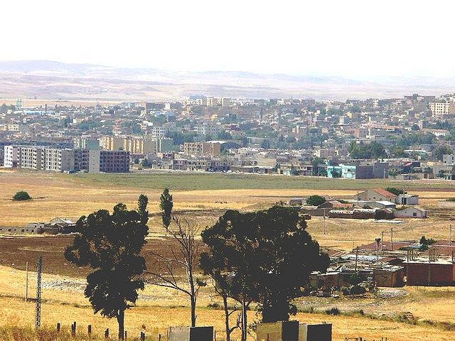
Sedrata (Berber: Isedraten, Arabic: سدراتة) is a municipality and large city in Souk Ahras Province, Algeria, capital of Sedrata District. It has a population of 110.213 as of the 2019 census, which gives it 11 seats in the PMA. Its municipal code is 4102 and postal code is 41200. It is located in the north east of the country, close to the border with Tunisia. It is situated to the west of Souk Ahras. There are four high schools in Sedrata, one of which is a technical school. There is also a centre of formation for jobs for pupils who dropped out of middle school. Sedrata accommodates one of the important paper factories in the east, as well as other factories.
Sedrata / Isedraten
سدراتة | |
|---|---|
Commune and town | |
 | |
 | |
 Sedrata / Isedraten | |
| Coordinates: 36°07′42″N 7°31′53″E | |
| Country | |
| Province | Souk Ahras Province |
| District | Sedrata District |
| Population (2019) | |
| • Total | 110.213 |
| Time zone | UTC+1 (CET) |
Climate
Sedrata has a hot-summer Mediterranean climate (Köppen: (Csa).
| Climate data for Sedrata | |||||||||||||
|---|---|---|---|---|---|---|---|---|---|---|---|---|---|
| Month | Jan | Feb | Mar | Apr | May | Jun | Jul | Aug | Sep | Oct | Nov | Dec | Year |
| Daily mean °C (°F) | 5.4 (41.7) |
6.5 (43.7) |
8.8 (47.8) |
11.7 (53.1) |
16.0 (60.8) |
20.1 (68.2) |
24.1 (75.4) |
24.2 (75.6) |
21.3 (70.3) |
15.4 (59.7) |
10.6 (51.1) |
6.5 (43.7) |
14.2 (57.6) |
| Average precipitation mm (inches) | 74 (2.9) |
63 (2.5) |
56 (2.2) |
45 (1.8) |
50 (2.0) |
21 (0.8) |
9 (0.4) |
11 (0.4) |
32 (1.3) |
42 (1.7) |
55 (2.2) |
66 (2.6) |
524 (20.8) |
| Source: Climate-Data.org[1] | |||||||||||||
References
- "Climate: Sedrata". Climate-Data.org. Retrieved 15 April 2014.
Capital: Souk Ahras | ||
| Districts | 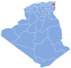 | |
| Communes |
| |
This article about a location in Souk Ahras Province is a stub. You can help Wikipedia by expanding it. |
Другой контент может иметь иную лицензию. Перед использованием материалов сайта WikiSort.org внимательно изучите правила лицензирования конкретных элементов наполнения сайта.
WikiSort.org - проект по пересортировке и дополнению контента Википедии