world.wikisort.org - Algeria
Gdyel (Arabic: قديل), former Saint-Cloud, is a town and commune in District Gdyel, Oran Province, Algeria, about 15 miles to the east of Oran. Under French rule, it was the centre of a wine-growing district and was called St. Cloud.
Gdyel | |
|---|---|
Commune and town | |
 | |
 Gdyel | |
| Coordinates: 35.782171°N 0.423746°W | |
| Country | |
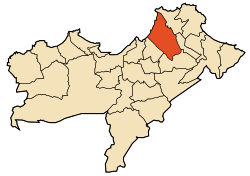
| Province | Oran Province |
| District | Gdyel District |
| Area | |
| • Total | 36.22 sq mi (93.82 km2) |
| Population (2009) | |
| • Total | 39,129 |
| Time zone | UTC+1 (CET) |
According to the 1998 census it has a population of 29 999.[1]
When the Americans invaded Algeria in November 1942 (Operation Torch), the troops who landed at Beach Z, between Arzew and St. Leu (now called Bethioua) were held up for two days by fierce fighting at St. Cloud. Eventually, the town was simply by-passed by Major-General Terry de La Mesa Allen, which surprised the defenders of Oran, who quickly surrendered.[2]
References
- Statoids
- Colin Smith, England's Last War Against France: Fighting Vichy 1940-1942, ISBN, 0297852183, 2009
| Oran District |
|  |
|---|---|---|
| Aïn El Turk District |
| |
| Arzew District |
| |
| Bethioua District |
| |
| Es Sénia District |
| |
| Bir El Djir District |
| |
| Boutlélis District |
| |
| Oued Tlélat District |
| |
| Gdyel District |
| |
{{ar:قديل}} {{fr:Gdyel}}
This article about a location in Oran Province is a stub. You can help Wikipedia by expanding it. |
Другой контент может иметь иную лицензию. Перед использованием материалов сайта WikiSort.org внимательно изучите правила лицензирования конкретных элементов наполнения сайта.
WikiSort.org - проект по пересортировке и дополнению контента Википедии