world.wikisort.org - Algeria
El Maffa (also written El Maja) is a village in the commune of El Ouata,[1] Béchar Province, Algeria. The village is located on the northeast bank of the Oued Saoura 5 kilometres (3.1 mi) southeast of El Ouata. It is connected to El Ouata by a local road along the side of the river, along with the other villages Ammas, Aguedal and El Beïda.[2]
El Maffa | |
|---|---|
Village | |
 El Maffa | |
| Coordinates: 29°50′12″N 1°46′50″W | |
| Country | |
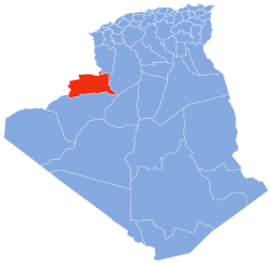
| Province | Béchar Province |
| District | El Ouata District |
| Commune | El Ouata[1] |
| Elevation | 425 m (1,394 ft) |
| Time zone | UTC+1 (CET) |
References
- "Décret n° 84-365, fixant la composition, la consistance et les limites territoriale des communes. Wilaya d'El Oued" (PDF) (in French). Journal officiel de la République Algérienne. 19 December 1984. p. 1490. Archived from the original (PDF) on 2011-07-31. Retrieved 2 March 2013.
- "El Maja, Algeria". Geonames.Org. Retrieved 9 May 2013.
Neighbouring towns and cities
Places adjacent to El Maffa | ||||||||||||||||
|---|---|---|---|---|---|---|---|---|---|---|---|---|---|---|---|---|
| ||||||||||||||||
Capital: Béchar | ||
| Béchar District |
|  |
| Abadla District |
| |
| Béni Abbès District | ||
| Béni Ounif District |
| |
| El Ouata District | ||
| Igli District |
| |
| Kénadsa District |
| |
| Kerzaz District | ||
| Lahmar District | ||
| Ouled Khodeïr District |
| |
| Tabelbala District |
| |
| Taghit District |
| |
This article about a location in Béchar Province is a stub. You can help Wikipedia by expanding it. |
Текст в блоке "Читать" взят с сайта "Википедия" и доступен по лицензии Creative Commons Attribution-ShareAlike; в отдельных случаях могут действовать дополнительные условия.
Другой контент может иметь иную лицензию. Перед использованием материалов сайта WikiSort.org внимательно изучите правила лицензирования конкретных элементов наполнения сайта.
Другой контент может иметь иную лицензию. Перед использованием материалов сайта WikiSort.org внимательно изучите правила лицензирования конкретных элементов наполнения сайта.
2019-2026
WikiSort.org - проект по пересортировке и дополнению контента Википедии
WikiSort.org - проект по пересортировке и дополнению контента Википедии