world.wikisort.org - Algeria
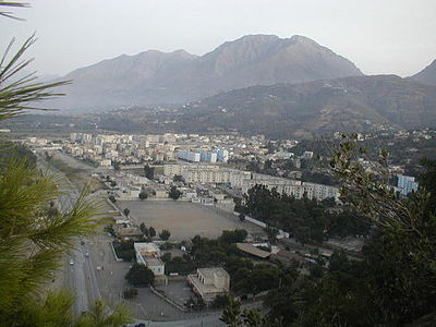
Aokas (Berber language: Aweqqas) is a coastal city and district in the Béjaïa Province in northern Algeria and is located at about 25 kilometres from the province's capital city of Bgayet. The commune of Aokas was created by decree of October 2, 1869. It covered an area of 2,202 hectares and had a population of 2,245 inhabitants in 1931. Its name in berber means shark.[1] Its average altitude is 300 meters.
Aokas / Aweqqas | |
|---|---|
City | |
 | |
 Aokas / Aweqqas | |
| Coordinates: 36°38′N 5°15′E | |
| Country | |
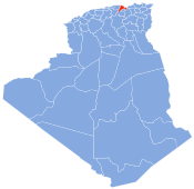
| Province | Béjaïa |
| District | Aokas |
| Government | |
| • President of the People's Municipal Assembly | Lagha Mohamed (2017-2022) |
| Area | |
| • Total | 27.87 km2 (10.76 sq mi) |
| Elevation | 300 m (1,000 ft) |
| • Density | 574/km2 (1,490/sq mi) |
| Time zone | UTC+1 (West Africa Time) |
| Postal code | 06007 |
| NOS code | 0622 |
The population of Aokas (Aweqqas) was of 15 989 in 2008.[2]
Geography
Aokas (transliterated in tifinagh: ⴰⵡⵇⵇⴰⵙ), means shark in berber, is located in the wilaya of Béjaïa, in coastal Kabylia
Hamlets
Apart from the main locality of the commune, the hamlets of Aït Aïssa, Akkar, Mesbah, Tizi Djarmana, Aliouene ou Iaamrounene, Ansa, Tabellout, Tikherroubine, Amerzague, Tala Khaled, Laazib, Tidelsine, Iourarène, Tala Khelifa, Aguemoune, Tarmant I, Tarmant II and El Anseur are located in its confines.[3]
Borders
North -> Mediterranean Sea
North-East -> Mediterranean Sea
East -> Souk El Ténine
South-East -> Souk El Ténine and Taskriout
South -> Taskriout
South-West -> Taskriout and Tizi N'Berber
West -> Tizi N'Berber
North-West -> Tichy
Cityscape
 Aokas (Cape)
 Aokas (...)

References
- "Aweqqas". amawal.wikidot.com (in French). Retrieved 21 January 2019.
- "Décret n°84-365 du 1 novembre 1984 fixant la composition, la consistance et les limites territoriales des communes" (PDF) (in French). Journal officiel de la République algérienne démocratique et populaire. 19 December 1984. p. 1484. Retrieved 20 January 2019.
| Districts |
|  |
|---|---|---|
| Communes |
| |
| Villages and other locales |
| |
This article about a location in Béjaïa Province is a stub. You can help Wikipedia by expanding it. |
Другой контент может иметь иную лицензию. Перед использованием материалов сайта WikiSort.org внимательно изучите правила лицензирования конкретных элементов наполнения сайта.
WikiSort.org - проект по пересортировке и дополнению контента Википедии