world.wikisort.org - Afghanistan
Saydābād (Pashto: سيد اباد) is a city in Maidan Wardak Province, central Afghanistan. It is the administrative center of Saydabad District, and located along the main Kabul-Kandahar Highway.
This article relies largely or entirely on a single source. (October 2017) |
Saydabad | |
|---|---|
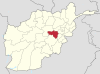
 Saydabad Location in Afghanistan | |
| Coordinates: 34.0004°N 68.7135°E | |
| Country | |
| Province | Maidan Wardak Province |
| District | Saydabad District |
| Elevation | 2,155 m (7,070 ft) |
| Population | |
| • Total | 7,301 |
| Time zone | UTC+4:30 (Afghanistan Standard Time) |
The city of Saydabad has a population of 7,301.[1] It is located within the heartland of the Wardak tribe of Pashtuns.[2]: 10
Geography
Saydabad is located about 2,155 m above sea level.
Demographics
A majority of the population are Pashtuns. Pashto of the Wardagi accent is spoken in the town.
References
- "Markaz-e Sayyidabad, Afghanistan". Falling Rain.
- Coyle, Dennis Walter (2014). Placing Wardak Among Pashto Varieties (Master's thesis). University of North Dakota.
Maidan Wardak Province | ||
|---|---|---|
Capital: Maidan Shar | ||
| Districts |
|  |
| Populated places | ||
| Landforms |
| |
| Other |
| |
This Wardak Province, Afghanistan location article is a stub. You can help Wikipedia by expanding it. |
Текст в блоке "Читать" взят с сайта "Википедия" и доступен по лицензии Creative Commons Attribution-ShareAlike; в отдельных случаях могут действовать дополнительные условия.
Другой контент может иметь иную лицензию. Перед использованием материалов сайта WikiSort.org внимательно изучите правила лицензирования конкретных элементов наполнения сайта.
Другой контент может иметь иную лицензию. Перед использованием материалов сайта WikiSort.org внимательно изучите правила лицензирования конкретных элементов наполнения сайта.
2019-2026
WikiSort.org - проект по пересортировке и дополнению контента Википедии
WikiSort.org - проект по пересортировке и дополнению контента Википедии