world.wikisort.org - Afghanistan
Nawa (other names: Bareh Kheyl, Nāwah, Mahmūd Khel, Barak Khel, Nāwa, Mahmud Khel, Bāreh Kheyl, Bara Khel) is located on 32.3215°N 67.887°E at 2,007 m altitude in the central part of Nawa District, Afghanistan. The town is located within the heartland of the Tarakai tribe of Ghilji Pashtuns.[1]
This article needs additional citations for verification. (June 2020) |
Nawa
ناوه | |
|---|---|
 Nawa Location in Afghanistan | |
| Coordinates: 32°19′17″N 67°53′13″E | |
| Country | |
| Province | Ghazni |
| District | Nawa |
| Elevation | 2,007 m (6,585 ft) |
| Time zone | UTC+4:30 |
Climate
Nawa has a humid continental climate (Köppen climate classification: Dsa) with hot summers and cold winters.
| Climate data for Nawa, Ghazni Province | |||||||||||||
|---|---|---|---|---|---|---|---|---|---|---|---|---|---|
| Month | Jan | Feb | Mar | Apr | May | Jun | Jul | Aug | Sep | Oct | Nov | Dec | Year |
| Daily mean °C (°F) | −5.3 (22.5) |
−1.5 (29.3) |
6.2 (43.2) |
11.8 (53.2) |
17.0 (62.6) |
22.8 (73.0) |
25.1 (77.2) |
23.5 (74.3) |
19.7 (67.5) |
12.8 (55.0) |
6.4 (43.5) |
0.3 (32.5) |
11.6 (52.8) |
| Average precipitation mm (inches) | 52.9 (2.08) |
73.7 (2.90) |
76.5 (3.01) |
51.8 (2.04) |
25.6 (1.01) |
9.9 (0.39) |
22.9 (0.90) |
33.4 (1.31) |
12.0 (0.47) |
6.1 (0.24) |
20.9 (0.82) |
9.7 (0.38) |
395.4 (15.55) |
| Average relative humidity (%) | 51 | 56 | 42 | 31 | 21 | 19 | 29 | 29 | 20 | 22 | 36 | 38 | 33 |
| Source 1: ClimateCharts[2] | |||||||||||||
| Source 2: World Weather Online (precipitation & humidity)[3] | |||||||||||||
Notable people
- Nur Muhammad Taraki (President of Afghanistan from 1978 to 1979);
- Enaiatollah Akbari, the protagonist of the book "In the sea there are crocodiles" by Fabio Geda, which tells of the journey of an Afghan child (Enaiat) who escapes from slavery and travels through the Middle East until eventually arriving in Italy, where he lives.
See also
References
- Ghazni Province Tribal Map (Page 4). Naval Postgraduate School.
- "Climate: Nawah - ClimateCharts, Laura Zepner, Pierre Karrasch, Felix Wiemann & Lars Bernard (2020) ClimateCharts.net – an interactive climate analysis web platform, International Journal of Digital Earth, DOI: 10.1080/17538947.2020.1829112". Retrieved 24 September 2022.
- "Humidity: Nawah - World Weather Online". Retrieved 24 September 2022.
Capital: Ghazni | ||
| Districts | 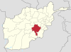 | |
| Populated places |
| |
| Landforms | ||
| Other |
| |
This Ghazni Province, Afghanistan location article is a stub. You can help Wikipedia by expanding it. |
Текст в блоке "Читать" взят с сайта "Википедия" и доступен по лицензии Creative Commons Attribution-ShareAlike; в отдельных случаях могут действовать дополнительные условия.
Другой контент может иметь иную лицензию. Перед использованием материалов сайта WikiSort.org внимательно изучите правила лицензирования конкретных элементов наполнения сайта.
Другой контент может иметь иную лицензию. Перед использованием материалов сайта WikiSort.org внимательно изучите правила лицензирования конкретных элементов наполнения сайта.
2019-2025
WikiSort.org - проект по пересортировке и дополнению контента Википедии
WikiSort.org - проект по пересортировке и дополнению контента Википедии