world.wikisort.org - Afghanistan
Haji Khel is a town located at 32.9928°N 67.9653°E at 2,117 m altitude in the northern part of Ab Band district, Ghazni Province, Afghanistan and is the capital of the district.
This article needs additional citations for verification. (May 2011) |
Haji Khel
حاجی خیل | |
|---|---|
 Haji Khel Location in Afghanistan | |
| Coordinates: 32°59′34″N 67°57′55″E | |
| Country | |
| Province | Ghazni |
| District | Ab Band |
| Elevation | 2,117 m (6,946 ft) |
| Time zone | UTC+4:30 |
Climate
Haji Khel features a humid continental climate with mediterranean precipitation patterns (Köppen: Dsa). It has hot, dry summers and cold, snowy winters.
| Climate data for Haji Khel | |||||||||||||
|---|---|---|---|---|---|---|---|---|---|---|---|---|---|
| Month | Jan | Feb | Mar | Apr | May | Jun | Jul | Aug | Sep | Oct | Nov | Dec | Year |
| Daily mean °C (°F) | −5 (23) |
−2.3 (27.9) |
4.2 (39.6) |
11.3 (52.3) |
17.6 (63.7) |
21.6 (70.9) |
23.6 (74.5) |
22.2 (72.0) |
18.8 (65.8) |
12.3 (54.1) |
5.0 (41.0) |
−0.6 (30.9) |
10.7 (51.3) |
| Average precipitation mm (inches) | 45.9 (1.81) |
83.0 (3.27) |
74.3 (2.93) |
31.1 (1.22) |
12.9 (0.51) |
2.6 (0.10) |
10.9 (0.43) |
9.5 (0.37) |
3.5 (0.14) |
1.3 (0.05) |
26.8 (1.06) |
10.7 (0.42) |
312.5 (12.31) |
| Average relative humidity (%) | 54 | 62 | 47 | 32 | 22 | 17 | 23 | 23 | 17 | 21 | 36 | 39 | 33 |
| Source 1: ClimateCharts[1] | |||||||||||||
| Source 2: World Weather Online (precipitation & humidity)[2] | |||||||||||||
See also
References
- "Climate: Hajikhel - ClimateCharts, Laura Zepner, Pierre Karrasch, Felix Wiemann & Lars Bernard (2020) ClimateCharts.net – an interactive climate analysis web platform, International Journal of Digital Earth". doi:10.1080/17538947.2020.1829112. Retrieved 24 September 2022.
- "Humidity: Hajikhel - World Weather Online". Retrieved 24 September 2022.
Capital: Ghazni | ||
| Districts | 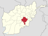 | |
| Populated places |
| |
| Landforms | ||
| Other |
| |
This Ghazni Province, Afghanistan location article is a stub. You can help Wikipedia by expanding it. |
Текст в блоке "Читать" взят с сайта "Википедия" и доступен по лицензии Creative Commons Attribution-ShareAlike; в отдельных случаях могут действовать дополнительные условия.
Другой контент может иметь иную лицензию. Перед использованием материалов сайта WikiSort.org внимательно изучите правила лицензирования конкретных элементов наполнения сайта.
Другой контент может иметь иную лицензию. Перед использованием материалов сайта WikiSort.org внимательно изучите правила лицензирования конкретных элементов наполнения сайта.
2019-2026
WikiSort.org - проект по пересортировке и дополнению контента Википедии
WikiSort.org - проект по пересортировке и дополнению контента Википедии