world.wikisort.org - Afghanistan
Bagrami is a village situated in the eastern fringes of Kabul at 34.4911°N 69.2756°E and 1797 m altitude, part of municipal District 12 and partly in District 22. The population is 31,680 (2007 calculation). Downtown Kabul can be reached in 30 minutes. The Bagrami Industrial Park is one of the major projects for the economy of the region. In 2010 the town also harboured a shanty town of mud-built huts from refugees escaping the violence of the Taliban insurgency in the southern provinces of Afghanistan.[1]
Bagrami | |
|---|---|
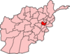
 Bagrami Location in Afghanistan | |
| Coordinates: 34°29′28″N 69°16′32″E | |
| Country | |
| Elevation | 5,896 ft (1,797 m) |
| Population (2007) | |
| • Total | 31,680 |
| Time zone | + 4.30 |
Climate
Bagrami has a hot-summer humid continental climate (Köppen climate classification: Dsa). July is the warmest month of the year. The temperature in July averages 25.0 °C (77.0 °F). At −3.4 °C (25.9 °F) on average, January is the coldest month of the year.
About 415 millimetres (16.3 in) of precipitation falls annually. The driest month is August with 4 millimetres (0.2 in). In April, the precipitation reaches its peak, with an average of 82 millimetres (3.2 in).
| Climate data for Bagrami, Kabul Province | |||||||||||||
|---|---|---|---|---|---|---|---|---|---|---|---|---|---|
| Month | Jan | Feb | Mar | Apr | May | Jun | Jul | Aug | Sep | Oct | Nov | Dec | Year |
| Average high °C (°F) | 2.8 (37.0) |
3.4 (38.1) |
11.1 (52.0) |
18.4 (65.1) |
24.3 (75.7) |
29.1 (84.4) |
31.5 (88.7) |
30.3 (86.5) |
26.3 (79.3) |
20.1 (68.2) |
12.5 (54.5) |
7.0 (44.6) |
18.1 (64.5) |
| Daily mean °C (°F) | −3.4 (25.9) |
−2.4 (27.7) |
4.8 (40.6) |
11.8 (53.2) |
17.6 (63.7) |
22.3 (72.1) |
25.0 (77.0) |
23.9 (75.0) |
19.9 (67.8) |
13.8 (56.8) |
6.7 (44.1) |
0.8 (33.4) |
11.7 (53.1) |
| Average low °C (°F) | −9.6 (14.7) |
−8.2 (17.2) |
−1.6 (29.1) |
5.2 (41.4) |
10.8 (51.4) |
15.4 (59.7) |
18.4 (65.1) |
17.5 (63.5) |
13.4 (56.1) |
7.5 (45.5) |
0.8 (33.4) |
−5.5 (22.1) |
5.3 (41.6) |
| Average precipitation mm (inches) | 44 (1.7) |
63 (2.5) |
69 (2.7) |
82 (3.2) |
54 (2.1) |
14 (0.6) |
9 (0.4) |
4 (0.2) |
8 (0.3) |
16 (0.6) |
25 (1.0) |
27 (1.1) |
415 (16.4) |
| Source: Climate-Data.org[2] | |||||||||||||
See also
Notes
- "Taliban fear drives Afghans from homes"
- "Climate: Bagrami - Climate-Data.org". Retrieved 4 September 2022.
Capital: Kabul | ||
| Districts |
|  |
| Cities |
| |
| Landmarks |
| |
This Kabul Province, Afghanistan location article is a stub. You can help Wikipedia by expanding it. |
Другой контент может иметь иную лицензию. Перед использованием материалов сайта WikiSort.org внимательно изучите правила лицензирования конкретных элементов наполнения сайта.
WikiSort.org - проект по пересортировке и дополнению контента Википедии