world.wikisort.org - Afghanistan
Baghrān (Pashto: بغران) is a village and the district center of Baghran District in Helmand province, Afghanistan. It is located at 33.0669°N 65.0917°E and at an altitude of 1,564 m. The population of Baghran and the nearest settlements is 26,724.
Baghran
بغران | |
|---|---|
 Baghran's main street is being resurfaced as part of a foreign reconstruction project. | |
 | |
| Coordinates: 33°4′1″N 65°5′30″E | |
| Country | |
| Province | Helmand |
| District | Baghran |
| Elevation | 5,131 ft (1,564 m) |
| Population | |
| • Total | 26,724 |
| Time zone | + 4.30 |
In 2005 the United States was funding a $2 million project to pave 700 meters of the Baghran's main road.[1]
It is controlled by the Taliban, and has been called their "most secure stronghold".[2]
Climate
Baghran features a humid continental climate (Köppen: Dsa) with hot summers and moderately cold winters.
| Climate data for Baghran | |||||||||||||
|---|---|---|---|---|---|---|---|---|---|---|---|---|---|
| Month | Jan | Feb | Mar | Apr | May | Jun | Jul | Aug | Sep | Oct | Nov | Dec | Year |
| Daily mean °C (°F) | −2.5 (27.5) |
−0.3 (31.5) |
6.4 (43.5) |
13.7 (56.7) |
17.8 (64.0) |
22.3 (72.1) |
24.0 (75.2) |
22.6 (72.7) |
17.7 (63.9) |
12.2 (54.0) |
5.8 (42.4) |
0.8 (33.4) |
11.7 (53.1) |
| Average precipitation mm (inches) | 46.1 (1.81) |
90.4 (3.56) |
67.0 (2.64) |
40.0 (1.57) |
14.9 (0.59) |
1.2 (0.05) |
0.7 (0.03) |
0.8 (0.03) |
0.7 (0.03) |
6.6 (0.26) |
30.1 (1.19) |
11.4 (0.45) |
309.9 (12.21) |
| Average relative humidity (%) | 41 | 43 | 34 | 25 | 17 | 10 | 11 | 12 | 11 | 19 | 32 | 34 | 24 |
| Source 1: ClimateCharts[3] | |||||||||||||
| Source 2: World Weather Online (precipitation & humidity)[4] | |||||||||||||
See also
Taliban captured Area,
References
- "Afghan Valley to Receive $2.4 Million for Reconstruction". American Forces Press Service. 16 August 2005. Retrieved 18 July 2009.
- "Taliban Present Gentler Face but Wield Iron Fist in Afghan District". The New York Times. 5 August 2015. Retrieved 20 May 2016.
- "Climate: Baghran - ClimateCharts, Laura Zepner, Pierre Karrasch, Felix Wiemann & Lars Bernard (2020) ClimateCharts.net – an interactive climate analysis web platform, International Journal of Digital Earth, DOI: 10.1080/17538947.2020.1829112". Retrieved 20 September 2022.
- "Humidity: Baghran - World Weather Online". Retrieved 20 September 2022.
Capital: Lashkargah | ||
| Districts | 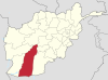 | |
| Populated places | ||
| Landmarks |
| |
| Other |
| |
This Helmand Province, Afghanistan location article is a stub. You can help Wikipedia by expanding it. |
Текст в блоке "Читать" взят с сайта "Википедия" и доступен по лицензии Creative Commons Attribution-ShareAlike; в отдельных случаях могут действовать дополнительные условия.
Другой контент может иметь иную лицензию. Перед использованием материалов сайта WikiSort.org внимательно изучите правила лицензирования конкретных элементов наполнения сайта.
Другой контент может иметь иную лицензию. Перед использованием материалов сайта WikiSort.org внимательно изучите правила лицензирования конкретных элементов наполнения сайта.
2019-2026
WikiSort.org - проект по пересортировке и дополнению контента Википедии
WikiSort.org - проект по пересортировке и дополнению контента Википедии