world.wikisort.org - USA
Woodville Township is one of thirteen townships in Greene County, Illinois, USA. As of the 2010 census, its population was 239 and it contained 128 housing units.[2]
Woodville Township | |
|---|---|
Township | |
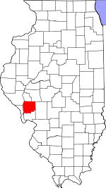
 Location in Greene County | |
 Greene County's location in Illinois | |
| Coordinates: 39°12′26″N 90°31′42″W | |
| Country | United States |
| State | Illinois |
| County | Greene |
| Established | November 4, 1884 |
| Area | |
| • Total | 48.24 sq mi (124.9 km2) |
| • Land | 47.41 sq mi (122.8 km2) |
| • Water | 0.83 sq mi (2.1 km2) 1.72% |
| Elevation | 459 ft (140 m) |
| Population (2010) | |
| • Estimate (2016)[1] | 225 |
| • Density | 5/sq mi (2/km2) |
| Time zone | UTC-6 (CST) |
| • Summer (DST) | UTC-5 (CDT) |
| ZIP codes | 62016, 62027 |
| FIPS code | 17-061-83401 |
Geography
According to the 2010 census, the township has a total area of 48.24 square miles (124.9 km2), of which 47.41 square miles (122.8 km2) (or 98.28%) is land and 0.83 square miles (2.1 km2) (or 1.72%) is water.[2]
Unincorporated towns
- Clark at 39.25977°N 90.577899°W
- East Hardin at 39.160048°N 90.609010°W
- King at 39.230881°N 90.579010°W
- Titus at 39.193381°N 90.578732°W
(This list is based on USGS data and may include former settlements.)
Cemeteries
The township contains these eleven cemeteries: Borlin, Busch, Clark, Cumming, Dayton, Fry, Maberry, Mills, Mount Gilead, Reynolds and Varble.
Major highways
 Illinois Route 16
- Woody Road
Rivers
Demographics
| Historical population | |||
|---|---|---|---|
| Census | Pop. | %± | |
| 2016 (est.) | 225 | [1] | |
| U.S. Decennial Census[3] | |||
School districts
- Calhoun Community Unit School District 40
- Carrollton Community Unit School District 1
Political districts
- Illinois' 17th congressional district
- State House District 97
- State Senate District 49
References
- "Woodville Township, Greene County, Illinois". Geographic Names Information System. United States Geological Survey. Retrieved 2010-01-17.
- United States Census Bureau 2007 TIGER/Line Shapefiles
- United States National Atlas
- "Population and Housing Unit Estimates". Retrieved June 9, 2017.
- "Population, Housing Units, Area, and Density: 2010 - County -- County Subdivision and Place -- 2010 Census Summary File 1". United States Census. Archived from the original on 2020-02-12. Retrieved 2013-05-28.
- "Census of Population and Housing". Census.gov. Retrieved June 4, 2016.
External links
Places adjacent to Woodville Township, Greene County, Illinois | ||||||||||||||||
|---|---|---|---|---|---|---|---|---|---|---|---|---|---|---|---|---|
| ||||||||||||||||
Municipalities and communities of Greene County, Illinois, United States | ||
|---|---|---|
County seat: Carrollton | ||
| Cities |
|  |
| Villages |
| |
| Townships |
| |
| Unincorporated communities | ||
| ||
Текст в блоке "Читать" взят с сайта "Википедия" и доступен по лицензии Creative Commons Attribution-ShareAlike; в отдельных случаях могут действовать дополнительные условия.
Другой контент может иметь иную лицензию. Перед использованием материалов сайта WikiSort.org внимательно изучите правила лицензирования конкретных элементов наполнения сайта.
Другой контент может иметь иную лицензию. Перед использованием материалов сайта WikiSort.org внимательно изучите правила лицензирования конкретных элементов наполнения сайта.
2019-2025
WikiSort.org - проект по пересортировке и дополнению контента Википедии
WikiSort.org - проект по пересортировке и дополнению контента Википедии