world.wikisort.org - USA
Udell Township is one of eighteen townships in Appanoose County, Iowa, United States. As of the 2010 census, its population was 343.[3]
Udell Township, Appanoose County | |
|---|---|
Township | |
 | |
| Coordinates: 40°48′21″N 092°41′25″W | |
| Country | |
| State | |
| County | Appanoose |
| Area | |
| • Total | 27.27 sq mi (70.62 km2) |
| • Land | 26.83 sq mi (69.50 km2) |
| • Water | 0.43 sq mi (1.12 km2) |
| Elevation | 965 ft (294 m) |
| Population (2010) | |
| • Total | 343 |
| • Density | 13/sq mi (4.9/km2) |
| FIPS code | 19-94155[2] |
| GNIS feature ID | 0468803 |
It was named for Dr. Nathan Udell, a pioneer settler.[4]
Geography
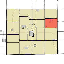
Udell Township covers an area of 27.3 square miles (70.6 km2) and contains two incorporated settlements: Udell and Unionville, which together account for approximately half of the township's total population. According to the USGS, it contains five cemeteries: Clancy, Eaton, Fairview, Taylor and Unionville.
References
- "US Board on Geographic Names". United States Geological Survey. 2007-10-25. Retrieved 2008-01-31.
- "U.S. Census website". United States Census Bureau. Retrieved 2008-01-31.
- "Geographic Identifiers: 2010 Demographic Profile Data (G001): Udell township, Appanoose County, Iowa". U.S. Census Bureau, American Factfinder. Archived from the original on February 12, 2020. Retrieved May 9, 2013.
- L. L. Taylor (1913). Past and Present of Appanoose County, Iowa: A Record of Settlement, Organization, Progress and Achievement. S. J. Clarke Publishing Company. pp. 291.
External links
Municipalities and communities of Appanoose County, Iowa, United States | ||
|---|---|---|
County seat: Centerville | ||
| Cities |
|  |
| Townships |
| |
| Unincorporated communities |
| |
| ||
This article about the geography of Appanoose County, Iowa is a stub. You can help Wikipedia by expanding it. |
Текст в блоке "Читать" взят с сайта "Википедия" и доступен по лицензии Creative Commons Attribution-ShareAlike; в отдельных случаях могут действовать дополнительные условия.
Другой контент может иметь иную лицензию. Перед использованием материалов сайта WikiSort.org внимательно изучите правила лицензирования конкретных элементов наполнения сайта.
Другой контент может иметь иную лицензию. Перед использованием материалов сайта WikiSort.org внимательно изучите правила лицензирования конкретных элементов наполнения сайта.
2019-2025
WikiSort.org - проект по пересортировке и дополнению контента Википедии
WikiSort.org - проект по пересортировке и дополнению контента Википедии