world.wikisort.org - USA
Solano is an unincorporated community in Harding County, New Mexico, United States, founded in 1907. It lies along NM 39 and the tracks of a spur of the Southern Pacific Railroad[1] about half-way between Roy and Mosquero. The post office was opened in 1907.[1][2]
Solano, New Mexico | |
|---|---|
Unincorporated community | |
 Solano Location within the state of New Mexico  Solano Solano (the United States) | |
| Coordinates: 35°50′59″N 104°04′07″W | |
| Country | United States |
| State | New Mexico |
| County | Harding |
| Elevation | 5,627 ft (1,715 m) |
| Time zone | UTC-7 (Mountain (MST)) |
| • Summer (DST) | UTC-6 (MDT) |
| ZIP codes | 87746 |
| Area code(s) | 575 |
| GNIS feature ID | 894990 |
History
Solano began in 1907 when F. M. Hughes built his house and a store.[3] It was named after a local mail carrier, Cipriano Solano.[2] Solano was the largest town in Harding County for a time, and even published a local newspaper, The Solano Herald, but when the coal mines in Dawson shut down in the 1950s, its importance waned.[3]
References
- Pearce, T. M. (1965) "Solano" New Mexico Place Names; A Geographical Dictionary University of New Mexico Press, Albuquerque, New Mexico, page 158, OCLC 420847
- Julyan, Robert (1998) "Solano" Place Names of New Mexico (2nd ed.) University of New Mexico Press, Albuquerque, New Mexico, page 338, ISBN 0-8263-1689-1
- "Solano, New Mexico" Archived February 2, 2011, at the Wayback Machine New Mexico Tourism Department
Municipalities and communities of Harding County, New Mexico, United States | ||
|---|---|---|
County seat: Mosquero | ||
| Villages | 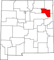 | |
| Unincorporated communities | ||
| Footnotes | ‡This populated place also has portions in an adjacent county or counties | |
| ||
Authority control | |
|---|---|
| General |
|
| National libraries | |
This New Mexico state location article is a stub. You can help Wikipedia by expanding it. |
Текст в блоке "Читать" взят с сайта "Википедия" и доступен по лицензии Creative Commons Attribution-ShareAlike; в отдельных случаях могут действовать дополнительные условия.
Другой контент может иметь иную лицензию. Перед использованием материалов сайта WikiSort.org внимательно изучите правила лицензирования конкретных элементов наполнения сайта.
Другой контент может иметь иную лицензию. Перед использованием материалов сайта WikiSort.org внимательно изучите правила лицензирования конкретных элементов наполнения сайта.
2019-2025
WikiSort.org - проект по пересортировке и дополнению контента Википедии
WikiSort.org - проект по пересортировке и дополнению контента Википедии