world.wikisort.org - USA
Jones, originally Jones Switch, is an unincorporated community in Autauga County, Alabama, United States.[1] The name was officially shortened on May 1, 1903. The community has a post office, with postmasters appointed from 1878 to 2006.[2][3] The post office also serves unincorporated areas of Autauga County such as Vine Hill, Fremont, Bethel, Salem, Milton, and Fig Tree.
Jones, Alabama | |
|---|---|
Unincorporated community | |
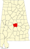
 Jones Location within the state of Alabama  Jones Jones (the United States) | |
| Coordinates: 32°35′2″N 86°53′50″W | |
| Country | United States |
| State | Alabama |
| County | Autauga |
| Elevation | 200 ft (60 m) |
| Time zone | UTC-6 (Central (CST)) |
| • Summer (DST) | UTC-5 (CDT) |
| ZIP code | 36749 |
| Area code(s) | 334 |
Geography
Jones is located at 32.58402°N 86.89748°W and has an elevation of 200 feet (61 m).[1] Mulberry Creek is located to the west and rolling hills are located to the east.
References
- U.S. Geological Survey Geographic Names Information System: Jones
- U.S. Geological Survey Geographic Names Information System: Jones Post Office
- "Postmasters by City". Postmaster Finder. United States Postal Service. Retrieved July 27, 2011.
Municipalities and communities of Autauga County, Alabama, United States | ||
|---|---|---|
County seat: Prattville | ||
| Cities |
|  |
| Towns |
| |
| CDPs |
| |
| Unincorporated communities | ||
| Ghost town |
| |
| Footnotes | ‡This populated place also has portions in an adjacent county or counties | |
| ||
This Autauga County, Alabama state location article is a stub. You can help Wikipedia by expanding it. |
Текст в блоке "Читать" взят с сайта "Википедия" и доступен по лицензии Creative Commons Attribution-ShareAlike; в отдельных случаях могут действовать дополнительные условия.
Другой контент может иметь иную лицензию. Перед использованием материалов сайта WikiSort.org внимательно изучите правила лицензирования конкретных элементов наполнения сайта.
Другой контент может иметь иную лицензию. Перед использованием материалов сайта WikiSort.org внимательно изучите правила лицензирования конкретных элементов наполнения сайта.
2019-2025
WikiSort.org - проект по пересортировке и дополнению контента Википедии
WikiSort.org - проект по пересортировке и дополнению контента Википедии