world.wikisort.org - USA
Great Crossing is an unincorporated community located in Scott County, Kentucky, United States.
Great Crossing | |
|---|---|
Unincorporated community | |
 Great Crossing Location within the state of Kentucky  Great Crossing Great Crossing (the United States) | |
| Coordinates: 38°12′52″N 84°36′19″W | |
| Country | United States |
| State | Kentucky |
| County | Scott |
| Elevation | 810 ft (250 m) |
| Time zone | UTC-5 (Eastern (EST)) |
| • Summer (DST) | UTC-4 (EDT) |
| GNIS feature ID | 493245[1] |
Geography
Great Crossing is located in west-central Scott County at 38°12'56.1"N 84°36'21.1"W and is part of the Lexington-Fayette metropolitan area.
Kentucky Route 227 bisects the center of the community, and U.S. Route 460 passes south of the community center. Georgetown is 3 miles (11 km) to the east, Stamping Ground is 6 miles (17 km) to the northwest, and Frankfort is 16 miles (38 km) to the west.
Elkhorn Creek, an 18 mile long navigable waterway, bisects the community.
Climate
The climate in this area is characterized by hot, humid summers and generally mild to cool winters. According to the Köppen Climate Classification system, Great Crossing has a humid subtropical climate, abbreviated "Cfa" on climate maps.
History
Great Crossing was founded in 1783 by Robert Johnson. The location was centered around a shallow area where bison had crossed the Elkhorn Creek. The community was also known as Johnson's Station, Great Buffalo Crossing, The Great Crossing and The Crossing. A post office operated in the community from 1811 to 1905.
See also
- Great Crossing High School, a school in nearby Georgetown that opened in 2019 and is indirectly named for the community
References
Municipalities and communities of Scott County, Kentucky, United States | ||
|---|---|---|
County seat: Georgetown | ||
| Cities | 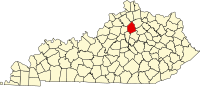 | |
| Other localities | ||
| Footnotes | ‡This populated place also has portions in an adjacent county or counties | |
| ||
This Scott County, Kentucky state location article is a stub. You can help Wikipedia by expanding it. |
Другой контент может иметь иную лицензию. Перед использованием материалов сайта WikiSort.org внимательно изучите правила лицензирования конкретных элементов наполнения сайта.
WikiSort.org - проект по пересортировке и дополнению контента Википедии