world.wikisort.org - USA
Garrisonville is an unincorporated community in Stafford County in the U.S. state of Virginia.[2]
Garrisonville | |
|---|---|
Unincorporated community | |
 Aerial view of Garrisonville (foreground) and Aquia Harbour (center) with Aquia Creek and the Potomac River in the background | |
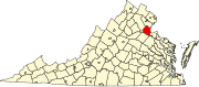
 Garrisonville Location within the state of Virginia  Garrisonville Garrisonville (Virginia)  Garrisonville Garrisonville (the United States) | |
| Coordinates: 38°28′57″N 77°25′36″W | |
| Country | United States |
| State | Virginia |
| County | Stafford |
| Time zone | UTC−5 (Eastern (EST)) |
| • Summer (DST) | UTC−4 (EDT) |
| GNIS feature ID | 1499463[1] |
Geography
Garrisonville is located at an elevation of 282 ft (86 m),[1] south of Marine Corps Base Quantico.
Transportation

Garrisonville is served by State Route 610 (Garrisonville Road), which passes east—west through the community, and Interstate 95 and U.S. Route 1, which run north—south to the east.
References
- "Garrisonville". Geographic Names Information System. United States Geological Survey, United States Department of the Interior.
- Dodd, Anita L.; Lee, M. Amanda (2007). Stafford County. Arcadia Publishing. p. ix. ISBN 9780738544106.
Wikimedia Commons has media related to Garrisonville, Virginia.
Municipalities and communities of Stafford County, Virginia, United States | ||
|---|---|---|
County seat: Stafford | ||
| CDPs |
|  |
| Unincorporated communities |
| |
| Footnotes | ‡This populated place also has portions in an adjacent county or counties | |
| ||
This Stafford County, Virginia state location article is a stub. You can help Wikipedia by expanding it. |
Текст в блоке "Читать" взят с сайта "Википедия" и доступен по лицензии Creative Commons Attribution-ShareAlike; в отдельных случаях могут действовать дополнительные условия.
Другой контент может иметь иную лицензию. Перед использованием материалов сайта WikiSort.org внимательно изучите правила лицензирования конкретных элементов наполнения сайта.
Другой контент может иметь иную лицензию. Перед использованием материалов сайта WikiSort.org внимательно изучите правила лицензирования конкретных элементов наполнения сайта.
2019-2025
WikiSort.org - проект по пересортировке и дополнению контента Википедии
WikiSort.org - проект по пересортировке и дополнению контента Википедии