world.wikisort.org - USA
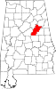
Curry is an unincorporated community in Talladega County, Alabama, United States, located on Alabama State Route 21, 6.2 miles (10.0 km) northeast of Talladega.
Curry, Alabama | |
|---|---|
Unincorporated community | |
 Curry, Alabama  Curry, Alabama | |
| Coordinates: 33°29′11″N 86°01′02″W | |
| Country | United States |
| State | Alabama |
| County | Talladega |
| Elevation | 538 ft (164 m) |
| Time zone | UTC-6 (Central (CST)) |
| • Summer (DST) | UTC-5 (CDT) |
| Area code(s) | 256 & 938 |
| GNIS feature ID | 159473[1] |
References
- "Curry". Geographic Names Information System. United States Geological Survey.
Municipalities and communities of Talladega County, Alabama, United States | ||
|---|---|---|
County seat: Talladega | ||
| Cities |
|  |
| Towns |
| |
| CDPs |
| |
| Unincorporated communities |
| |
| Ghost town | ||
| Footnotes | ‡This populated place also has portions in an adjacent county or counties | |
| ||
This Talladega County, Alabama state location article is a stub. You can help Wikipedia by expanding it. |
Текст в блоке "Читать" взят с сайта "Википедия" и доступен по лицензии Creative Commons Attribution-ShareAlike; в отдельных случаях могут действовать дополнительные условия.
Другой контент может иметь иную лицензию. Перед использованием материалов сайта WikiSort.org внимательно изучите правила лицензирования конкретных элементов наполнения сайта.
Другой контент может иметь иную лицензию. Перед использованием материалов сайта WikiSort.org внимательно изучите правила лицензирования конкретных элементов наполнения сайта.
2019-2025
WikiSort.org - проект по пересортировке и дополнению контента Википедии
WikiSort.org - проект по пересортировке и дополнению контента Википедии