world.wikisort.org - USA
Caineville is an unincorporated community in central Wayne County, Utah, United States.[1]
Caineville, Utah | |
|---|---|
Unincorporated community | |
 Abandoned former church/schoolhouse | |
 Caineville, Utah Location of Caineville within the State of Utah  Caineville, Utah Caineville, Utah (the United States) | |
| Coordinates: 38°19′59″N 111°01′08″W | |
| Country | United States |
| State | Utah |
| County | Wayne |
| Settled | 1882 |
| Founded by | Elijah Cutler Behunin |
| Named for | John Thomas Caine |
| Elevation | 4,600 ft (1,400 m) |
| Time zone | UTC-7 (Mountain (MST)) |
| • Summer (DST) | UTC-6 (MDT) |
| ZIP code | 84775 |
| Area code | 435 |
| GNIS feature ID | 1426269[1] |
Description
| Historical population | |||
|---|---|---|---|
| Census | Pop. | %± | |
| 1900 | 131 | — | |
| 1910 | 38 | −71.0% | |
| 1920 | 67 | 76.3% | |
| 1930 | 71 | 6.0% | |
| 1940 | 68 | −4.2% | |
| 1950 | 20 | −70.6% | |
| Source: U.S. Census Bureau[2] | |||
The community is located east of Capitol Reef National Park and west of Hanksville, along the Fremont River and Utah State Route 24. The settlement was named after John Thomas Caine[3] and was founded by Elijah Cutler Behunin, whom the LDS Church sent there in 1882 to open the area for settlement.[4]
See also
![]() Utah portal
Utah portal
References
- "Caineville". Geographic Names Information System. United States Geological Survey, United States Department of the Interior.
- "Census of Population and Housing". United States Census Bureau. Archived from the original on 8 February 2006. Retrieved 18 Nov 2011.
- Hunt, Charles B.; Averitt, Paul; Miller, Ralph L. (1953). "Geology and Geography of the Henry Mountains Region, Utah". Professional Paper (228). United States Geological Survey: 21.
{{cite journal}}: Cite journal requires|journal=(help) - Van Cott, John W. (1990). Utah Place Names: A Comprehensive Guide to the Origins of Geographic Names: A Compilation. Salt Lake City: University of Utah Press. pp. 61–62. ISBN 978-0-87480-345-7. OCLC 797284427. Retrieved 9 Feb 2018.
External links
Wikimedia Commons has media related to Caineville, Utah.
Municipalities and communities of Wayne County, Utah, United States | ||
|---|---|---|
County seat: Loa | ||
| Towns | 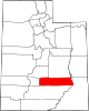 | |
| CDPs | ||
| Unincorporated communities | ||
| Ghost towns | ||
| ||
This article about a location in Utah is a stub. You can help Wikipedia by expanding it. |
Текст в блоке "Читать" взят с сайта "Википедия" и доступен по лицензии Creative Commons Attribution-ShareAlike; в отдельных случаях могут действовать дополнительные условия.
Другой контент может иметь иную лицензию. Перед использованием материалов сайта WikiSort.org внимательно изучите правила лицензирования конкретных элементов наполнения сайта.
Другой контент может иметь иную лицензию. Перед использованием материалов сайта WikiSort.org внимательно изучите правила лицензирования конкретных элементов наполнения сайта.
2019-2025
WikiSort.org - проект по пересортировке и дополнению контента Википедии
WikiSort.org - проект по пересортировке и дополнению контента Википедии