world.wikisort.org - United_Kingdom
Stanhope /ˈstænəp/ is a market town[1] and civil parish in the County Durham district, in the ceremonial county of Durham, England. It lies on the River Wear between Eastgate and Frosterley, in the north-east of Weardale. The main A689 road over the Pennines is crossed by the B6278 between Barnard Castle and Shotley Bridge. In 2001 Stanhope had a population of 1,633,[2] in 2019 an estimate of 1,627, and a figure of 1,602 in the 2011 census for the ONS built-up-area which includes Crawleyside.[3] In 2011 the parish population was 4,581.[4]
This article uses bare URLs, which are uninformative and vulnerable to link rot. (August 2022) |
| Stanhope | |
|---|---|
| Town and civil parish | |
 Stanhope Castle | |
 Stanhope Location within County Durham | |
| Area | 98.68 sq mi (255.6 km2) |
| Population | 1,633 (2001 census) |
| • Density | 17/sq mi (6.6/km2) |
| OS grid reference | NY995395 |
| Civil parish |
|
| District | |
| Shire county | |
| Region | |
| Country | England |
| Sovereign state | United Kingdom |
| Post town | Bishop Auckland |
| Postcode district | DL13 |
| Dialling code | 01388 |
| Police | Durham |
| Fire | County Durham and Darlington |
| Ambulance | North East |
| UK Parliament |
|
Civil parish
Stanhope | |
|---|---|
Civil parish | |
Stanhope Castle | |
| Country | England |
| Primary council | County Durham |
| County | Durham |
| Region | North East England |
| Status | Parish |
| Settlements | Stanhope, Bollihope, Bridge End, Brotherlee, Copthill, Cornriggs, Cowshill, Crawleyside, Daddry Shield, East Blackdene, Eastgate, Frosterley, Hill End, Ireshopeburn, Killhope, Lanehead, Lintzgarth, New House, Rookhope, Shittlehope, St John's Chapel, Unthank, Wearhead, West Blackdene, Westgate and White Kirkley |
| Area | |
| • Total | 256 km2 (99 sq mi) |
| Population (2011) | |
| • Total | 4,581 |
| • Density | 18/km2 (46/sq mi) |
| Website | https://www.stanhopeparishcouncil.co.uk/ |
The civil parish includes the settlements of Cornriggs, Cowshill, Daddry Shield, Eastgate, Frosterley, Ireshopeburn, Lanehead, St John's Chapel, Wearhead and Westgate, all on the A689 road, and also Bollihope, Bridge End, Brotherlee, Copthill, Crawleyside, East Blackdene, Hill End, Lintzgarth, New House, Rookhope and West Blackdene. Other places it includes are Killhope, Shittlehope, Unthank and White Kirkley. This gives it the largest parish area in England, at 221 km2.[5] It has some land in common with the neighbouring Wolsingham civil parish. On 31 December 1894 "Stanhope Urban" parish was formed from part of Stanhope parish, but on 1 April 1937 it was merged back. On 1 April 1946, 2,396 acres (969.6 ha) were transferred to the parish from Wolsingham.[6]
Description
Stanhope is surrounded by moorland in the North Pennines Area of Outstanding Natural Beauty (AONB) – the second largest of a current 40 such areas in England and Wales. Features of interest include:
- A petrified tree stump standing in the churchyard was found with two others, one of which features in the Great North Museum in Newcastle upon Tyne.[7]
- The Durham Dales Centre incorporates a tea room, tourist information and craft shops.
- Stanhope Bridge, a scheduled monument, was built in the 15th century and widened in 1792.[8]
- The ford has a stepping-stone bridge for pedestrians.
- The 18th-century Stanhope Castle in the town centre stands on the possible site of a medieval castle. It was built in 1798 by Cuthbert Rippon, MP for Gateshead.[9]
- The town has one of only two heated open-air swimming pools in the North East.
Stanhope was at the centre of the Weardale campaign (1327), when Sir James Douglas of Scotland invaded England and faced Edward III and Roger Mortimer, earl of March. A series of skirmishes took place on the valley floor and in Stanhope Park.
The parish church dedicated to St Thomas is mostly from the 12th–13th centuries, with restoration in 1663 and 1867.[10][11] The earliest known Rector was Richardus in 1200. Joseph Butler, later Bishop of Bristol, was Rector in 1725.[12]
Stanhope Castle may be on the site of a motte and bailey castle according to some evidence from the 1790s. Furthermore, Bishop Anthony Bek granted land "to the west side of Stanhope castle". The present castle was built for Cuthbert Rippon (1744-1801) in 1798 with additions in 1823 by his son, also Cuthbert (1797–1867) and Member of Parliament for Gateshead. Ignatius Bonomi (1787–1870) was the architect. In 1941 the castle was adapted by the Home Office as a school for boys and remained so until 1980, where it was converted into apartments.[13][14][15] Part of the gardens lie to the north of the castle across the main road, including the park wall and gazebo.[16]
Stanhope Agricultural Show is held on the second weekend of September each year. It has been held annually since 1834, except in world-war years, the 2001 United Kingdom foot-and-mouth outbreak foot and mouth crisis and times of bad weather.[17]
Weardale Railway
Stanhope is the current terminus of the Weardale Railway, a heritage line operating mainly at weekends from Bishop Auckland, with stations at Frosterley, Wolsingham and Witton-le-Wear.[18] Stanhope Station stood in for the fictional Partlington Station in an episode of the criminal drama series Vera.
Notable residents
In order of birth:
- Joseph Butler (1692–1752), theologian and cleric
- William Greenwell (1820–1918), archaeologist and Anglican cleric, catalogued Late Bronze Age finds at Heathery Burn Cave near Stanhope in 1859–1872.[19]
- William Percival Crozier (1879–1944), scholar and journalist, edited the Manchester Guardian in 1932–1944.
- Muriel Young (1923–2001), television continuity announcer, presenter and producer, died in Stanhope.
Gallery
 Durham Dales Centre. Stanhope, Co. Durham (in Weardale). Arts and Crafts Centre
 The preserved railway station and tearoom (summer)
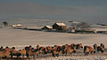 Scurfield House near to Stanhope, County Durham (Winter)
 St Thomas's Church, Stanhope
 Stone Bridge. A single-arch bridge carrying the B6278 over the River Wear
 Ford in Stanhope, County Durham


See also
- Battle of Stanhope Park
References
- "Stanhope Town Hall - Durham County Council". www.durham.gov.uk. Retrieved 16 April 2022.
- "Wear Valley Settlement Summary Sheets" (PDF). Durham County Council. Archived from the original (PDF) on 7 October 2007. Retrieved 4 August 2021.
- "Stanhope". City Population De. Retrieved 5 July 2021.
- "Parish population 2011". Retrieved 21 July 2015.
- "Archived copy". Archived from the original on 1 December 2005. Retrieved 23 November 2005.
{{cite web}}: CS1 maint: archived copy as title (link) - "Stanhope CP/AP through time". A Vision of Britain through Time. Retrieved 29 July 2021.
- Background, booklet. Retrieved 20 October 2019.
- Bridge history. Retrieved 20 October 2019.
- Illustrated site. Retrieved 20 October 2019.
- Historic England. "CHURCH OF ST THOMAS, Stanhope (1231701)". National Heritage List for England. Retrieved 29 July 2021.
- Egglestone, William Morley (1878). Stanhope Memorials of Bishop Butler. pp. 6–10.
- Hutchinson, William (1823). The History and Antiquities of the County Palatine of Durham Vol. 3. p. 353.
- Hutchinson, William (1823). The History and Antiquities of the County Palatine of Durham Vol. 3. pp. 351–52.
- Historic England. "STANHOPE CASTLE, Stanhope (1231718)". National Heritage List for England. Retrieved 30 July 2021.
- "Stanhope Castle website".
{{cite web}}: CS1 maint: url-status (link) - Historic England. "WALL ON NORTH EAST SIDE OF CASTLE GARDEN, AND GAZEBO ATTACHED, Stanhope (1278798)". National Heritage List for England. Retrieved 30 July 2021.
- http://www.stanhopeshow.com/.
- Official site. Retrieved 20 October 2019.
- W. Greenwell, 1894. "Antiquities of the Bronze Age found in the Heathery Burn Cave, County Durham", Archaeologia (2nd Series, 4), pp. 87–114.
External links
![]() Media related to Stanhope, County Durham at Wikimedia Commons
Media related to Stanhope, County Durham at Wikimedia Commons
| Unitary authorities | |
|---|---|
| Major settlements |
|
| Topics |
|
Authority control | |
|---|---|
| General | |
| National libraries | |
Другой контент может иметь иную лицензию. Перед использованием материалов сайта WikiSort.org внимательно изучите правила лицензирования конкретных элементов наполнения сайта.
WikiSort.org - проект по пересортировке и дополнению контента Википедии