world.wikisort.org - United_Kingdom
Hacheston is a village and a civil parish in the East Suffolk district, in the English county of Suffolk. The population of the parish at the 2011 census was 345.[2]
| Hacheston | |
|---|---|
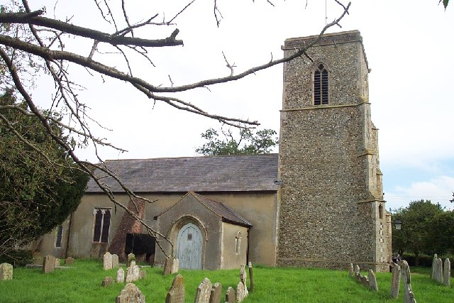 All Saints Church | |
 Hacheston Location within Suffolk | |
| Area | 7.21 km2 (2.78 sq mi) |
| Population | 345 (2011)[1] |
| • Density | 48/km2 (120/sq mi) |
| District |
|
| Shire county |
|
| Region |
|
| Country | England |
| Sovereign state | United Kingdom |
| Post town | Woodbridge |
| Postcode district | IP13 |
| Dialling code | 01728 |
| Police | Suffolk |
| Fire | Suffolk |
| Ambulance | East of England |
| UK Parliament |
|
It is located on the B1116 road between the towns of Wickham Market and Framlingham. Hacheston has a church and a village hall. Hacheston Halt railway station was closed in 1952.
Glevering Hall is a historic house and estate within the parish which was built in 1794 by Chaloner Arcedeckne, MP. Glevering Hall became a Grade II* listed building on 25 October 1951.[3]
Governance
An electoral ward in the same name exists. This ward stretches north to Bruisyard with a total population taken at the 2011 Census of 1,977.[4]
Notable residents
- Chaloner Arcedeckne (c. 1743–1809); MP and Jamaican landowner
- Claude Hinscliff (1875–1964); suffragist.
- Chinwe Chukwuogo-Roy MBE (1952-2012); visual artist.
Related pages
- Glevering Hall
- Hacheston Halt railway station
References
- "Nomis - Official Labour Market Statistics". www.nomisweb.co.uk. Retrieved 2 September 2020.
- "Civil Parish population 2011". Retrieved 15 September 2015.
- Historic England. "GLEVERING HALL (1283334)". National Heritage List for England. Retrieved 1 April 2014.
- "Ward population 2011". Retrieved 15 September 2015.
External links
| Wikimedia Commons has media related to Hacheston. |
| Boroughs or districts |
|
|---|---|
| Major settlements | |
| Topics |
|
This Suffolk location article is a stub. You can help Wikipedia by expanding it. |
Другой контент может иметь иную лицензию. Перед использованием материалов сайта WikiSort.org внимательно изучите правила лицензирования конкретных элементов наполнения сайта.
WikiSort.org - проект по пересортировке и дополнению контента Википедии