world.wikisort.org - Spain
Huétor-Tájar (or Huétor Tájar) is a municipality and town located in the province of Granada (Andalusia), in the southern Spain. It is situated 43 km west of the city of Granada, and its population in 2007 was 9,467. The municipality's extension is close to 40 km². Huétor-Tájar lies within the fertile Genil river valley, a part of the Granada depression.
Huétor-Tájar | |
|---|---|
 Flag  Coat of arms | |
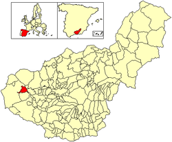 Location of Huétor-Tájar | |
| Country | Spain |
| Province | Granada |
| Government | |
| • Mayor | Fernando Delgado Ayén (PSOE) |
| Area | |
| • Total | 40 km2 (20 sq mi) |
| Elevation | 484 m (1,588 ft) |
| Population (2018)[1] | |
| • Total | 10,286 |
| • Density | 260/km2 (670/sq mi) |
| Time zone | UTC+1 (CET) |
| • Summer (DST) | UTC+2 (CEST) |
| Postal code | 18360 |
| Area code(s) | 34 (Spain) + 958 (Granada) |
| Website | www.huetortajar.org (in Spanish) |
The main source of income is the asparagus culture and its commercialisation under the Geographical Indication Esparragos de Huétor-Tájar.
The town is located near Granada, which has had a significant influence on it during the centuries.
External links
- Official site for Tourism of the province of Granada
- . Encyclopædia Britannica. Vol. 12 (11th ed.). 1911. pp. 335–336.
Wikimedia Commons has media related to Huétor Tájar.
| Authority control |
|
|---|
This article about a location in the province of Granada is a stub. You can help Wikipedia by expanding it. |
- Municipal Register of Spain 2018. National Statistics Institute.
На других языках
- [en] Huétor-Tájar
[es] Huétor Tájar
Huétor Tájar es una localidad y municipio español de la provincia de Granada, en la comunidad autónoma de Andalucía. Pertenece a la comarca de Loja, tiene una población de 10 236 habitantes (2017) y una extensión de prácticamente 40 km². El municipio se asienta en la fértil vega creada por el río Genil, que proporciona al municipio una importante riqueza agrícola, destacando el cultivo de espárragos con denominación de origen. Sobre esta base agrícola se asienta una importante industria agroalimentaria en torno a la conserva del espárrago y otros productos como la alcachofa.[ru] Уэтор-Тахар
Уэтор-Тахар (исп. Huétor-Tájar) — город и муниципалитет в Испании, входит в провинцию Гранада, в составе автономного сообщества Андалусия. Муниципалитет находится в составе района (комарки) Лоха. Занимает площадь 40 км². Население — 9998 человек (на 2010 год). Расстояние — 43 км до административного центра провинции.Текст в блоке "Читать" взят с сайта "Википедия" и доступен по лицензии Creative Commons Attribution-ShareAlike; в отдельных случаях могут действовать дополнительные условия.
Другой контент может иметь иную лицензию. Перед использованием материалов сайта WikiSort.org внимательно изучите правила лицензирования конкретных элементов наполнения сайта.
Другой контент может иметь иную лицензию. Перед использованием материалов сайта WikiSort.org внимательно изучите правила лицензирования конкретных элементов наполнения сайта.
2019-2025
WikiSort.org - проект по пересортировке и дополнению контента Википедии
WikiSort.org - проект по пересортировке и дополнению контента Википедии