world.wikisort.org - Slovenia
Radohova Vas (pronounced [ˈɾaːdɔxɔʋa ˈʋaːs]; Slovene: Radohova vas, German: Rodockendorf[2]) is a village southeast of Šentvid pri Stični in the Municipality of Ivančna Gorica in central Slovenia. The area is part of the historical region of Lower Carniola. The municipality is now included in the Central Slovenia Statistical Region.[3]
Radohova Vas | |
|---|---|
 | |
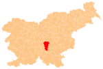
 Radohova Vas Location in Slovenia | |
| Coordinates: 45°56′37.57″N 14°51′41.3″E | |
| Country | |
| Traditional region | Lower Carniola |
| Statistical region | Central Slovenia |
| Municipality | Ivančna Gorica |
| Area | |
| • Total | 1.66 km2 (0.64 sq mi) |
| Elevation | 327.1 m (1,073.2 ft) |
| Population (2002) | |
| • Total | 189 |
| [1] | |
In the early 20th century an Early Iron Age burial ground was discovered and partially excavated west of the settlement.[4]
Gallery
 Historical postcard of Radohova Vas

References
- Statistical Office of the Republic of Slovenia
- Leksikon občin kraljestev in dežel zastopanih v državnem zboru, vol. 6: Kranjsko. 1906. Vienna: C. Kr. Dvorna in Državna Tiskarna, p. 102.
- Ivančna Gorica municipal site
- "EŠD 15718". Registry of Immovable Cultural Heritage (in Slovenian). Ministry of Culture of the Republic of Slovenia. Retrieved 2 September 2011.
External links
This article about the Municipality of Ivančna Gorica in Slovenia is a stub. You can help Wikipedia by expanding it. |
Текст в блоке "Читать" взят с сайта "Википедия" и доступен по лицензии Creative Commons Attribution-ShareAlike; в отдельных случаях могут действовать дополнительные условия.
Другой контент может иметь иную лицензию. Перед использованием материалов сайта WikiSort.org внимательно изучите правила лицензирования конкретных элементов наполнения сайта.
Другой контент может иметь иную лицензию. Перед использованием материалов сайта WikiSort.org внимательно изучите правила лицензирования конкретных элементов наполнения сайта.
2019-2025
WikiSort.org - проект по пересортировке и дополнению контента Википедии
WikiSort.org - проект по пересортировке и дополнению контента Википедии