world.wikisort.org - Slovakia
Tvrdošovce (Hungarian: Tardoskedd) is a large village and municipality in the Nové Zámky District in the Nitra Region of south-west Slovakia.
This article needs additional citations for verification. (March 2013) |
Tvrdošovce
Tardoskedd | |
|---|---|
Village | |
 Church of Saint Stephen | |
 Tvrdošovce Location in Slovakia | |
| Coordinates: 48°05′42″N 18°03′50″E | |
| Country | Slovakia |
| Region | Nitra |
| District | Nové Zámky |
| Founded | 1221 |
| Government | |
| • Mayor | Marián Tóth (MOST-HÍD) |
| Area | |
| • Total | 55.55[1] km2 (21.45[1] sq mi) |
| Elevation | 119[2] m (390[2] ft) |
| Population (2021) | |
| • Total | 5,171[3] |
| Time zone | UTC+1 (CET) |
| • Summer (DST) | UTC+2 (CEST) |
| Postal code | 941 10[2] |
| Area code | +421 35[2] |
| Car plate | NZ |
| Website | www.tvrdosovce.sk |
Geography
The municipality lies at an altitude of 120 metres and covers an area of 55.56 km².
History
In historical records, the village was first mentioned in 1221. After the Austro-Hungarian army disintegrated in November 1918, Czechoslovak troops occupied the area, later acknowledged internationally by the Treaty of Trianon. Between 1938 and 1945 Tvrdošovce once more became part of Miklós Horthy's Hungary through the First Vienna Award. From 1945 until the Velvet Divorce, it was part of Czechoslovakia. Since then it has been part of Slovakia.
Population
It has a population of 5088 people.
Facilities
The village has a small public library, swimming pool, gym and a football pitch.
Photos
 open air railway museum
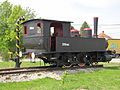 open air railway museum
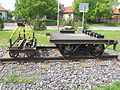 open air railway museum


External links
- https://web.archive.org/web/20070513023228/http://www.statistics.sk/mosmis/eng/run.html
- Tvrdošovce – Nové Zámky Okolie
- "Hustota obyvateľstva - obce [om7014rr_ukaz: Rozloha (Štvorcový meter)]". www.statistics.sk (in Slovak). Statistical Office of the Slovak Republic. 2022-03-31. Retrieved 2022-03-31.
- "Základná charakteristika". www.statistics.sk (in Slovak). Statistical Office of the Slovak Republic. 2015-04-17. Retrieved 2022-03-31.
- "Počet obyvateľov podľa pohlavia - obce (ročne)". www.statistics.sk (in Slovak). Statistical Office of the Slovak Republic. 2022-03-31. Retrieved 2022-03-31.
Municipalities of Nové Zámky District | ||
|---|---|---|
| ||
Authority control | |
|---|---|
| General |
|
| National libraries | |
This Nitra Region geography article is a stub. You can help Wikipedia by expanding it. |
На других языках
[de] Tvrdošovce
Tvrdošovce (bis 1948 slowakisch „Tardošked“; ungarisch Tardoskedd) ist eine Gemeinde in der Südwestslowakei mit 5075 Einwohnern (Stand 31. Dezember 2020). Sie liegt in der Donauebene, etwa 16 km von Nové Zámky entfernt und gehört zu den größten nichtstädtischen Gemeinden des Landes.- [en] Tvrdošovce
Другой контент может иметь иную лицензию. Перед использованием материалов сайта WikiSort.org внимательно изучите правила лицензирования конкретных элементов наполнения сайта.
WikiSort.org - проект по пересортировке и дополнению контента Википедии