world.wikisort.org - Slovakia
Hontianske Tesare (Hungarian: Teszér) is a village and municipality in the Krupina District of the Banská Bystrica Region of Slovakia.
This article needs additional citations for verification. (April 2022) |
Hontianske Tesáre | |
|---|---|
Municipality | |
 | |
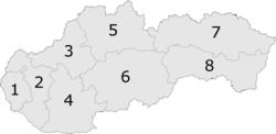
 Hontianske Tesáre Location of Hontianske Tesáre in the Banská Bystrica Region  Hontianske Tesáre Location of Hontianske Tesáre in Slovakia | |
| Coordinates: 48°12′N 18°55′E | |
| Country | |
| Region | Banská Bystrica |
| District | Krupina |
| First mentioned | 1279 |
| Area | |
| • Total | 33.11[1] km2 (12.78[1] sq mi) |
| Elevation | 162[2] m (531[2] ft) |
| Population (2021) | |
| • Total | 882[3] |
| Time zone | UTC+1 (CET) |
| • Summer (DST) | UTC+2 (CEST) |
| Postal code | 962 68[2] |
| Area code | +421 45[2] |
| Car plate | KA |
| Website | www.hontiansketesare.sk |
Genealogical resources
The records for genealogical research are available at the state archive "Statny Archiv in Banska Bystrica, Slovakia"
- Roman Catholic church records (births/marriages/deaths): 1760-1897 (parish B)
- Lutheran church records (births/marriages/deaths): 1702-1902 (parish A)
See also
- List of municipalities and towns in Slovakia
References
- "Hustota obyvateľstva - obce [om7014rr_ukaz: Rozloha (Štvorcový meter)]". www.statistics.sk (in Slovak). Statistical Office of the Slovak Republic. 2022-03-31. Retrieved 2022-03-31.
- "Základná charakteristika". www.statistics.sk (in Slovak). Statistical Office of the Slovak Republic. 2015-04-17. Retrieved 2022-03-31.
- "Počet obyvateľov podľa pohlavia - obce (ročne)". www.statistics.sk (in Slovak). Statistical Office of the Slovak Republic. 2022-03-31. Retrieved 2022-03-31.
External links
 Media related to Hontianske Tesáre at Wikimedia Commons
- Official website

- Surnames of living people in Hontianske Tesare
| Authority control: National libraries |
|---|
This Banská Bystrica Region geography article is a stub. You can help Wikipedia by expanding it. |
На других языках
[de] Hontianske Tesáre
Hontianske Tesáre (deutsch Dessir, ungarisch Teszér) ist eine Gemeinde in der Mittelslowakei.- [en] Hontianske Tesáre
[ru] Гонтьянске Тесаре (район Крупина)
Гонтьянске Тесаре (словацк. Hontianske Tesáre,нем. Dessir,венг. Teszér ) — деревня района Крупина Банскобистрицкого края Словакии. Население — 940 человек (2014).Текст в блоке "Читать" взят с сайта "Википедия" и доступен по лицензии Creative Commons Attribution-ShareAlike; в отдельных случаях могут действовать дополнительные условия.
Другой контент может иметь иную лицензию. Перед использованием материалов сайта WikiSort.org внимательно изучите правила лицензирования конкретных элементов наполнения сайта.
Другой контент может иметь иную лицензию. Перед использованием материалов сайта WikiSort.org внимательно изучите правила лицензирования конкретных элементов наполнения сайта.
2019-2025
WikiSort.org - проект по пересортировке и дополнению контента Википедии
WikiSort.org - проект по пересортировке и дополнению контента Википедии