world.wikisort.org - Russia
Kholmsk (Russian: Холмск), known until 1946 as Maoka (Japanese: 真岡),[8] is a port town and the administrative center of Kholmsky District of Sakhalin Oblast, Russia. It is located on the southwest coast of the Sakhalin Island, on coast of the gulf of Nevelsky in the Strait of Tartary of the Sea of Japan, 83 kilometers (52 mi) west of Yuzhno-Sakhalinsk. Population: 30,937 (2010 Census);[2] 35,141 (2002 Census);[9] 51,381 (1989 Census).[10]
Kholmsk
Холмск | |
|---|---|
Town[1] | |
 Kholmsk Commercial Port | |
 Flag  Coat of arms | |
Location of Kholmsk  | |
 Kholmsk Location of Kholmsk 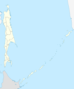 Kholmsk Kholmsk (Sakhalin Oblast) | |
| Coordinates: 47°03′N 142°03′E | |
| Country | Russia |
| Federal subject | Sakhalin Oblast[1] |
| Administrative district | Kholmsky District[1] |
| Founded | 1870 |
| Elevation | 10 m (30 ft) |
| Population | |
| • Total | 30,937 |
| • Estimate (2018)[3] | 27,954 (−9.6%) |
Administrative status | |
| • Capital of | Kholmsky District[1] |
Municipal status | |
| • Urban okrug | Kholmsky Urban Okrug[4] |
| • Capital of | Kholmsky Urban Okrug[4] |
| Time zone | UTC+11 (MSK+8 |
| Postal code(s)[6] | 694620 |
| Dialing code(s) | +7 42433[7] |
| OKTMO ID | 64754000001 |
| Town Day | the third Saturday of August |
| Website | admkholmsk |
History
It was founded in 1870 as a military post.[citation needed] After the Russo-Japanese War of 1904-1905, it was transferred to Japanese control, along with the rest of southern Sakhalin, under the Treaty of Portsmouth. The Japanese renamed it Maoka (真岡), it is said to mean "quiet place" in Ainu language.
On August 20, 1945, a combined marine battalion and the 113th infantry brigade landed in Port Maoka. They were preceded by a group of scouts, landed secretively by submarine Sh-118, in the Maoka area to successfully complete their task. However, Japanese resistance was desperate, and the landing party had to fight particularly fiercely. Japanese fire set one of the coastguard vessels on fire, to which the Russian response was intense naval bombardment of the town, causing more civilian deaths. See Soviet assault on Maoka for details.
The Red Army retook the whole of Sakhalin at the end of World War II, with the town receiving its present name in 1946. The name is derived from the Russian word Kholm for hill, referring to the town's location on the hillside surrounding the harbor.
As with a number of urban areas in the Russian Far East, Kholmsk has seen a large drop in population since the dissolution of the Soviet Union and the economic crisis which followed in the 1990s.
Administrative and municipal status
Within the framework of administrative divisions, Kholmsk serves as the administrative center of Kholmsky District and is subordinated to it.[1] As a municipal division, the town of Kholmsk and twenty-three rural localities of Kholmsky District are incorporated as Kholmsky Urban Okrug.[4]
Economy and transport
Kholmsk is an important seaport for Sakhalin Island. Since 1973, it has been the Sakhalin terminal of a Vanino-Kholmsk train ferry to the port of Vanino on the Russian mainland, connecting the mainline rail network with that of the island.[11]
Since Sakhalin railways use the Japanese gauge of 1,067 mm (3 ft 6 in), the railcars coming from the Russian mainland have their bogies changed in Kholmsk.[12]
It's the largest transport center on Sakhalin, which includes a non-freezing seaport with 2 terminals, 3 railway stations and a knot of highways. Kholmsk is connected with Vanino port by the Kholmsk—Vanino sea railway passenger-and-freight ferry. From the town, the federal highway R495 Kholmsk—Yuzhno-Sakhalinsk begins. Kholmsk is a large economic, industrial and cultural center of the Sakhalin Oblast, a center of sea fishery and ship repair.
Twin towns and sister cities
Kholmsk is twinned with:
References
Notes
- Law #25-ZO
- Russian Federal State Statistics Service (2011). Всероссийская перепись населения 2010 года. Том 1 [2010 All-Russian Population Census, vol. 1]. Всероссийская перепись населения 2010 года [2010 All-Russia Population Census] (in Russian). Federal State Statistics Service.
- "26. Численность постоянного населения Российской Федерации по муниципальным образованиям на 1 января 2018 года". Federal State Statistics Service. Retrieved January 23, 2019.
- Law #524
- "Об исчислении времени". Официальный интернет-портал правовой информации (in Russian). June 3, 2011. Retrieved January 19, 2019.
- Почта России. Информационно-вычислительный центр ОАСУ РПО. (Russian Post). Поиск объектов почтовой связи (Postal Objects Search) (in Russian)
- Телефонные коды Сахалина - Dialing codes of Sakhalin Archived December 17, 2017, at the Wayback Machine (in Russian)
- Irish, Ann (2009). Hokkaido: A History of Ethnic Transition and Development on Japan's Northern Island. McFarland. p. 265.
- Russian Federal State Statistics Service (May 21, 2004). Численность населения России, субъектов Российской Федерации в составе федеральных округов, районов, городских поселений, сельских населённых пунктов – районных центров и сельских населённых пунктов с населением 3 тысячи и более человек [Population of Russia, Its Federal Districts, Federal Subjects, Districts, Urban Localities, Rural Localities—Administrative Centers, and Rural Localities with Population of Over 3,000] (XLS). Всероссийская перепись населения 2002 года [All-Russia Population Census of 2002] (in Russian).
- Всесоюзная перепись населения 1989 г. Численность наличного населения союзных и автономных республик, автономных областей и округов, краёв, областей, районов, городских поселений и сёл-райцентров [All Union Population Census of 1989: Present Population of Union and Autonomous Republics, Autonomous Oblasts and Okrugs, Krais, Oblasts, Districts, Urban Settlements, and Villages Serving as District Administrative Centers]. Всесоюзная перепись населения 1989 года [All-Union Population Census of 1989] (in Russian). Институт демографии Национального исследовательского университета: Высшая школа экономики [Institute of Demography at the National Research University: Higher School of Economics]. 1989 – via Demoscope Weekly.
- SASCO: Vanino-Kholmsk (in Russian)
- Сахалинская узкоколейная железная дорога (The narrow-gauge railways of Sakhalin) Archived September 21, 2012, at WebCite (in Russian)
- Partnership between Russia and S.Korea
- Sakhalin region: Kholmsk was visited by economic delegation from Otaru (Japan)
- The Russian presence in Japan
Sources
- Сахалинская областная Дума. Закон №25-ЗО от 23 марта 2011 г. «Об административно-территориальном устройстве Сахалинской области», в ред. Закона №62-ЗО от 27 июня 2013 г. «О внесении изменения в статью 10 Закона Сахалинской области "Об административно-территориальном устройстве Сахалинской области"». Вступил в силу 9 апреля 2011 г.. Опубликован: "Губернские ведомости", №55(3742), 29 марта 2011 г. (Sakhalin Oblast Duma. Law #25-ZO of March 23, 2011 On the Administrative-Territorial Structure of Sakhalin Oblast, as amended by the Law #62-ZO of June 27, 2013 On Amending Article 10 of the Law of Sakhalin Oblast "On the Administrative-Territorial Structure of Sakhalin Oblast". Effective as of April 9, 2011.).
- Сахалинская областная Дума. Закон №524 от 21 июля 2004 г. «О границах и статусе муниципальных образований в Сахалинской области», в ред. Закона №45-ЗО от 27 мая 2013 г. «О внесении изменения в Закон Сахалинской области "О границах и статусе муниципальных образований в Сахалинской области"». Вступил в силу 1 января 2005 г. Опубликован: "Губернские ведомости", №175–176(2111–2112), 31 июля 2004 г. (Sakhalin Oblast Duma. Law #524 of July 21, 2004 On the Borders and Status of the Municipal Formations in Sakhalin Oblast, as amended by the Law #45-ZO of May 27, 2013 On Amending the Law of Sakhalin Oblast "On the Borders and Status of the Municipal Formations in Sakhalin Oblast". Effective as of January 1, 2005.).
External links
![]() Media related to Kholmsk at Wikimedia Commons
Media related to Kholmsk at Wikimedia Commons
 Kholmsk travel guide from Wikivoyage
- Official website of Kholmsk (in Russian)
- Kholmsk Business Directory (in Russian)
Authority control | |
|---|---|
| General |
|
| National libraries | |
На других языках
- [en] Kholmsk
[ru] Холмск
Холмск (до 1905 — Маука, с 1905 по 1946 — Маока; яп. 真岡) — город на Дальнем Востоке России, административный центр Холмского городского округа Сахалинской области. Расположен на юго-западном побережье острова Сахалин, на берегу залива Невельского Татарского пролива Японского моря, в 83 км к западу от Южно-Сахалинска. Население — 26 672[1] чел. (2021), площадь 32 км². Третий по численности населения город Сахалинской области.Другой контент может иметь иную лицензию. Перед использованием материалов сайта WikiSort.org внимательно изучите правила лицензирования конкретных элементов наполнения сайта.
WikiSort.org - проект по пересортировке и дополнению контента Википедии