world.wikisort.org - Netherlands
Meijel (Dutch: [ˈmɛijəl] (![]() listen); Limburgish: Méél) is a former municipality and a village in south-eastern Netherlands.
listen); Limburgish: Méél) is a former municipality and a village in south-eastern Netherlands.
Meijel
Méél | |
|---|---|
Village and former municipality | |
 | |
 Flag  Coat of arms | |
 Meijel Location in the Netherlands  Meijel Location in the province of Limburg in the Netherlands | |
| Coordinates: 51°21′N 5°53′E | |
| Country | Netherlands |
| Province | Limburg |
| Municipality | Peel en Maas |
| Area | |
| • Total | 2.80 km2 (1.08 sq mi) |
| Elevation | 34 m (112 ft) |
| Population (2021)[1] | |
| • Total | 5,120 |
| • Density | 1,800/km2 (4,700/sq mi) |
| Time zone | UTC+1 (CET) |
| • Summer (DST) | UTC+2 (CEST) |
| Postal code | 5768[1] |
| Dialing code | 077 |
History
The village was first mentioned in 1303 as "Iohannes et Henricus fratres dicti van der Vloet de Meyele". The etymology is uncertain. It might mean "middle of the forest".[3] Meijel developed on a sandy ridge in the raised bog of the Peel. It became a free heerlijkheid (no fief). In 1716, it became part of the Austrian Upper Guelders.[4]
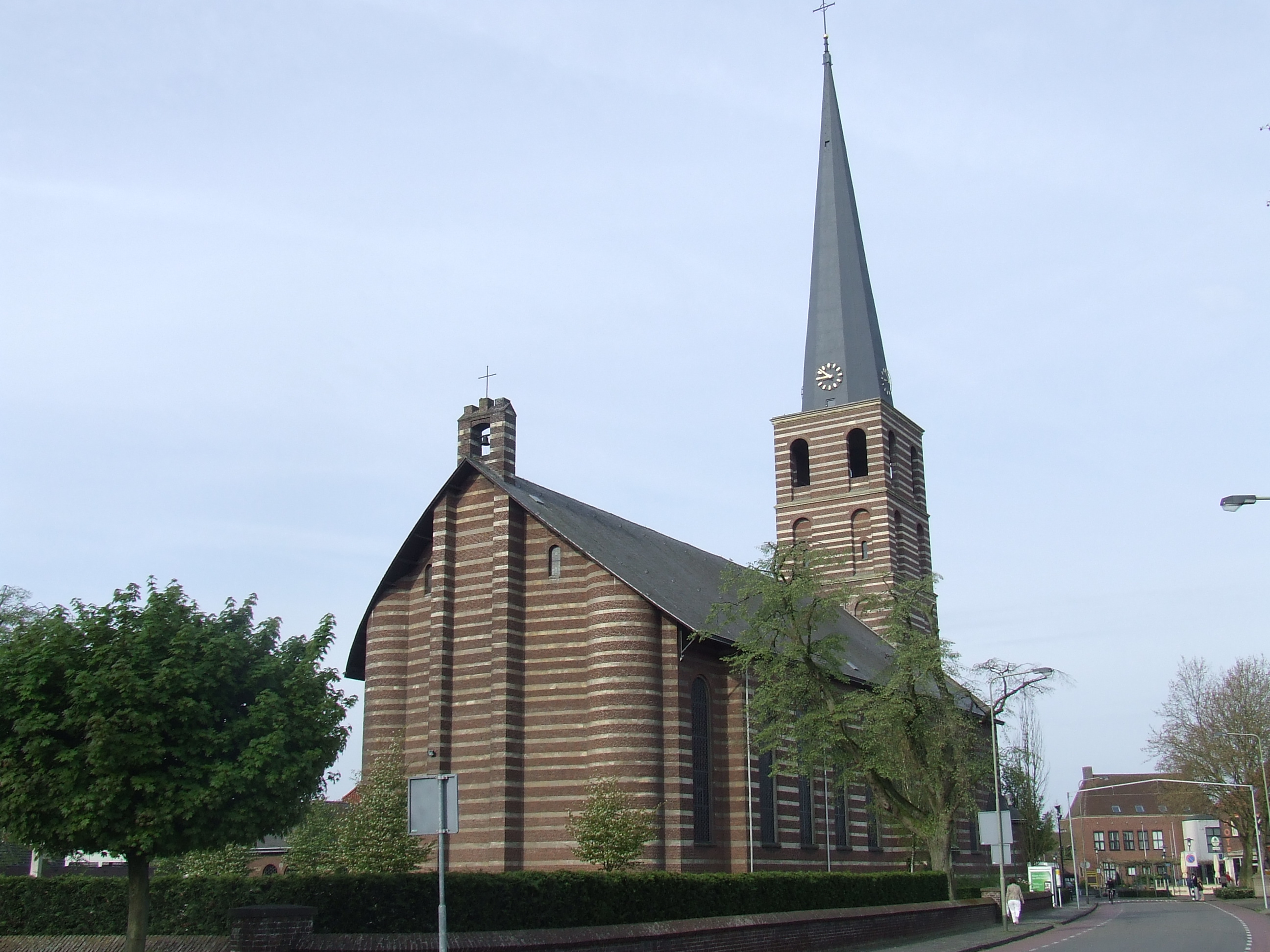
The Catholic St Nicolaas Church is a three aisled church with wide tower which was constructed between 1953 and 1955 to replace the church which was destroyed in 1944.[4]
Meijel was home to 996 inhabitants in 1840.[5] It was severely damaged during World War II.[4] Meijel was an independent municipality until 2010 when it was merged into Peel en Maas.[5]
References
- "Kerncijfers wijken en buurten 2021". Central Bureau of Statistics. Retrieved 25 April 2022.
- "Postcodetool for 5768AA". Actueel Hoogtebestand Nederland (in Dutch). Het Waterschapshuis. Retrieved 25 April 2022.
- "Meijel - (geografische naam)". Etymologiebank (in Dutch). Retrieved 25 April 2022.
- Sabine Broekhoven, & Ronald Stenvert (2003). Meijel (in Dutch). Zwolle: Waanders. ISBN 90 400 9623 6. Retrieved 25 April 2022.
- "Meijel". Plaatsengids (in Dutch). Retrieved 25 April 2022.
External links
- Official website
 Media related to Meijel at Wikimedia Commons
This Dutch Limburg location article is a stub. You can help Wikipedia by expanding it. |
На других языках
[de] Meijel
Meijel ( anhören?/i) ist ein Ort und eine ehemalige Gemeinde in der niederländischen Provinz Limburg. Die Einwohnerzahl beträgt etwa 6160 (Stand: 1. Januar 2020).[1] Der Ort hat eine Fläche von 19,98 km², davon sind 0,24 km² mit Wasser bedeckt. Am 1. Januar 2010 wurde Meijel zusammen mit Helden, Kessel und Maasbree zur neuen Gemeinde Peel en Maas zusammengeschlossen.- [en] Meijel
Другой контент может иметь иную лицензию. Перед использованием материалов сайта WikiSort.org внимательно изучите правила лицензирования конкретных элементов наполнения сайта.
WikiSort.org - проект по пересортировке и дополнению контента Википедии