world.wikisort.org - India
Kherwa Amjadpur is a village in Sandi block of Hardoi district, Uttar Pradesh, India.[2] It is located 8km away from Sandi, which is the nearest city.[3] The village has one primary school.[2] The main staple crops are wheat and maize.[3] As of 2011, its population is 752, in 231 households.[2]
Kherwa Amjadpur | |
|---|---|
Populated place | |
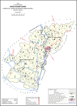 Map showing Kherwa Amjadpur (#415) in Sandi CD block | |
 Kherwa Amjadpur Location in Uttar Pradesh, India  Kherwa Amjadpur Kherwa Amjadpur (India) | |
| Coordinates: 27.346972°N 79.988745°E[1] | |
| Country | |
| State | Uttar Pradesh |
| District | Hardoi |
| Area | |
| • Total | 1.59 km2 (0.61 sq mi) |
| Population (2011)[2] | |
| • Total | 752 |
| • Density | 470/km2 (1,200/sq mi) |
| Languages | |
| • Official | Hindi |
| Time zone | UTC+5:30 (IST) |
The 1961 census recorded Kherwa Amjadpur (as "Khirwa Amzadpur") as comprising 1 hamlet, with a total population of 256 (139 male and 117 female), in 53 households and 43 physical houses.[4] The area of the village was given as 397 acres.[4]
The 1981 census recorded Kherwa Amjadpur as having a population of 387, in 77 households, and covering an area of 159.05 hectares.[3]
References
- Search for "Kherwa Amjadpur" here https://geonames.nga.mil/namesgaz/.
{{cite web}}: Missing or empty|title=(help) - "Census of India 2011: Uttar Pradesh District Census Handbook - Hardoi, Part A (Village and Town Directory)" (PDF). Census 2011 India. pp. 231–55. Retrieved 5 June 2021.
- Census 1981 Uttar Pradesh: District Census Handbook Part XIII-A: Village & Town Directory, District Hardoi (PDF). 1982. pp. 178–9. Retrieved 29 May 2021.
- Census 1961: District Census Handbook, Uttar Pradesh (36 - Hardoi District) (PDF). Lucknow. 1965. pp. 158, xcviii-xcvix of section "Bilgram Tahsil". Retrieved 5 June 2021.
Текст в блоке "Читать" взят с сайта "Википедия" и доступен по лицензии Creative Commons Attribution-ShareAlike; в отдельных случаях могут действовать дополнительные условия.
Другой контент может иметь иную лицензию. Перед использованием материалов сайта WikiSort.org внимательно изучите правила лицензирования конкретных элементов наполнения сайта.
Другой контент может иметь иную лицензию. Перед использованием материалов сайта WikiSort.org внимательно изучите правила лицензирования конкретных элементов наполнения сайта.
2019-2025
WikiSort.org - проект по пересортировке и дополнению контента Википедии
WikiSort.org - проект по пересортировке и дополнению контента Википедии