world.wikisort.org - India
Kattappana is a municipal town in the Sahyadri (or Western Ghats) of Kerala state, India. It is the main urban centre in the high ranges of Idukki district, situated about 2,788.71–2,952.76 feet (850.00–900.00 m) from sea level, Kattappana is a Tier-3 Semi-urban centre. It is the second municipality in Idukki District. It is a major commercial town and flourished with the boost in production of agriculture and spices.
Kattappana
കട്ടപ്പന | |
|---|---|
Municipality | |
From top, left to right: Kattappana from a nearby mountain, Kattappana new private bus stand , Housing Board Shopping Complex, St. George Forane Church and Kattappana Municipality Office. | |
 | |
 Kattappana Location in Kerala, India  Kattappana Kattappana (India) | |
| Coordinates: 09°45′15″N 77°06′57″E | |
| Country | |
| State | Kerala |
| District | Idukki |
| Named for | Spices |
| Government | |
| • Type | Municipality |
| • Body | Kattappana Municipality |
| • Municipal Chairperson | Shyni Sunny Cherian |
| Area | |
| • Total | 61.32 km2 (23.68 sq mi) |
| Elevation | 900 m (3,000 ft) |
| Population (2011) | |
| • Total | 42,646 |
| • Density | 700/km2 (1,800/sq mi) |
| Languages | |
| • Official | Malayalam, English |
| Time zone | UTC+5:30 (IST) |
| PIN | 685508 (Kattappana Head P.O), 685515 (Kattappana South P.O) |
| Telephone code | 04868 |
| Vehicle registration | KL-87(Kattappana) |
| Nearest cities | Kumily, Nedumkandam, Cheruthoni |
| Literacy | 95.25% |
| Lok Sabha constituency | Idukki |
| Sex ratio | 1016 ♂/♀ |
| Website | Kattappana Municipality |


People migrated to this place mainly during 1950s from different parts of nearby townships like Pala, Kottayam etc. However, there were inhabitants even before 100 years. The main occupation is cultivation of commercial crops and spices like tea, coffee, pepper, cardamom and the majority of them are farmers.[1] One of the anchor institutions in Kattappana is St. John's Hospital. When it was started in 1968, it was one of the main hospitals in a 100-km radius. Managed by the Hospitaller Brothers of St. John of God, the hospital has grown to a tertiary level of 450 - bedded multi-speciality hospital with sixteen clinical disciplines.[2]
Municipal administration

Previously, Kattappana was included in the Udumbanchola tehsil (taluk) of Idukki district and was later included in the newly formed Idukki tehsil (taluk). In 1962, it became a grama panchayath and the first council was held under the presidency of V.T Sebastian in 1964.[3] It was officially declared as municipality by the state government on 1 November 2015. It became the second municipality in the district, while Thodupuzha became the first one within the low ranges. The first municipal chairman was Mr. Johny Kulampallil and the current municipal chairperson is Ms Shyni Sunny Cherian.[4]
It is one of the more important commercial centre in the high ranges and was on a fast track in terms of development and infrastructure building. Kattappana became a grama panchayat in 1962 and the first panchayat council under the presidency of V.T. Sebastian was formed in 1964.
However, it was the development of the Kottayam–Kattappana road and the Puliyanmala–Thodupuzha State highway that turned the town into a commercial centre. It was the agriculture sector that played a pivotal role in economically uplifting the town
Open Defecation Free Municipality

The Union Minister for Urban Development, Housing & Urban Poverty Alleviation and Information & Broadcasting, Shri M. Venkaiah Naidu presented the Swachhata Certificate to then Chairman of Kattappana Municipality Shri Johny Kulampally on becoming the Open Defecation Free Municipality in Kerala, in Kochi on October 18, 2016.
| External video | |
|---|---|
DD News Report on Kattappana becoming the Open Defecation Free Municipality | |
Wards in Kattappana Municipality
For administrative convenience, the municipality is divided into 34 wards.
| Ward No. | Ward Name |
|---|---|
| 1 | Vazhavara |
| 2 | Nirmala city |
| 3 | Society |
| 4 | Konginippadavu |
| 5 | Vellayamkudy |
| 6 | Vettikkuzhakavala |
| 7 | Nathukallu |
| 8 | Kallukunnu |
| 9 | Pezhumkavala |
| 10 | Valiyapara |
| 11 | Kochuthovala North |
| 12 | Kochuthovala |
| 13 | Anakuthy |
| 14 | Parakkadavu |
| 15 | Puliyanmala |
| 16 | Ambalappara |
| 17 | Kattappana |
| 18 | Kunthalampara North |
| 19 | Kunthalampara South |
| 20 | Pallikavala |
| 21 | Erupathekkar |
| 22 | Ambalakkavala |
| 23 | Mettukkuzhi |
| 24 | Vallakkadavu |
| 25 | Kadamakkuzhy |
| 26 | Nariampara |
| 27 | Thovarayar |
| 28 | I.T.I kunnu |
| 29 | Valiyakandam |
| 30 | Govt. College |
| 31 | Suvarnagiri |
| 32 | Kalyanathandu |
| 33 | Mulakaramedu |
| 34 | Kounthi |
Demographics
As of 2011 Census, Kattappana had a population of 42,646, with 21,159 males and 21,487 females. Kattappana has an area of 61.32 km2 (23.68 sq mi) with 10,419 families residing in it. In Kattappana, 10.3% was under 6 years of age. The Scheduled Castes (SC) were 6% of the total population and the Scheduled Tribes (ST) were 1.23%. Kattappana had an average literacy of 95.25% higher than the state average of 94%.[5]
The town had a large population of Syrian Catholic families who migrated to Kattappana in early 1950s from Central Travancore.[4] The migrations were majorly from Palai, Chenganassery and Kanjirapally taluks of Kottayam district and Pathanamthitta. Apart from the Catholics, the Nadar, Viswakarma, Nair, and Ezhava communities also make up a good part of the population. The landmark of the town is an edifice dedicated to Narayana Guru. There are also Muslim families and the Juma Masjid caters to their religious needs.
Agriculture

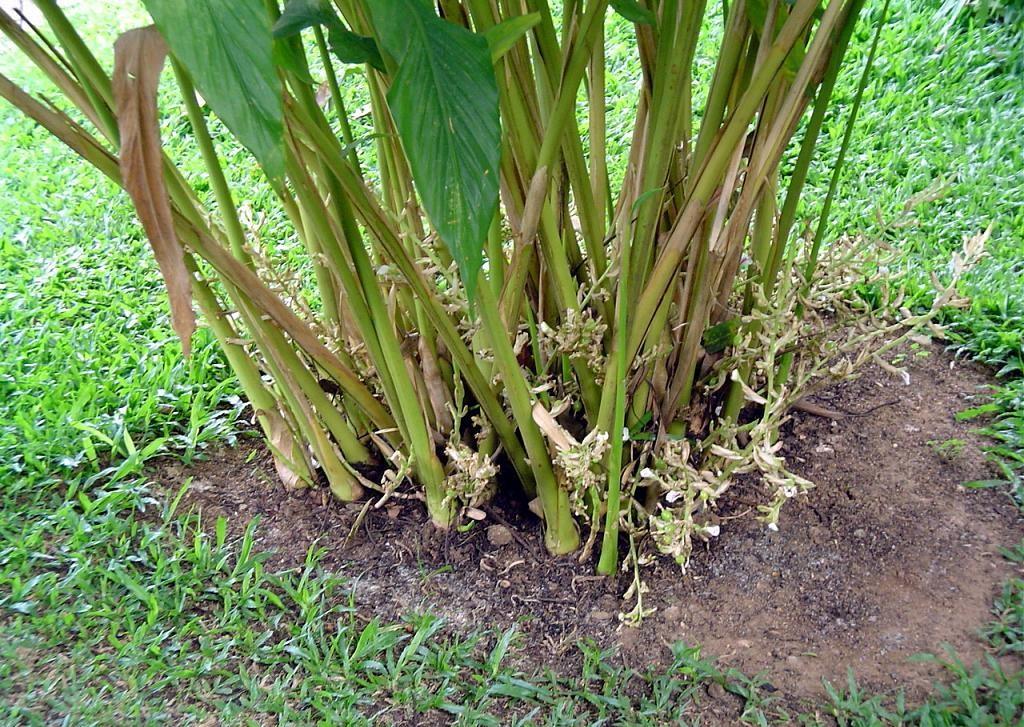
Kattappana is the center for spices trade and the primary producer of cardamom[6] and black pepper. The main occupation of people of Kattappana is agriculture. A specific type Njallani high yielding variety of cardamom, was developed in Kattappana. It is also the centre of production and marketing of coffee, cocoa and ginger. There are also several reputed tea plantations (Tata Tea, A V Thomas & Co, Malayalam Plantations, Kannan Devan etc.) in adjoining areas of the district.
Spices Board (erstwhile Cardamom Board under Government of India) has an office in Kattappana. A Spices Park is established at Puttadi near Kattappana. Cardamom Research Institute is situated at Pampadumpara.[citation needed]
Njallani high yielding variety of cardamom was developed by Sebastian Joseph Njallani of Kattappana, who migrated to Kattappana in 1952.[7]
But still there are people who has not received pattayam for their land.
Climate
The climate of Kattappana falls under the Köppen climate classification. The place normally experiences a moderate climate. The humidity rises from the month of March to April and mid May. The average annual temperature here is 23 °C. The months of June, July, August and October receives significant amount of rainfall. November and December are the coldest months in the year.
| Climate data for Kattappana, Kerala | |||||||||||||
|---|---|---|---|---|---|---|---|---|---|---|---|---|---|
| Month | Jan | Feb | Mar | Apr | May | Jun | Jul | Aug | Sep | Oct | Nov | Dec | Year |
| Average high °C (°F) | 26.1 (79.0) |
27.4 (81.3) |
29.1 (84.4) |
29.3 (84.7) |
29.2 (84.6) |
27.2 (81.0) |
26.1 (79.0) |
26.5 (79.7) |
26.8 (80.2) |
26.2 (79.2) |
25.5 (77.9) |
25.5 (77.9) |
27.1 (80.7) |
| Average low °C (°F) | 16.8 (62.2) |
17.5 (63.5) |
19.0 (66.2) |
20.2 (68.4) |
20.8 (69.4) |
20.1 (68.2) |
19.6 (67.3) |
19.6 (67.3) |
19.3 (66.7) |
19.1 (66.4) |
18.5 (65.3) |
17.2 (63.0) |
19.0 (66.2) |
| Average precipitation mm (inches) | 22 (0.9) |
30 (1.2) |
52 (2.0) |
116 (4.6) |
163 (6.4) |
307 (12.1) |
396 (15.6) |
246 (9.7) |
163 (6.4) |
252 (9.9) |
176 (6.9) |
75 (3.0) |
1,998 (78.7) |
| Source: Climate-Data.org[8] | |||||||||||||
Notable Personalities
- Late Brother Fortunatus Thanhäuser, O.H., (1918-2005)(Servant of God)
- Shaji Chen - Tamil, Malayalam Writer and Tamil Film Actor
- Fr. Francis Dominic OFM (Founder, Assisi Snehashram)
- Dr Anil Pradeep K (Doctor)
- M.C Kattappana (Actor)
- Edamanakkunnel Mathai Augusthy (Ex MLA)
- Shyni sunny (Chairperson, Kattappana Municipality)
- Cartoonist Sajidas mohan (National award winner)
Healthcare
St. John's Hospital Kattappana is a leading hospital in Idukki District. It is owned and managed by the Hospitaller Order of St. John of God. It has a full range of modern facilities. An institution named St. John College of Nursing is attached to the hospital
St.John's Hospital, Kattappana was started in 1968 by Bro. Fortunatus Thanhäuser, a missionary from Germany who adopted Kattappana as his home from 1967 until his death in 2005. He came to Kattappana, India in January 1967. The mission entrusted to him was to provide for the health needs of the most remote populations in the Highrange region of Kerala.
Theni Medical College in Tamil Nadu is around 70 km from Kattappana and is a closer destination than any other medical college in Kerala.
Kottayam Medical College is the next nearest medical college for Kattappana residents. There is a Government-run District Hospital in Pynave, Idukki.
Another major hospital in Kattappana is Kattappana Government Taluk Hospital & Co-operative Hospital near the private bus stand. Its also equipped with all major departments and facilities.
Other hospitals functioning in Kattappana
- Anchana Hospital, Kattappana
- Bala Hospital, Pulianmala Road *Christy Hospital, Idukki kavala
- Saro Hospital, Erattayar Road
- Government Ayurvedic Hospital,Kattappana
- Government Homeo Hospital.
Population Analysis
The current population of Kattappana town are mostly descendants of migrants who migrated to the area in early 1950s, when the area was forest land. The town has large population of Syrian Catholic families who migrated to Kattappana in early 1950s from Central Travancore.[9] The migrations were majorly from Pala, Chenganassery and Kanjirapally taluks of Kottayam district and Pathanamthitta. Apart from the Catholics, the Nadar, Viswakarma, Nair, and Ezhava communities also make up a good part of the population. The landmark of the town is an edifice dedicated to Narayana Guru. There are also Muslim families and the Juma Masjid caters to their religious needs.
Descendants of earlier inhabitants, the tribals of the forest, can still be seen. The Mannan tribe is now concentrated around Kovilmala, near Kanchiyar.[10]
Religious Places
The major places of religious worship include:
- Jyothis Pastoral Centre, Kattappana
- Sree Lakshminarayana Temple, Idukkikavala, Kattappana
- Sree Dharma Sastha Temple, Ambalakavala[14]
- Visvakarma Mahadeva Temple,Kochuthovala Rd, Kattappana
- St. Paul's Malankara Catholic Church, Kattappana (Archdiocese of Tiruvalla)
- St.George Forane Syrian Catholic Church,Pallikavala, Kattappana (Diocese of Kanjirappally)
- St.George Forane Church,Vellyamkudy (Diocese of Idukki)
- St Mary's Orthodox Church, Kattappana
- St George Jacobite Syrian Church, Kattappana (under Idukki Bhadrasanam)
- St Mary's Knanaya Church, Kattappana
- St. John's CSI Church, Kattappana
- India Pentecostal Mission Church, Kattappana
- Darussalam Juma Masjid, Kattappana
Art, Sports and Culture
Theatres
- Aiswarya Multiplex Theatre (formerly known as Sangeetha), near the Town Hall
- Sagara Movies (Multiplex, 4K Dolby Atmos), Kochuthovala Road.
- Santhosh Theatre, Near Kattappana Police Station.
Arts and Music Clubs
- Kattappana Town Lions Club [16] is part of Lions Club International and is engaged in humanitarian service and community projects for community service.
- Kattappana also has Rotary club international
- Idukki Malankarajyothi Integral Development Society, Jyothis Center, Kattappana.
- Bodhana Social Service Society, Jyothis Center, Kattappana.
- Kattappana has multiple public libraries.
Sports
schools and colleges in kattappana have been promoting sports. In the State school athletic meets, Kattappana educational district used to be runners-up for many years consecutively. There are football clubs in the town, such as Spices City Club. An annual football event is conducted in which various clubs from all over Kerala participate. Kattappana also has a sports stadium and two Football Turfs
Transportation

Kattappana has a well established road system to other districts as well as to nearby state Tamil Nadu. Recently one new National highway 185 announced to Idukki district, through Adimali-Cheruthoni-Kattappana-Kumily.
Distances to nearby towns
- Nedumkandam - 18.5 km
- Kumily - 26.8 km
- Kottayam - 100.2 km
- Cumbum -31.8 km
- Palai - 73.7 km
- Thodupuzha - 85.3 km
- Changanasherry - 112.9 km
- Theni - 68.9 km
Major Roads Connecting Kattappana
 NH 185
 SH 43
SH 43 SH 33
SH 33
Educational Facilities
Colleges
- Government College, Kattappana
- College of Applied Science, Kattappana
- St. John's College of Nursing
- St.Sebastian College Kattappana
- JPM College Labhakada,Kattappana
- Christ College Puliyanmala, Kattappana
- St.John's College of pharmaceutical Sciences Kattappana
- St. Sebastian's College Kattappana
- Govt ITI College, Kattappana
Nearby Educational Facilities
- Government Engineering College, Idukki (32.3 km)
- Marian College, Kuttikkanam (Autonomous)
- M.E.S. College, Nedumkandam (13.7 km)
- Govt. Polytechnic College, Nedumkandam (24.2 km)
- Govt. Polytechnic College, Kumily (35 km)
- Holy Cross College, Puttady (10 km)
- Model Polytechnic(IHRD), Idukki (30 km)
- John Paul Memorial (JPM),Labbakada
Schools
- Infant Jesus Residential School, Kattappana (CBSE)
- Ossanam English Medium Higher Secondary School Kattappana
- Carmel CMI Public School, Puliyanmala, Kattappana (CBSE)
- Auxillium Senior Secondary School, Kattappana (ICSE)
- St. George's Higher Secondary School Kattappana
- St. Jerome's Higher Secondary School Vellayamkudy
- Nirmal Jyothi Public School
- Government Tribal HSS, Kattappana
- Saraswathy Vidya Peetham, Vellayamkudy
References
- "'Trial Run Begins at Spices Park'". The Hindu. 6 September 2010. Archived from the original on 10 September 2010. Retrieved 30 June 2014.
- "St. John's Hospital website". Retrieved 17 August 2016.
- "Kattappana to become a municipality - The Hindu › kerala › article7204111". The Hindu. 15 May 2015. Retrieved 6 December 2016.
- "UDF wrests power in Kattappana and Thodupuzha - The Hindu› kerala › article7894574". The Hindu. 19 November 2015. Retrieved 7 December 2016.
- Kerala, Directorate of Census Operations. District Census Handbook, Idukki (PDF). Thiruvananthapuram: Directorateof Census Operations,Kerala. p. 58,59. Retrieved 14 July 2020.
- Cardamom Cultivation
- "Tale of an Indigenous Farmer", Rediff.com
- "CLIMATE: KATTAPANA", Climate-Data.org. Web: .
- "St George Forane Church, Kattappana". Archived from the original on 31 March 2012. Retrieved 9 October 2011.
- Mannan tribe
External links

Другой контент может иметь иную лицензию. Перед использованием материалов сайта WikiSort.org внимательно изучите правила лицензирования конкретных элементов наполнения сайта.
WikiSort.org - проект по пересортировке и дополнению контента Википедии