world.wikisort.org - Germany
Großkrotzenburg is a municipality in the Main-Kinzig district, in Hesse, Germany. It has a population of around 7,500.
Großkrotzenburg | |
|---|---|
Municipality | |
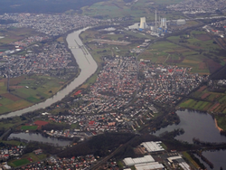 Aerial view | |
 Coat of arms | |
Location of Großkrotzenburg within Main-Kinzig-Kreis district  | |
 Großkrotzenburg  Großkrotzenburg | |
| Coordinates: 50°05′N 08°59′E | |
| Country | Germany |
| State | Hesse |
| Admin. region | Darmstadt |
| District | Main-Kinzig-Kreis |
| Government | |
| • Mayor (2016–22) | Thorsten Bauroth[1] (Ind.) |
| Area | |
| • Total | 7.45 km2 (2.88 sq mi) |
| Elevation | 112 m (367 ft) |
| Population (2020-12-31)[2] | |
| • Total | 7,548 |
| • Density | 1,000/km2 (2,600/sq mi) |
| Time zone | UTC+01:00 (CET) |
| • Summer (DST) | UTC+02:00 (CEST) |
| Postal codes | 63538 |
| Dialling codes | 06186 |
| Vehicle registration | MKK, HU, GN, SLÜ |
| Website | www.grosskrotzenburg.de |
The town is mainly known for its swimming lake and its coal-fired power station.
Geography
Location
Großkrotzenburg is located in the extreme southwest of the Main-Kinzig district, in the southeast of Hesse, bordering on Bavaria. It lies on the right bank of the river Main.
Part of the municipal territory is covered by the Kahler Seenplatte, a system of lakes created by mining and (gravel) quarrying that stretches across the Hessian-Bavarian border and is named after the town Kahl am Main.

Neighbouring communities
Großkrotzenburg borders on (from the north, clockwise) Hanau, Kahl am Main (in (Aschaffenburg district), and Hainburg (in Offenbach district).
Infrastructure
Utilities
Kraftwerk Staudinger is a coal-fired thermal power station located west of the town, directly on the Main river. Due to the size of its cooling towers, the power plant is a local landmark.
Transport
Großkrotzenburg lies on the Bundesstrasse 8.
References
- Direkt gewählte (Ober-) Bürgermeister/-innen der hessischen Städte und Gemeinden, accessed 5 July 2021.
- "Bevölkerung in Hessen am 31.12.2020 nach Gemeinden". Hessisches Statistisches Landesamt (in German). June 2021.
| Wikimedia Commons has media related to Großkrotzenburg. |
Towns and municipalities in Main-Kinzig-Kreis district | ||
|---|---|---|
|  | |
Authority control | |
|---|---|
| General | |
| National libraries | |
| Other |
|
This Hesse location article is a stub. You can help Wikipedia by expanding it. |
На других языках
- [en] Großkrotzenburg
[ru] Гроскроценбург
Гроскроценбург (нем. Großkrotzenburg) — коммуна в Германии, в земле Гессен. Подчиняется административному округу Дармштадт. Входит в состав района Майн-Кинциг. Население составляет 7342 человека (на 31 декабря 2010 года).[1] Занимает площадь 7,45 км². Официальный код — 06 4 35 011.Другой контент может иметь иную лицензию. Перед использованием материалов сайта WikiSort.org внимательно изучите правила лицензирования конкретных элементов наполнения сайта.
WikiSort.org - проект по пересортировке и дополнению контента Википедии