world.wikisort.org - France
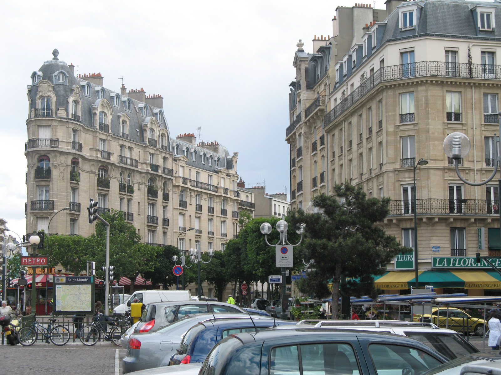
Saint-Mandé (French pronunciation: [sɛ̃ mɑ̃de] (![]() listen)) is a high-end commune of the Val-de-Marne department in Île-de-France in the eastern suburbs of Paris, France. It is located 5.3 km (3.3 mi) from the center of Paris. It is one of the smallest communes of the Île-de-France by land area, but is one of the most densely populated municipalities in Europe. It is located on the edge of the 12th arrondissement of Paris, near the Porte de Vincennes and the Porte de Saint-Mandé.
The motto of the city is Cresco et Floresco, which means "I grow and I flourish".
listen)) is a high-end commune of the Val-de-Marne department in Île-de-France in the eastern suburbs of Paris, France. It is located 5.3 km (3.3 mi) from the center of Paris. It is one of the smallest communes of the Île-de-France by land area, but is one of the most densely populated municipalities in Europe. It is located on the edge of the 12th arrondissement of Paris, near the Porte de Vincennes and the Porte de Saint-Mandé.
The motto of the city is Cresco et Floresco, which means "I grow and I flourish".
Saint-Mandé | |
|---|---|
Commune | |
 At the line 1 metro station | |
 Coat of arms | |
 Paris and inner ring départements | |
Location of Saint-Mandé  | |
 Saint-Mandé  Saint-Mandé | |
| Coordinates: 48°50′32″N 2°25′07″E | |
| Country | France |
| Region | Île-de-France |
| Department | Val-de-Marne |
| Arrondissement | Nogent-sur-Marne |
| Canton | Vincennes |
| Intercommunality | Grand Paris |
| Government | |
| • Mayor (2020–2026) | Julien Weil[1] |
| Area 1 | 0.92 km2 (0.36 sq mi) |
| Population | 22,377 |
| • Density | 24,000/km2 (63,000/sq mi) |
| Time zone | UTC+01:00 (CET) |
| • Summer (DST) | UTC+02:00 (CEST) |
| INSEE/Postal code | 94067 /94160 |
| Elevation | 42–54 m (138–177 ft) |
| 1 French Land Register data, which excludes lakes, ponds, glaciers > 1 km2 (0.386 sq mi or 247 acres) and river estuaries. | |
History
On 1 January 1860, the city of Paris was enlarged by annexing neighboring communes. On that occasion, about two-thirds of the commune of Saint-Mandé was annexed to Paris, and now forms the neighborhoods of Bel-Air and Picpus, in the 12th arrondissement of Paris.
In 1929, the commune of Saint-Mandé lost one-quarter of its territory when the city of Paris annexed the Bois de Vincennes, a small part of which belonged to Saint-Mandé, leaving Saint-Mandé as a small rump commune after the territorial losses of 1860 and 1929.
Population
|
| ||||||||||||||||||||||||||||||||||||||||||||||||||||||||||||||||||||||||||||||||||||||||||||||||||||||||||||||||||
| Source: EHESS[3] and INSEE (1968-2017)[4] | |||||||||||||||||||||||||||||||||||||||||||||||||||||||||||||||||||||||||||||||||||||||||||||||||||||||||||||||||||
Personalities
- Juliette Benzoni (1920–2016), novel writer
- Charles Berling (b. 1958), actor
- Françoise Blanchard (1954–2013), actress
- Maurice Boitel (1919–2007), painter
- Armand Carrel (1800–1836), political writer, who died there in a duel
- Gaëtan Charbonnier (b. 1988), footballer
- Claudette Colbert (1903–1996), actress
- Georges Courteline (1858–1929), writer and lampoonist
- Bruno Cremer (1929–2010), actor
- Alexandra David-Néel (1868–1969), Asian scholar
- Frédéric Diefenthal (b. 1968), actor
- Juliette Drouet (1806–1883), mistress of Victor Hugo
- Grégory Fitoussi (b. 1976), actor
- Alfred Grévin (1827–1892), caricaturist, founder of Musée Grévin
- Benoît Chomel de Jarnieu (b. 1955), Naval Admiral
- Jacqueline Lamba Breton, (1910–1993) was a French painter and married (1934–1943) to André Breton[5]
- Paul Nicolas (1899–1959), footballer
- Christine Nougaret (b. 1958), archivist
- Charles Nungesser (1892–1927), aviator
- Guillaume Jonquieres, footballer
Transport
The municipality is crossed by a principal north–south axis, the Avenue du Général-de-Gaulle (formerly Rue de la République), and by an east–west axis, the Avenue de Paris (RN 34). Another important and historical street of the municipality is the Chaussée de l'Étang which goes along the Bois de Vincennes. Saint-Mandé is served by Saint-Mandé station on Paris Métro Line 1, as well as line no 8. RATP buses include lines 46, 56, 86 and 325. The closest airport is Orly Airport, located around 17 km (11 mi) away.
Education
Schools include:[6]
- Preschools/nurseries (maternelles): Paul Bert, Charles Digeon, La Tourelle, E.G. Tillion preschool
- Elementary schools: Paul Bert, Charles Digeon, E.G. Tillion elementary
Junior high school students are served by Ecole & Collège Decroly,[7] and Collège Jacques Offenbach.[8]
The private school system Ensemble Scolaire St Michel de Picpus maintains a secondary campus in Saint-Mandé.[9]
Twin towns
Saint-Mandé is twinned with:
 Waltham Forest, London, United Kingdom since 21 April 1956
 Eschwege, Hesse, Germany since 23 September 1989
 Concord, Massachusetts, United States since 15 March 1997
 Tres Cantos, Community of Madrid, Spain since 12 March 2005
 Drogheda, Ireland since 9 September 2011
 Yanggu, Gangwon, South Korea since 12 October 2011
See also
References
- "Répertoire national des élus: les maires" (in French). data.gouv.fr, Plateforme ouverte des données publiques françaises. 13 September 2022.
- "Populations légales 2019". The National Institute of Statistics and Economic Studies. 29 December 2021.
- Des villages de Cassini aux communes d'aujourd'hui: Commune data sheet Saint-Mandé, EHESS. (in French)
- Population en historique depuis 1968, INSEE
- "Jacqueline Lamba Breton Biography (1910–1993)". leninimports.com.
- "Les écoles." Saint-Mandé. Retrieved on September 11, 2016.
- Home. Ecole & Collège Decroly. Retrieved on September 11, 2016.
- Home. Collège Jacques Offenbach. Retrieved on September 11, 2016.
- Home. Ensemble Scolaire St Michel de Picpus. Retrieved on September 11, 2016.
External links
- Official website (in French)
На других языках
[de] Saint-Mandé
Saint-Mandé ist eine französische Gemeinde mit 22.377 Einwohnern (Stand 1. Januar 2019), die sich östlich an die Hauptstadt Paris anschließt. Sie gehört zum Ballungsraum Île de France und liegt, einem Zipfel gleichend, im Nordwesten des Départements Val-de-Marne.- [en] Saint-Mandé
[es] Saint-Mandé
Saint-Mandé es una comuna y población de Francia, en la región de Isla de Francia, departamento de Valle del Marne, en el distrito de Nogent-sur-Marne. La comuna conforma por sí misma el cantón homónimo.[5][ru] Сен-Манде
Сен-Манде́ (фр. Saint-Mandé) — город и коммуна во Франции, находится в регионе Иль-де-Франс. Департамент коммуны — Валь-де-Марн. Центр кантона Сен-Манде. Округ коммуны — Ножан-сюр-Марн.Другой контент может иметь иную лицензию. Перед использованием материалов сайта WikiSort.org внимательно изучите правила лицензирования конкретных элементов наполнения сайта.
WikiSort.org - проект по пересортировке и дополнению контента Википедии