world.wikisort.org - France
Gourbeyre is a commune in the French overseas region and department of Guadeloupe, in the Lesser Antilles. It is a suburb of the city of Basse-Terre.
This article needs additional citations for verification. (January 2020) |
Gourbeyre | |
|---|---|
Commune | |
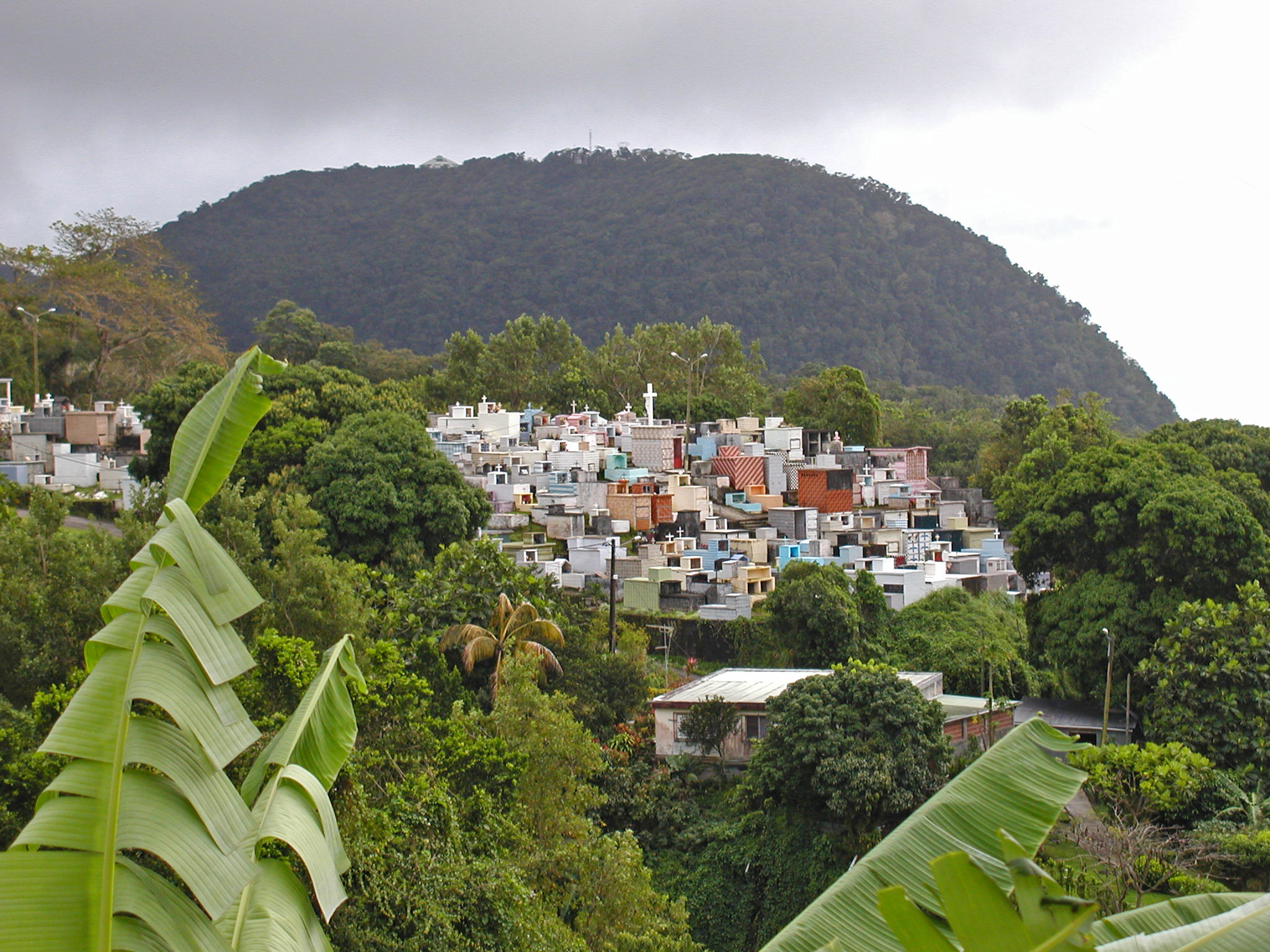 Gourbeyre Cemetery adjoins the church and overlooks the sea | |
 Location of the commune (in red) within Guadeloupe | |
Location of Gourbeyre  | |
| Coordinates: 16°00′N 61°42′W | |
| Country | France |
| Overseas region and department | Guadeloupe |
| Arrondissement | Basse-Terre |
| Canton | Trois-Rivières |
| Intercommunality | CA Grand Sud Caraïbe |
| Government | |
| • Mayor (2020–2026) | Claude Edmond[1] |
| Area 1 | 22.52 km2 (8.70 sq mi) |
| Population | 7,760 |
| • Density | 340/km2 (890/sq mi) |
| Time zone | UTC−04:00 (AST) |
| INSEE/Postal code | 97109 /97113 |
| 1 French Land Register data, which excludes lakes, ponds, glaciers > 1 km2 (0.386 sq mi or 247 acres) and river estuaries. | |
The commune of Gourbeyre was in the past a pivotal point in the defense of Guadeloupe's Basse-Terre Island.
Government
From 1640 to 1643 the government of Guadeloupe consisted entirely of governor Aubert. The governor's house is regarded as the most beautiful in the commune of Gourbeyre.
Charles Houël was named governor in 1648 and immediately began the construction of the Fort of Saint Charles on the right bank of the Galleon River. This moved the seat of government. The Fort (renamed Fort Delgrès in 1989) was placed to resist the attack of the English by providing cover for French ships.
Colonisation
"Montagne Saint-Charles et du Palmiste" was the name given for the Gourbeyre commune up to the 17th century. Through the 18th century it was an important capital in colonial France.
Gourbeyre had some military importance due to its mountainous topography. The area was considered to be impregnable during the English attacks of 1691 and 1703. Colonists were attracted to settle in Gourbeyre because of trading opportunities and in view of the protection provided against English attacks for residents in Gourbeyre.
Religion
Many religious communities settled in the commune of Gourbeyre. By 1650 monks had obtained the rights to cultivate the land and in the cases of the Order of Our Lady of Mount Carmel and the Jesuits had turned to cultivation of sugar plantations and the refining of sugar. In Bisdary the Jesuits were vested with 250 hectares of sugar cane which was cultivated and maintained by up to 400 slaves.
Further history
At the beginning of the 19th century, the commune of Gourbeyre had 461 whites, 3418 slaves and 168 of other races.
Very serious events occurred in the commune of Gourbeyre, particularly in Dolé village, with the revolt of Delgrès opposed to the Richepanse general, sent by Napoleon. In January 1838, a new municipal organization detached the commune of Gourbeyre, from Basse-Terre.
In 1843, a terrible earthquake destroyed the area. The governor admiral of Gourbeyre was instrumental in reconstructing the area.
After a fire in 1955, and hurricanes in 1964 and 1979, a new building was built here in 1986 to house the departmental records and historical private papers important to the history of the island. It also hosts researchers, students and personalities.
Geography
Gourbeyre is located east of the city Basse-Terre and southwest of the Soufrière volcano. Gourbeyre is near a river and located on the N1 highway. Gourbeyre is at the crossing point between the windward and the leeward shores.
Population
| Year | Pop. | ±% p.a. |
|---|---|---|
| 1967 | 7,066 | — |
| 1974 | 6,813 | −0.52% |
| 1982 | 6,399 | −0.78% |
| 1990 | 6,330 | −0.14% |
| 1999 | 7,642 | +2.11% |
| 2007 | 8,088 | +0.71% |
| 2012 | 7,820 | −0.67% |
| 2017 | 7,795 | −0.06% |
| Source: INSEE[3] | ||
Economy
Crops such as cocoa, coffee and bananas are grown in the mountains and a sugar factory produces sugar at the river's estuary. Cattle rearing is also done.
Historical and natural sites brings tourists to Gourbeyre. Also a marina is down at the shoreline, nearby Basse-Terre.
Education
Public preschools and primary schools include:[4]
- Ecole primaire Noglotte Eugène
- Ecole primaire Luce Joseph
- Ecole maternelle Raymonde Augustin
- Ecole maternelle Blanchet
- Ecole maternelle Champfleury
Public junior high schools include:[5]
- Collège Richard Samuel
Private secondary schools under contract:[6]
- LP Blanchet
Sights
- Center observatory of Soufrière
- Departmental records of Guadeloupe
- Marina of Sens River
- Warm baths of the village of Dolé
Notable residents
- Lucette Michaux-Chevry, (1929-2021), former mayoress of Gourbeyre and Basse-Terre.
- Marie-Luce Penchard, (born 1959), mayor of Basse-Terre (since 2014).
See also
References
- "Répertoire national des élus: les maires". data.gouv.fr, Plateforme ouverte des données publiques françaises (in French). 2 December 2020.
- "Populations légales 2019". The National Institute of Statistics and Economic Studies. 29 December 2021.
- Population en historique depuis 1968, INSEE
- "LISTE DES ECOLES PUBLIQUES ET PRIVEES SOUS CONTRAT." Académie de la Guadeloupe. Retrieved on 10 March 2018.
- "Établissements du 2nd degré PUBLIC 2017-2018." Académie de la Guadeloupe. Retrieved on 10 March 2018.
- "Etablissements du 2nd degré privé sous contrat 2017-2018."Académie de la Guadeloupe. Retrieved on 10 March 2018.
External links
Authority control | |
|---|---|
| General | |
| National libraries | |
| Other | |
На других языках
[de] Gourbeyre
Gourbeyre (Guadeloupe-Kreolisch: Goubè) ist eine Gemeinde mit 7760 Einwohnern (Stand 1. Januar 2019) im französischen Überseedépartement Guadeloupe. Dort befindet sich das Archiv des Départements. Gourbeyre ist ein Mitglied des Gemeindeverbands Grand Sud Caraïbe.- [en] Gourbeyre
[fr] Gourbeyre
Gourbeyre (en créole guadeloupéen : Goubè) est une commune française, située dans le département-région de la Guadeloupe. C'est l'une des villes-centres d'une agglomération de plus de 51 000 habitants, l'unité urbaine de Basse-Terre. Elle est le chef-lieu du canton du même nom. Ses habitants sont appelés les Gourbeyriens et les Gourbeyriennes.Другой контент может иметь иную лицензию. Перед использованием материалов сайта WikiSort.org внимательно изучите правила лицензирования конкретных элементов наполнения сайта.
WikiSort.org - проект по пересортировке и дополнению контента Википедии