world.wikisort.org - China
Beibei District (simplified Chinese: 北碚区; traditional Chinese: 北碚區; pinyin: Běibèi Qū) is a district in the Chongqing municipality, People's Republic of China.[1] A satellite town in the north of central Chongqing, Beibei got its name because of the huge rock that extends to the middle of Jialing River, and is known for its historical culture in the period of the Republic of China. It covers around 755 square kilometers (292 sq mi) and has a population of about 650,000 (2004).[citation needed]
Beibei
北碚区 | |
|---|---|
District | |
 Government building in Beibei. | |
 | |
 Beibei District in Chongqing | |
| Country | People's Republic of China |
| Municipality | Chongqing |
| Time zone | UTC+8 (China Standard) |
| Area code | 023 |


Location and geography
Beibei is located at the outer side of the Chongqing Metropolitan Area. It shares borders with Shapingba (south), Bishan (west), Hechuan (north), and Yubei (east), on the west bank of Jialing River.
Climate
| Climate data for Beibei (1981−2010) | |||||||||||||
|---|---|---|---|---|---|---|---|---|---|---|---|---|---|
| Month | Jan | Feb | Mar | Apr | May | Jun | Jul | Aug | Sep | Oct | Nov | Dec | Year |
| Record high °C (°F) | 18.8 (65.8) |
26.2 (79.2) |
33.7 (92.7) |
36.5 (97.7) |
37.9 (100.2) |
37.9 (100.2) |
40.9 (105.6) |
44.3 (111.7) |
43.8 (110.8) |
35.3 (95.5) |
29.0 (84.2) |
20.2 (68.4) |
44.3 (111.7) |
| Average high °C (°F) | 10.5 (50.9) |
13.1 (55.6) |
17.9 (64.2) |
23.2 (73.8) |
27.3 (81.1) |
29.4 (84.9) |
32.9 (91.2) |
33.3 (91.9) |
28.3 (82.9) |
21.9 (71.4) |
17.3 (63.1) |
11.6 (52.9) |
22.2 (72.0) |
| Daily mean °C (°F) | 7.7 (45.9) |
9.8 (49.6) |
13.6 (56.5) |
18.4 (65.1) |
22.5 (72.5) |
25.0 (77.0) |
28.2 (82.8) |
28.1 (82.6) |
23.9 (75.0) |
18.5 (65.3) |
14.0 (57.2) |
9.0 (48.2) |
18.2 (64.8) |
| Average low °C (°F) | 5.7 (42.3) |
7.5 (45.5) |
10.6 (51.1) |
15.0 (59.0) |
19.0 (66.2) |
21.9 (71.4) |
24.7 (76.5) |
24.5 (76.1) |
21.0 (69.8) |
16.3 (61.3) |
11.8 (53.2) |
7.2 (45.0) |
15.4 (59.8) |
| Record low °C (°F) | −1.8 (28.8) |
0.2 (32.4) |
0.6 (33.1) |
5.8 (42.4) |
10.1 (50.2) |
14.9 (58.8) |
18.9 (66.0) |
18.0 (64.4) |
14.0 (57.2) |
6.6 (43.9) |
2.0 (35.6) |
−1.9 (28.6) |
−1.9 (28.6) |
| Average precipitation mm (inches) | 17.6 (0.69) |
21.5 (0.85) |
43.5 (1.71) |
99.0 (3.90) |
148.6 (5.85) |
195.8 (7.71) |
200.9 (7.91) |
144.4 (5.69) |
127.0 (5.00) |
87.8 (3.46) |
47.3 (1.86) |
23.3 (0.92) |
1,156.7 (45.55) |
| Average relative humidity (%) | 85 | 81 | 78 | 78 | 78 | 82 | 77 | 75 | 80 | 86 | 86 | 86 | 81 |
| Source: China Meteorological Data Service Center[2] | |||||||||||||
Administrative divisions
| Name | Chinese (S) | Hanyu Pinyin | Population (2010)[3] | Area (km2) |
|---|---|---|---|---|
| Tiansheng Subdistrict | 天生街道 | Tiānshēng Jiēdào | 124,728 | 7.3 |
| Chaoyang Subdistrict | 朝阳街道 | Cháoyáng Jiēdào | 38,127 | 2.3 |
| Beiwenquan Subdistrict | 北温泉街道 | Běiwēnquán Jiēdào | 8,4847 | 24.8 |
| Dongyang Subdistrict | 东阳街道 | Dōngyáng Jiēdào | 40,143 | 48.79 |
| Longfengqiao Subdistrict | 龙凤桥街道 | Lóngfèngqiáo Jiēdào | 33,981 | 31.6 |
| Caijiagang Subdistrict | 蔡家岗街道 | Càijiāgǎng Jiēdào | 35,564 | 45.75 |
| Xiema town | 歇马镇 | Xiēmǎ Zhèn | 60,933 | |
| Chengjiang town | 澄江镇 | Chéngjiāng Zhèn | 28,056 | 72 |
| Dongjiaxi town | 童家溪镇 | Tóngjiāxī Zhèn | 21,820 | 22.7 |
| Tianfu town | 天府镇 | Tiānfǔ Zhèn | 30,980 | 54 |
| Shijialiang town | 施家梁镇 | Shījiāliáng Zhèn | 8,773 | 20.14 |
| Shuitu town | 水土镇 | Shuǐtǔ Zhèn | 44,551 | 52 |
| Jingguan town | 静观镇 | Jìngguān Zhèn | 43,674 | 72.5 |
| Liuyin town | 柳荫镇 | Liǔyīn Zhèn | 17,505 | 63.83 |
| Fuxing town | 复兴镇 | Fùxīng Zhèn | 33,621 | 63.9 |
| Sansheng town | 三圣镇 | Sānshèng Zhèn | 19,305 | 59.22 |
| Jindaoxia town | 金刀峡镇 | Jīndāoxiá Zhèn | 13,752 |
Colleges and universities
- Southwest University (西南大學) (formed by a 2005 merger of the former Southwest China Normal University and Southwest Agricultural University, founded in 1906 and 1950 respectively)
High schools
- High School Affiliated to Southwest University (西南大学附中)
- Chongqing Chaoyang High School (重庆朝阳中学)
- Chongqing Jianshan High School (重庆兼善中学)
- Chongqing Jiangbei High School (重庆江北中学)
Transportation
- Yuhe Expressway (Chongqing–Hechuan District; 渝合高速)
- Xiangyu Railway(Xiangfan–Chongqing; 襄渝铁路)
- Suiyu Railway(Suining–Chongqing; 遂渝铁路)
- China National Highway 212
Metro
Beibei is served by one metro line operated by Chongqing Rail Transit:
- Line 6- Caojiawan, Caijia, Xiangjiagang, Longfengxi, Tiansheng, Beibei
Industry
Beibei is one of the three national industry bases for measuring instrument.[specify]
Tourism
- The North Spring (北温泉)
- Jinyun Mountain (缙云山)
- Golden Sword Gorge (金刀峡)
- Three Gorges of Jialing River (嘉陵江小三峡)
- Tomb of General Zhang Zizhong (抗日名将张自忠将军墓)
- Former residences of Lao She and Liang Shih-Chiu (民国时期老舍旧居,梁实秋“雅舍”旧址)
- Old campus of Fudan University during WW2 (抗战时期复旦大学旧址)
Gallery
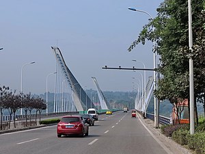 Bridge and cars in Beibei (2014)

References
- "Beibei District – Topic". YouTube. Retrieved 22 September 2014.
- 中国地面气候标准值月值(1981-2010) (in Simplified Chinese). China Meteorological Data Service Center. Retrieved 22 August 2022.
- shi, Guo wu yuan ren kou pu cha ban gong; council, Guo jia tong ji ju ren kou he jiu ye tong ji si bian = Tabulation on the 2010 population census of the people's republic of China by township / compiled by Population census office under the state; population, Department of; statistics, employment statistics national bureau of (2012). Zhongguo 2010 nian ren kou pu cha fen xiang, zhen, jie dao zi liao (Di 1 ban. ed.). Beijing Shi: Zhongguo tong ji chu ban she. ISBN 978-7-5037-6660-2.
External links
- Official website Government of Beibei
- Visit Beibei
| ||
| Districts | 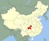
 | |
| Counties | ||
| Autonomous counties | ||
| Defunct divisions |
| |
| Attractions |
| |
| Sports Venues | ||
| Higher Education |
| |
| Culture & Demographics |
| |
| Transport |
| |
Authority control | |
|---|---|
| General | |
| National libraries | |
На других языках
- [en] Beibei District
[ru] Бэйбэй
Бэйбэ́й (кит. упр. 北碚, пиньинь Běibèi, буквально: «северный утёс») — район городского подчинения города центрального подчинения Чунцин (КНР).Другой контент может иметь иную лицензию. Перед использованием материалов сайта WikiSort.org внимательно изучите правила лицензирования конкретных элементов наполнения сайта.
WikiSort.org - проект по пересортировке и дополнению контента Википедии