world.wikisort.org - Brazil
Porto Nacional is a Brazilian municipality in the state of Tocantins. The population was 53,316 (2020) in an area of 4,450 km2 (1,720 sq mi), including both rural and urban areas.
Porto Nacional | |
|---|---|
municipality | |
 Flag  Seal | |
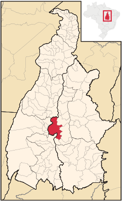 Location of Porto Nacional | |
| Coordinates: 10°42′28″S 48°25′01″W | |
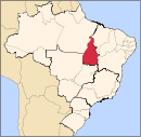
| Country | Brazil |
| Region | Norte |
| State | Tocantins |
| Government | |
| • Mayor | Paulo Alves Mourão (PT) |
| Area | |
| • Total | 4,449.917 km2 (1,718.123 sq mi) |
| Population (2020 [1]) | |
| • Total | 53,316 |
| • Density | 11.04/km2 (28.6/sq mi) |
| Time zone | UTC-3 (UTC-3) |
Location
It is located approximately in the center of the state at a distance of 60 km. from the state capital of Palmas, which lies to the north on highway TO-050 Porto Nacional lies on the right bank of the important Tocantins River, which flows north to join the Araguaia River. Leaving from the capital of Goiás, Goiânia, it is located at a distance of 769 km, taking the BR-153 (Belém-Braília) and then TO-255.
The city is served by Porto Nacional Airport.
The economy
The main economic activities are cattle raising and the growing of crops like soybeans, pineapple, rice, mamona, corn, and sorghum.
- Cattle herd: 84,291
Planted area of main crops in 2006
- Pineapple: 70 ha.
- Soybeans: 13,000 ha.
- Rice: 2,000 ha.
- Mamona: 680 ha.
- Corn: 2,083 ha.
- Sorghum: 8,000 ha.
- Plantations of coconut, mango, and citrus fruits.
Farm data for 2006
- Total number of farms: 1,278
- Agricultural area: 129,098 ha.
- Planted area: 10,300 ha.
- Area of natural pasture: 70,101
- Persons working in agriculture: 3,300 (most were relatives of the owner of the farm)
Health and education
- Number of health establishments (2005): 29
- Private health establishments: 10
- Hospitals: 1 with 81 beds
- Infant mortality rate:
- Number of schools: 59 primary schools and 10 middle schools. There were two institutes of higher learning with 688 students in 2006.
- Literacy rate: 79% (over 25 years old)
- Ranking on the Municipal Human Development Index: 0.750
References
- "IBGE 2020". Retrieved 26 January 2021.
External links
Capital: Palmas | ||||||||||||
| Mesoregion Ocidental |
|  | ||||||||||
| Mesoregion Oriental |
| |||||||||||
Authority control | |
|---|---|
| General |
|
| National libraries | |
This Tocantins, Brazil location article is a stub. You can help Wikipedia by expanding it. |
На других языках
- [en] Porto Nacional
[ru] Порту-Насиунал
Порту-Насиунал (порт. Porto Nacional) — муниципалитет в Бразилии, входит в штат Токантинс. Составная часть мезорегиона Восточный Токантинс. Входит в экономико-статистический микрорегион Порту-Насиунал. Население составляет 49 146 человек на 2010 год. Занимает площадь 4 449,917 км². Плотность населения — 11,04 чел./км².Другой контент может иметь иную лицензию. Перед использованием материалов сайта WikiSort.org внимательно изучите правила лицензирования конкретных элементов наполнения сайта.
WikiSort.org - проект по пересортировке и дополнению контента Википедии