world.wikisort.org - Australia
Wareek is a Central Victorian locality which straddles both the Pyrenees Shire and the Shire of Central Goldfields.
| Wareek Victoria | |
|---|---|
 Wareek | |
| Coordinates | 37.0004489°S 143.591372°E |
| Population | 72 (SAL 2021)[1] |
| Postcode(s) | 3465 |
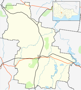
| Location |
|
| LGA(s) |
|
| State electorate(s) | Ripon |
| Federal division(s) | Mallee |
People and properties
The "largest landholder and possibly the wealthiest" in the area was Charles Wilson from Sunny Park Wareek[2][3] ( Coordinates 36.9813035°S 143.607879°E ). Wilson's daughter Maude Wilson married John Miller in 1901 at Sunny Park and they then lived in the Rathscar district where their four children were born. John and his brother Bill were share farmers.
The Norwood Homestead on Norwood Road, Wareek, ( Coordinates 36.9824418°S 143.6426573°E ), constructed in 1863, is said to be "one of the most distinctive gothic revival houses in Victoria". The two-storey homestead is registered on the Register of the National Estate.[4]
At the Wareek Hall there is an Honour Roll, of those from the Bung Bong district, who fought in World War I. It contains 19 names, including 5 names of those who did not return.[5]
Bung Bong, Wareek Cemetery

The cemetery is located at 413 Bung Bong-Rathscar Rd, Wareek VIC 3465. ( Coordinates 37°02.549′S 143°35.152′E ) and in 2017 is being upgraded by the community with new fences and facilities.
Information on the interments,[6] with more details and images of the headstones - here.[7]
Wareek Hall

The Wareek Hall was officially opened in August 1914. The opening ceremony included speeches, a concert and concluded with a "bountiful supper".[8] The centenary of that opening was "celebrated" in August 2014.[9][10]
See also
- Bung Bong, Victoria
- Homebush, Victoria
- List of localities in the Shire of Central Goldfields
- List of locations in the Shire of Pyrenees
- Rathscar, Victoria
References
- Australian Bureau of Statistics (28 June 2022). "Wareek (Suburb and Locality)". Australian Census 2021 QuickStats. Retrieved 28 June 2022.
- "Death of C A Wilson". Maryborough and Dunolly Advertiser. 12 January 1917. Retrieved 27 June 2017.
- "Talbot Leader". Talbot Leader. 13 January 1917. Retrieved 27 June 2017.
- "Norwood Homestead". 7 June 1999.
- "Bung Bong District roll of honour". Monument Australia.
- "Wareek Bung Bong Cemetery". February 2009.
- "Bung Bong & Wareek Cemetery". 2006.
- "Wareek hall. Enthusiastic opening". 7 August 1914. Retrieved 31 December 2019.
- "Newsletter of the Mechanics' Institutes Of Victoria Inc - Wareek Public Hall, Page 27" (PDF). Mechanics' Institutes Of Victoria. 2014. Retrieved 31 December 2019.
- Steed, Lachy (15 August 2014). "Wareek Hall celebrates centenary". Maryborough Advertiser. Retrieved 31 December 2019.
External links
This article about a location in Victoria, Australia is a stub. You can help Wikipedia by expanding it. |
Другой контент может иметь иную лицензию. Перед использованием материалов сайта WikiSort.org внимательно изучите правила лицензирования конкретных элементов наполнения сайта.
WikiSort.org - проект по пересортировке и дополнению контента Википедии