world.wikisort.org - Yemen
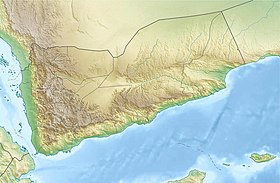
Dhubab is a small coastal town in the Taiz Governorate of south-western Yemen. It is the seat of Dhubab District.
Dhubab | |
|---|---|
Town | |
| Coordinates: 12.944839°N 43.416595°E | |
| Country | |
| Governorate | Taiz Governorate |
| District | Dhubab District |
History
During World War I, British patrol vessels shelled Dhubab fort in November 1914. They later opened fire on Yakhtul on 8 December 1914, damaging 7 or 8 dhows moored there.[1]
Geography
Dhubab lies on the coast of the Red Sea on a jutting headland, 46.6 kilometres by road south of Mocha and north of Mayyun.[2][3]
References
- Serjeant, Robert Bertram; Bidwell, Robin Leonard (21 July 2005). Arabian Studies. Cambridge University Press. p. 29. ISBN 978-0-521-01729-9. Retrieved 1 October 2011.
- Maps (Map). Google Maps.
- Bing Maps (Map). Microsoft and Harris Corporation Earthstar Geographics LLC.
Текст в блоке "Читать" взят с сайта "Википедия" и доступен по лицензии Creative Commons Attribution-ShareAlike; в отдельных случаях могут действовать дополнительные условия.
Другой контент может иметь иную лицензию. Перед использованием материалов сайта WikiSort.org внимательно изучите правила лицензирования конкретных элементов наполнения сайта.
Другой контент может иметь иную лицензию. Перед использованием материалов сайта WikiSort.org внимательно изучите правила лицензирования конкретных элементов наполнения сайта.
2019-2025
WikiSort.org - проект по пересортировке и дополнению контента Википедии
WikiSort.org - проект по пересортировке и дополнению контента Википедии
