world.wikisort.org - Vietnam
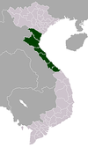
Gio Linh (![]() listen) is a rural district of Quảng Trị province in the North Central Coast region of Vietnam. Gio Linh borders Vĩnh Linh district to the north, Đông Hà to the south.
listen) is a rural district of Quảng Trị province in the North Central Coast region of Vietnam. Gio Linh borders Vĩnh Linh district to the north, Đông Hà to the south.
This article may be expanded with text translated from the corresponding article in Vietnamese. (March 2009) Click [show] for important translation instructions.
|
Gio Linh district
Huyện Gio Linh | |
|---|---|
District | |
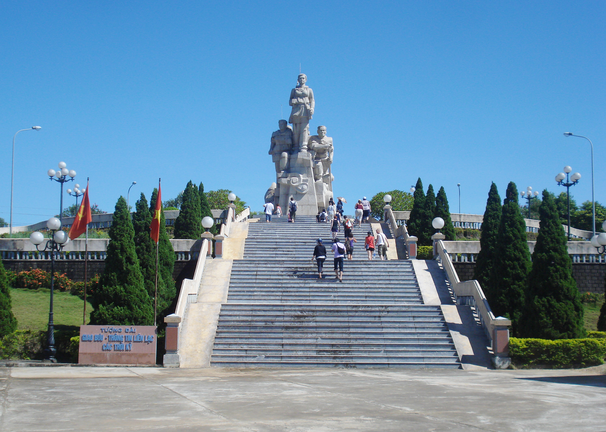 Post Office monument | |
| Country | |
| Region | North Central Coast |
| Province | Quảng Trị |
| Capital | Gio Linh |
| Area | |
| • Total | 183 sq mi (474 km2) |
| Population (2003) | |
| • Total | 73,702 |
| Time zone | UTC+7 (UTC + 7) |
The planned Quang Tri Airport will be constructed in this district. As of 2003 the district had a population of 73,702.[1] The district covers an area of 474 km². The district capital lies at Gio Linh.[1] Cồn Tiên is part of Gio Linh.[2]
History
Vietnam War
Gio Linh was the site of the northernmost Allied position during the Vietnam war. It was under the command of the 12th Marine, and the 1967 hill commander was then USMC Major Alfred M. Gray, Jr. who eventually retired in 1991 as General and Commandant of the USMC. The position was on highway 1 and expanded on an existing 1950-era French fort. The fort was occupied by a company of the Army of Vietnam First Division. The USMC command had a typical unit strength ranging from 200 to 600 men, depending on the believed level of ground assault risk. During the period April 1967 to September 1967 they suffered 28 killed and 200 wounded.
Divisions
Gio Linh district is divided into nineteen districts:
- Gio Châu
- Trung Hải
- Trung Giang
- Trung Sơn
- Gio Mỹ
- Gio Phong
- Gio An
- Gio Bình
- Gio Hải
- Gio Sơn
- Gio Hòa
- Linh Hải
- Gio Việt
- Vĩnh Trường
- Hải Thái
- Gio Mai
- Gio Quang
- Linh Thượng
- Gio Thành
References
- "Districts of Vietnam". Statoids. Retrieved March 20, 2009.
- "Cồn Tiên High School". Archived from the original on 2013-10-19. Retrieved 2013-10-16.
Districts of Vietnam North Central Coast | ||
|---|---|---|
| Thanh Hóa Province |
|  |
| Nghệ An Province |
| |
| Hà Tĩnh Province |
| |
| Quảng Bình Province |
| |
| Quảng Trị Province |
| |
| Thừa Thiên Huế Province |
| |
※ denotes provincial seat. | ||
Другой контент может иметь иную лицензию. Перед использованием материалов сайта WikiSort.org внимательно изучите правила лицензирования конкретных элементов наполнения сайта.
WikiSort.org - проект по пересортировке и дополнению контента Википедии