world.wikisort.org - Stati_Uniti_d'America
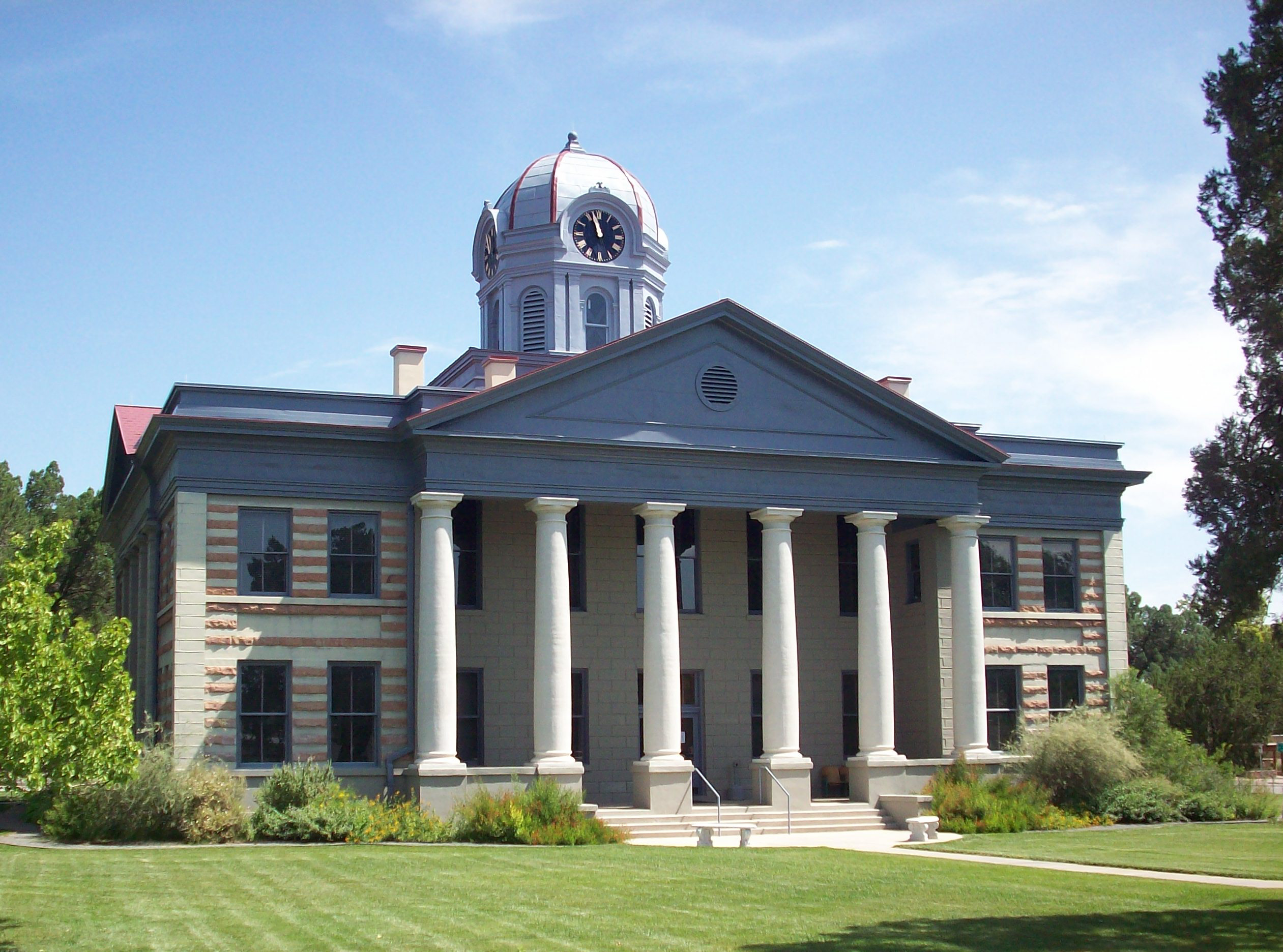
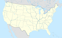
La contea di Jeff Davis in inglese Jeff Davis County è una contea dello Stato del Texas, negli Stati Uniti. La popolazione al censimento del 2010 era di 2 342 abitanti.[1] Il capoluogo di contea è Fort Davis.[2] Il nome della contea deriva da Jefferson Davis, unico presidente degli Stati Confederati d'America (1861–1865).[3]
| Contea di Jeff Davis contea | |
|---|---|
 | |
| Localizzazione | |
| Stato |  Stati Uniti Stati Uniti
|
| Stato federato |  Texas Texas
|
| Amministrazione | |
| Capoluogo | Fort Davis |
| Data di istituzione | 1887 |
| Territorio | |
| Coordinate del capoluogo | 30°43′12″N 104°07′48″W |
| Superficie | 5 865 km² |
| Abitanti | 2 342 (2010) |
| Densità | 0,4 ab./km² |
| Altre informazioni | |
| Lingue | inglese |
| Fuso orario | UTC-6 |
| Cartografia | |
 | |
| Sito istituzionale | |

Geografia fisica
| Anno[4] | Popolazione | ±% |
|---|---|---|
| 1890 | 1,394 | |
| 1900 | 1,150 | −17.5% |
| 1910 | 1,678 | 45.9% |
| 1920 | 1,445 | −13.9% |
| 1930 | 1,800 | 24.6% |
| 1940 | 2,375 | 31.9% |
| 1950 | 2,090 | −12.0% |
| 1960 | 1,582 | −24.3% |
| 1970 | 1,527 | −3.5% |
| 1980 | 1,647 | 7.9% |
| 1990 | 1,946 | 18.2% |
| 2000 | 2,207 | 13.4% |
| 2010 | 2,342 | 6.1% |
Secondo l'Ufficio del censimento degli Stati Uniti d'America la contea ha un'area totale di 2265 miglia quadrate (5870 km²), costituiti completamente da terraferma.[5] Nella contea si trova la Davis Mountains, una catena montuosa.
Strade principali
 Interstate 10
 U.S. Highway 90
 State Highway 17
 State Highway 118
 State Highway 166


Contee adiacenti
- Reeves County (nord)
- Pecos County (est)
- Brewster County (sud-est)
- Presidio County (sud-ovest)
- Guadalupe Municipality (ovest)
- Hudspeth County (nord-ovest)
- Culberson County (nord)
Aree protette
| Parco | Autorità di mantenimento | Area | Anno di fondazione |
|---|---|---|---|
| Chihuahuan Desert Nature Center and Botanical Gardens | Chihuahuan Desert Research Institute | 507 acri (205 ha)[6] | 1978[6] |
| Davis Mountains State Park | Texas Parks and Wildlife Department | 2 709 acri (1 096 ha)[7] | 1933[7] |
| Davis Mountains Preserve | The Nature Conservancy of Texas | 33 075 acri (13 385 ha)[8] | 1997[9] |
| Fort Davis National Historic Site | National Park Service | 523 acri (212 ha)[10] | 1961[11] |
Educazione
La parte occidentale della contea è servita dalla Valentine Independent School District, mentre nella parte centrale e orientale dalla Fort Davis Independent School District.
Note
- State & County QuickFacts, su quickfacts.census.gov, United States Census Bureau. URL consultato il 18 dicembre 2013 (archiviato dall'url originale il 12 luglio 2011).
- Find a County, su naco.org, National Association of Counties. URL consultato il 7 giugno 2011.
- Gannett, Henry, The Origin of Certain Place Names in the United States, Govt. Print. Off., 1905, p. 168.
- U.S. Decennial Census, su census.gov, United States Census Bureau. URL consultato il 2 maggio 2015 (archiviato dall'url originale il 12 maggio 2015).
- 2010 Census Gazetteer Files (TXT), su www2.census.gov, United States Census Bureau, 22 agosto 2012. URL consultato il 2 maggio 2015.
- Staff, About Us, su cdri.org, Chihuahuan Desert Research Institute. URL consultato l'11 agosto 2016.
- Staff, Davis Mountains State Park, History, su tpwd.texas.gov, Texas Parks and Wildlife Department, 16 dicembre 2014. URL consultato il 4 aprile 2014.
- Staff, Davis Mountains Preserve (XML), su nature.org, The Nature Conservancy. URL consultato il 4 aprile 2014.
- Staff, Davis Mountains Preserve, Saving a ‘Sky Island’ in the Wilds of Far West Texas (PDF), su nature.org, The Nature Conservancy, 5 febbraio 2013, p. 1. URL consultato il 4 aprile 2014 (archiviato dall'url originale il 20 novembre 2014).
- Land Resources Division, Listing of Acreage (Summary) (PDF), su irma.nps.gov, National Park Service, 31 dicembre 2014, p. 5. URL consultato il 4 aprile 2014.
- Staff, Fort Davis: Frontier Post, su nps.gov, National Park Service, 31 marzo 2015. URL consultato il 4 aprile 2014.
Altri progetti
 Wikimedia Commons contiene immagini o altri file su contea di Jeff Davis

Collegamenti esterni
- (EN) Sito ufficiale, su co.jeff-davis.tx.us.
- (EN) Contea di Jeff Davis, su Geographic Names Information System, USGS.

| Controllo di autorità | VIAF (EN) 136050909 · LCCN (EN) n81060010 · WorldCat Identities (EN) lccn-n81060010 |
|---|

На других языках
[de] Jeff Davis County (Texas)
Das Jeff Davis County[3] ist ein County im Bundesstaat Texas der Vereinigten Staaten. Der Sitz der County-Verwaltung (County Seat) befindet sich in Fort Davis.[4][en] Jeff Davis County, Texas
Jeff Davis County is a county in the U.S. state of Texas. As of the 2020 census, its population was 1,996.[1] Its county seat is Fort Davis.[2] The county is named for Jefferson Davis, who served as the 23rd United States Secretary of War in the 1850s, and as President of the Confederate States of America.[3][fr] Comté de Jeff Davis (Texas)
Le comté de Jeff Davis, en anglais : Jeff Davis County, est un comté situé dans l'ouest de l'État du Texas aux États-Unis. Fondé le 15 mars 1887, son siège de comté est la census-designated place de Fort Davis. Selon le recensement des États-Unis de 2010, sa population est de 2 342 habitants, estimée, en 2018, à 2 252 habitants. Le comté a une superficie de 5 865,3 km2, dont la presque totalité en surfaces terrestres. Il est nommé en l'honneur de Jefferson Davis, le président des États confédérés d'Amérique.- [it] Contea di Jeff Davis (Texas)
[ru] Джефф-Дейвис (округ, Техас)
Округ Джефф-Дэвис (англ. Jeff Davis county) — округ штата Техас Соединённых Штатов Америки. На 2000 год в нём проживало 2207 человек. По оценке бюро переписи населения США в 2008 году население округа составляло 2275 человек.[1] Окружным центром является город Форт-Дэвис.Текст в блоке "Читать" взят с сайта "Википедия" и доступен по лицензии Creative Commons Attribution-ShareAlike; в отдельных случаях могут действовать дополнительные условия.
Другой контент может иметь иную лицензию. Перед использованием материалов сайта WikiSort.org внимательно изучите правила лицензирования конкретных элементов наполнения сайта.
Другой контент может иметь иную лицензию. Перед использованием материалов сайта WikiSort.org внимательно изучите правила лицензирования конкретных элементов наполнения сайта.
2019-2026
WikiSort.org - проект по пересортировке и дополнению контента Википедии
WikiSort.org - проект по пересортировке и дополнению контента Википедии