world.wikisort.org - Etats-Unis
West Brownsville est un borough situé au sud-est du comté de Washington, en Pennsylvanie, aux États-Unis[1],[2]. En 2010, il comptait une population de 992 habitants, estimée au à 951 habitants[3]. Le borough est incorporé le [1].
| West Brownsville | ||||
 Pont ferroviaire de West Brownsville. | ||||
| Administration | ||||
|---|---|---|---|---|
| Pays | ||||
| État | ||||
| Comté | Washington | |||
| Type de localité | Borough | |||
| Maire | Lindsey Bennett | |||
| Code ZIP | 15417 | |||
| GNIS | 1193637 | |||
| Indicatif(s) téléphonique(s) local (locaux) | 724 | |||
| Démographie | ||||
| Population | 992 hab. (2010) | |||
| Densité | 270 hab./km2 | |||
| Géographie | ||||
| Coordonnées | 40° 01′ 47″ nord, 79° 53′ 11″ ouest | |||
| Altitude | 235 m |
|||
| Superficie | 368 ha = 3,68 km2 | |||
| · dont terre | 3,36 km2 (91,3 %) | |||
| · dont eau | 0,32 km2 (8,7 %) | |||
| Divers | ||||
| Municipalité depuis | [1] | |||
| Localisation | ||||
 Carte du comté de Washington. | ||||
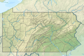
| Géolocalisation sur la carte : Pennsylvanie
Géolocalisation sur la carte : États-Unis
Géolocalisation sur la carte : États-Unis
| ||||
| modifier |
||||
Démographie
Lors du recensement de 2010, le borough comptait une population de 992 habitants. Elle est estimée, en 2020, à 951 habitants.
| Historique des recensements | |||
| Ann. | Pop. | %± | |
|---|---|---|---|
| 1850 | 477 | — | |
| 1860 | 613 | ▲ +28,51 % | |
| 1870 | 547 | ▼ −10,77 % | |
| 1880 | 571 | ▲ +4,39 % | |
| 1890 | 735 | ▲ +28,72 % | |
| 1900 | 742 | ▲ +0,95 % | |
| 1910 | 2 036 | ▲ +174,39 % | |
| 1920 | 1 900 | ▼ −6,68 % | |
| 1930 | 1 717 | ▼ −9,63 % | |
| 1940 | 1 844 | ▲ +7,4 % | |
| 1950 | 1 610 | ▼ −12,69 % | |
| 1960 | 1 907 | ▲ +18,45 % | |
| 1970 | 1 426 | ▼ −25,22 % | |
| 1980 | 1 433 | ▲ +0,49 % | |
| 1990 | 1 170 | ▼ −18,35 % | |
| 2000 | 1 075 | ▼ −8,12 % | |
| 2010 | 992 | ▼ −7,72 % | |
| Est. 2020 | 951 | [3] | ▼ −4,13 % |
| le site pennsylvania.hometownlocator.com | |||
Notes et références
Notes
- (en) Cet article est partiellement ou en totalité issu de l’article de Wikipédia en anglais intitulé « West Brownsville, Pennsylvania » (voir la liste des auteurs).
Références
- (en) « West Brownsville, Washington, Pennsylvania (IL) detailed profile » [« Données sur West Brownsville, comté de Washington, Pennsylvanie »], sur city-data.com (consulté le ).
- (en) « West Brownsville », Geographic Names Information System
- (en) « West Brownsville, PA Profile: Facts & Data », sur le site pennsylvania.hometownlocator.com (consulté le ).
Voir aussi
Articles connexes
- Pennsylvanie
- Comtés du Commonwealth de Pennsylvanie
- Liste des municipalités en Pennsylvanie
Liens externes
- Ressource relative à la géographie :
- Portail de la Pennsylvanie
На других языках
[en] West Brownsville, Pennsylvania
West Brownsville is a former important transportation nexus and a present-day borough in Washington County, Pennsylvania, United States and part of the Pittsburgh metropolitan area. The population was 972 at the 2020 census.[4] Culturally, by postal route, and socially, the community is connected to cross-river sister-city Brownsville, for the two were long joined by the Amerindian trail known as Nemacolin's Path that became a wagon road after the American Revolution, but West Brownsville is a separate municipality. Brownsville was the first point where the descent from the Appalachians could safely reach the river down the generally steep banks of the Monongahela River. Between Brownsville and West Brownsville was a shallow stretch, usable as a river ford astride a major Emigrant Trail to the various attractive regions in the Northwest Territory, the first National Road, the Cumberland Pike (Now U.S. Route 40[lower-alpha 1]).- [fr] West Brownsville
Текст в блоке "Читать" взят с сайта "Википедия" и доступен по лицензии Creative Commons Attribution-ShareAlike; в отдельных случаях могут действовать дополнительные условия.
Другой контент может иметь иную лицензию. Перед использованием материалов сайта WikiSort.org внимательно изучите правила лицензирования конкретных элементов наполнения сайта.
Другой контент может иметь иную лицензию. Перед использованием материалов сайта WikiSort.org внимательно изучите правила лицензирования конкретных элементов наполнения сайта.
2019-2025
WikiSort.org - проект по пересортировке и дополнению контента Википедии
WikiSort.org - проект по пересортировке и дополнению контента Википедии


