world.wikisort.org - Etats-Unis
Riverton est une census-designated place du comté de Cherokee au Kansas.
Pour les articles homonymes, voir Riverton.
| Riverton | ||||
 Eisler Brothers General Store | ||||
| Administration | ||||
|---|---|---|---|---|
| Pays | ||||
| État | ||||
| Comté | Cherokee | |||
| Type de localité | Census-designated place | |||
| Code FIPS | 20-60200 | |||
| GNIS | 0469345 | |||
| Indicatif(s) téléphonique(s) local (locaux) | 620 | |||
| Démographie | ||||
| Population | 929 hab. (2010) | |||
| Densité | 156 hab./km2 | |||
| Géographie | ||||
| Coordonnées | 37° 04′ 30″ nord, 94° 42′ 17″ ouest | |||
| Altitude | 254 m |
|||
| Superficie | 595 ha = 5,95 km2 | |||
| · dont terre | 5,81 km2 (97,65 %) | |||
| · dont eau | 0,14 km2 (2,35 %) | |||
| Fuseau horaire | CST (UTC-6) | |||
| Localisation | ||||
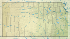
| Géolocalisation sur la carte : Kansas
Géolocalisation sur la carte : États-Unis
Géolocalisation sur la carte : États-Unis
| ||||
| modifier |
||||


C'est une des trois seules villes du Kansas traversées par la Route 66.
Le bureau de poste a été établi en 1919[1]. La population est de 929 habitants en 2010.
Riverton est situé sur l'ancienne U.S. Route 66.
Notes et références
 Portail du Kansas
На других языках
[en] Riverton, Kansas
Riverton is an unincorporated community in Cherokee County, Kansas, United States. It is located at the junction of K-66 (former U.S. Route 66) and U.S. Route 69 Alternate and U.S. Route 400, near the Spring River. It is one of only three towns in Kansas along former U.S. Route 66. As of the 2010 census, the CDP population was 929.[2]- [fr] Riverton (Kansas)
Текст в блоке "Читать" взят с сайта "Википедия" и доступен по лицензии Creative Commons Attribution-ShareAlike; в отдельных случаях могут действовать дополнительные условия.
Другой контент может иметь иную лицензию. Перед использованием материалов сайта WikiSort.org внимательно изучите правила лицензирования конкретных элементов наполнения сайта.
Другой контент может иметь иную лицензию. Перед использованием материалов сайта WikiSort.org внимательно изучите правила лицензирования конкретных элементов наполнения сайта.
2019-2025
WikiSort.org - проект по пересортировке и дополнению контента Википедии
WikiSort.org - проект по пересортировке и дополнению контента Википедии