world.wikisort.org - Etats-Unis
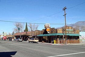
Lone Pine est un census-designated place dans le comté d'Inyo en Californie. Situé à 26 kilomètres au sud-est d'Independence et à une altitude de 1 136 m, le village comptait 2 035 habitants au recensement de 2010 contre 1 655 en 2000. Le village est situé dans la vallée de l'Owens, près des Alabama Hills. L'hôpital local, l'hôpital Southern Inyo, offre des services de secours d'urgence.
| Lone Pine | ||||
 Main Street sur la U.S. Route 395. | ||||
| Administration | ||||
|---|---|---|---|---|
| Pays | ||||
| État | ||||
| Comté | Inyo | |||
| Type de localité | Census designated place | |||
| Code ZIP | 93545 | |||
| Code FIPS | 06-42580 | |||
| GNIS | 277545 | |||
| Indicatif(s) téléphonique(s) local (locaux) | 442/760 | |||
| Démographie | ||||
| Population | 2 035 hab. (2010) | |||
| Densité | 41 hab./km2 | |||
| Géographie | ||||
| Coordonnées | 36° 36′ 22″ nord, 118° 03′ 46″ ouest | |||
| Altitude | 1 136 m |
|||
| Superficie | 4 976,6 ha = 49,766 km2 | |||
| · dont terre | 49,298 km2 (99,06 %) | |||
| · dont eau | 0,47 km2 (0,94 %) | |||
| Fuseau horaire | PST (UTC-8) | |||
| Localisation | ||||
 Carte du comté d'Inyo. | ||||
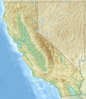
| Géolocalisation sur la carte : États-Unis
Géolocalisation sur la carte : États-Unis
Géolocalisation sur la carte : Californie
| ||||
| modifier |
||||
C'est sur le territoire de cette commune que fut tourné le film d'horreur Tremors.
Histoire
Le , un séisme a dévasté Lone Pine et tué 27 de ses 250 à 300 habitants.
Tourisme

Démographie

Notes et références
- (en) Cet article est partiellement ou en totalité issu de l’article de Wikipédia en anglais intitulé « Lone Pine, California » (voir la liste des auteurs).
Liens externes
- Portail de la Californie
На других языках
[de] Lone Pine (Kalifornien)
Lone Pine ist ein census-designated place mit 2035 Einwohnern (Stand 2010) im Inyo County des Bundesstaats Kalifornien. Er liegt im Owens Valley auf einer Höhe von 1136 m unter der Ostflanke der Sierra Nevada am Fuße des 4418 m hohen Mount Whitney, dem höchsten Berg der USA außerhalb Alaskas.[en] Lone Pine, California
Lone Pine is a census-designated place (CDP) in Inyo County, California, United States.[2] Lone Pine is located 16 mi (26 km) south-southeast of Independence,[3] at an elevation of 3,727 ft (1,136 m).[2] The population was 2,035 at the 2010 census, up from 1,655 at the 2000 census. The town is located in the Owens Valley, near the Alabama Hills and Mount Whitney, between the eastern peaks of the Sierra Nevada to the west and the Inyo Mountains to the east. The local hospital, Southern Inyo Hospital, offers standby emergency services.[4] The town is named after a solitary pine tree that once existed at the mouth of Lone Pine Canyon.[5] On March 26, 1872, the very large Lone Pine earthquake destroyed most of the town and killed 27 of its 250 to 300 residents.- [fr] Lone Pine (Californie)
Текст в блоке "Читать" взят с сайта "Википедия" и доступен по лицензии Creative Commons Attribution-ShareAlike; в отдельных случаях могут действовать дополнительные условия.
Другой контент может иметь иную лицензию. Перед использованием материалов сайта WikiSort.org внимательно изучите правила лицензирования конкретных элементов наполнения сайта.
Другой контент может иметь иную лицензию. Перед использованием материалов сайта WikiSort.org внимательно изучите правила лицензирования конкретных элементов наполнения сайта.
2019-2025
WikiSort.org - проект по пересортировке и дополнению контента Википедии
WikiSort.org - проект по пересортировке и дополнению контента Википедии


