world.wikisort.org - Etats-Unis
Conneaut est une ville américaine située dans le comté d'Ashtabula dans l'État de l'Ohio. En 2010, sa population était de 12 841 habitants.
Cet article est une ébauche concernant une localité de l’Ohio.
Vous pouvez partager vos connaissances en l’améliorant (comment ?) selon les recommandations des projets correspondants.
| Conneaut | ||||
 | ||||
| Administration | ||||
|---|---|---|---|---|
| Pays | ||||
| État | ||||
| Comté | Ashtabula | |||
| Type de localité | City | |||
| Code ZIP | 44030 | |||
| Code FIPS | 39-18350 | |||
| GNIS | 1077521 | |||
| Indicatif(s) téléphonique(s) local (locaux) | 440 | |||
| Démographie | ||||
| Population | 12 841 hab. (2010) | |||
| Densité | 188 hab./km2 | |||
| Géographie | ||||
| Coordonnées | 41° 57′ 00″ nord, 80° 34′ 00″ ouest | |||
| Altitude | 197 m |
|||
| Superficie | 6 845 ha = 68,45 km2 | |||
| · dont terre | 68,27 km2 (99,74 %) | |||
| · dont eau | 0,18 km2 (0,26 %) | |||
| Fuseau horaire | EST (UTC-5) | |||
| Divers | ||||
| Fondation | 1799 | |||
| Municipalité depuis | 1902 | |||
| Devise | "Ohio's Sharpest Corner" | |||
| Localisation | ||||
 Carte du comté d'Ashtabula. | ||||
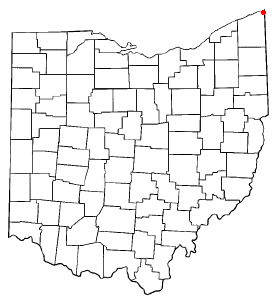
| Géolocalisation sur la carte : Ohio
Géolocalisation sur la carte : États-Unis
Géolocalisation sur la carte : États-Unis
| ||||
| Liens | ||||
| Site web | http://www.conneautohio.gov/ | |||
| modifier |
||||


Traduction
- (en) Cet article est partiellement ou en totalité issu de l’article de Wikipédia en anglais intitulé « Conneaut, Ohio » (voir la liste des auteurs).
 Portail de l’Ohio
На других языках
[de] Conneaut
Conneaut (Aussprache: [.mw-parser-output .IPA a{text-decoration:none}ˈkɒniɔːt]) ist eine Stadt im Ashtabula County im US-amerikanischen Bundesstaat Ohio.[en] Conneaut, Ohio
Conneaut (/ˈkɒniɔːt/[3] KON-ee-awt) is a city in Ashtabula County, Ohio, United States, along Lake Erie at the mouth of Conneaut Creek 66 miles (106 km) northeast of Cleveland. The population was 12,841 at the 2010 Census. Conneaut is located at the far northeastern corner of the state.- [fr] Conneaut (Ohio)
Текст в блоке "Читать" взят с сайта "Википедия" и доступен по лицензии Creative Commons Attribution-ShareAlike; в отдельных случаях могут действовать дополнительные условия.
Другой контент может иметь иную лицензию. Перед использованием материалов сайта WikiSort.org внимательно изучите правила лицензирования конкретных элементов наполнения сайта.
Другой контент может иметь иную лицензию. Перед использованием материалов сайта WikiSort.org внимательно изучите правила лицензирования конкретных элементов наполнения сайта.
2019-2026
WikiSort.org - проект по пересортировке и дополнению контента Википедии
WikiSort.org - проект по пересортировке и дополнению контента Википедии