world.wikisort.org - Etats-Unis
La ville de Concordia est le siège du comté de Cloud, situé dans le Kansas, aux États-Unis.
Pour les articles homonymes, voir Concordia.
Cet article est une ébauche concernant une localité du Kansas.
Vous pouvez partager vos connaissances en l’améliorant (comment ?) selon les recommandations des projets correspondants.
| Concordia | ||||
 Église ND du Perpétuel-Secours, cathédrale avant 1944 | ||||
| Administration | ||||
|---|---|---|---|---|
| Pays | ||||
| État | ||||
| Comté | Cloud | |||
| Maire | Gregory L. Hattan | |||
| Code ZIP | 66901 | |||
| Code FIPS | 20-15200 | |||
| GNIS | 0473311 | |||
| Indicatif(s) téléphonique(s) local (locaux) | 785 | |||
| Démographie | ||||
| Population | 5 395 hab. (2010) | |||
| Densité | 613 hab./km2 | |||
| Géographie | ||||
| Coordonnées | 39° 34′ 09″ nord, 97° 39′ 30″ ouest | |||
| Altitude | 420 m |
|||
| Superficie | 880 ha = 8,8 km2 | |||
| · dont terre | 8,8 km2 (100 %) | |||
| · dont eau | 0 km2 (0 %) | |||
| Fuseau horaire | CST (UTC-6) | |||
| Divers | ||||
| Municipalité depuis | 1872 | |||
| Localisation | ||||
 Carte du comté de Cloud. | ||||
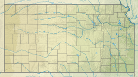
| Géolocalisation sur la carte : Kansas
Géolocalisation sur la carte : États-Unis
Géolocalisation sur la carte : États-Unis
| ||||
| Liens | ||||
| Site web | http://www.concordiaks.org/ | |||
| modifier |
||||


Patrimoine
- Ancienne cathédrale catholique Notre-Dame-du-Perpétuel-Secours, cathédrale avant le transfert du siège du diocèse de Concordia au siège de Salina en 1944, devenu dès lors diocèse de Salina.
 Portail du Kansas
На других языках
[en] Concordia, Kansas
Concordia is a city in and the county seat of Cloud County, Kansas, United States.[1] It is located along the Republican River in the Smoky Hills region of the Great Plains in North Central Kansas. As of the 2020 census, the population of the city was 5,111.[4][5] Concordia is home of the Cloud County Community College and the Nazareth Convent and Academy.- [fr] Concordia (Kansas)
Текст в блоке "Читать" взят с сайта "Википедия" и доступен по лицензии Creative Commons Attribution-ShareAlike; в отдельных случаях могут действовать дополнительные условия.
Другой контент может иметь иную лицензию. Перед использованием материалов сайта WikiSort.org внимательно изучите правила лицензирования конкретных элементов наполнения сайта.
Другой контент может иметь иную лицензию. Перед использованием материалов сайта WikiSort.org внимательно изучите правила лицензирования конкретных элементов наполнения сайта.
2019-2026
WikiSort.org - проект по пересортировке и дополнению контента Википедии
WikiSort.org - проект по пересортировке и дополнению контента Википедии