world.wikisort.org - Etats-Unis
Cedar Slope est une census-designated place américaine située dans le comté de Tulare dans l'État de Californie. En 2010, sa population était de 0 habitants.
| Cedar Slope | ||||
| Administration | ||||
|---|---|---|---|---|
| Pays | ||||
| État | ||||
| Comté | Tulare | |||
| Type de localité | Census-designated place | |||
| GNIS | 2585406 | |||
| Démographie | ||||
| Population | 0 hab. (2010) | |||
| Densité | 0 hab./km2 | |||
| Géographie | ||||
| Coordonnées | 36° 08′ 37″ nord, 118° 34′ 37″ ouest | |||
| Altitude | 1 702 m |
|||
| Superficie | 180 ha = 1,8 km2 | |||
| · dont terre | 1,8 km2 (100 %) | |||
| · dont eau | 0 km2 (0 %) | |||
| Fuseau horaire | PST (UTC-8) | |||
| Localisation | ||||
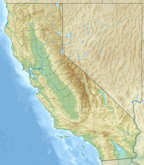
| Géolocalisation sur la carte : Californie
Géolocalisation sur la carte : États-Unis
Géolocalisation sur la carte : États-Unis
| ||||
| modifier |
||||
Source de la traduction
- (en) Cet article est partiellement ou en totalité issu de l’article de Wikipédia en anglais intitulé « Cedar Slope, California » (voir la liste des auteurs).
- Portail de la Californie
На других языках
[en] Cedar Slope, California
Cedar Slope is a census-designated place (CDP) in Tulare County, California.[2] Cedar Slope sits at an elevation of 5,584 feet (1,702 m).[2] The 2010 United States census reported that Cedar Slope was uninhabited.[3] Cedar Slope can be reached from Porterville by 37 curvy miles [4] on California State Route 190 with an elevation gain of 5,525 feet.- [fr] Cedar Slope
Текст в блоке "Читать" взят с сайта "Википедия" и доступен по лицензии Creative Commons Attribution-ShareAlike; в отдельных случаях могут действовать дополнительные условия.
Другой контент может иметь иную лицензию. Перед использованием материалов сайта WikiSort.org внимательно изучите правила лицензирования конкретных элементов наполнения сайта.
Другой контент может иметь иную лицензию. Перед использованием материалов сайта WikiSort.org внимательно изучите правила лицензирования конкретных элементов наполнения сайта.
2019-2025
WikiSort.org - проект по пересортировке и дополнению контента Википедии
WikiSort.org - проект по пересортировке и дополнению контента Википедии


