world.wikisort.org - Etats-Unis
La ville américaine de Cartersville est le siège du comté de Bartow, dans l’État de Géorgie. Lors du recensement de 2010, sa population s’élevait à 19 731 habitants.
Cet article est une ébauche concernant la Géorgie.
Vous pouvez partager vos connaissances en l’améliorant (comment ?) selon les recommandations des projets correspondants.
| Cartersville | ||||
 Bartow County Courthouse | ||||
| Administration | ||||
|---|---|---|---|---|
| Pays | ||||
| État | ||||
| Comté | Comté de Bartow | |||
| Type de localité | City | |||
| Maire | Matt Santini | |||
| Code ZIP | 30120 ; 30121 | |||
| Code FIPS | 13-13688 | |||
| GNIS | 0355017 | |||
| Indicatif(s) téléphonique(s) local (locaux) | 770 | |||
| Démographie | ||||
| Population | 19 731 hab. (2010) | |||
| Densité | 324 hab./km2 | |||
| Géographie | ||||
| Coordonnées | 34° 11′ nord, 84° 48′ ouest | |||
| Altitude | 240 m |
|||
| Superficie | 6 090 ha = 60,9 km2 | |||
| · dont terre | 60,6 km2 (99,51 %) | |||
| · dont eau | 0,3 km2 (0,49 %) | |||
| Fuseau horaire | EST (UTC-5) | |||
| Divers | ||||
| Municipalité depuis | 1850 | |||
| Localisation | ||||
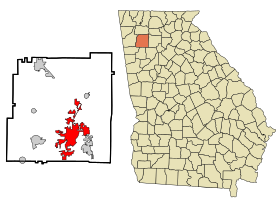 Carte du comté de Comté de Bartow. | ||||
| Géolocalisation sur la carte : Géorgie
Géolocalisation sur la carte : États-Unis
Géolocalisation sur la carte : États-Unis
| ||||
| Liens | ||||
| Site web | http://www.cityofcartersville.org/ | |||
| modifier |
||||


Démographie

Source
- (en) Cet article est partiellement ou en totalité issu de l’article de Wikipédia en anglais intitulé « Cartersville, Georgia » (voir la liste des auteurs).
Notes et références
- (en) « Statistiques des États-Unis - Géogie - Profils des comtés de 2010 » (consulté en )
 Portail de la Géorgie
На других языках
[de] Cartersville
Cartersville ist eine Stadt und zudem der County Seat des Bartow County im US-Bundesstaat Georgia mit 19.731 Einwohnern (Stand: 2010).[en] Cartersville, Georgia
Cartersville is a city in Bartow County, Georgia, United States; it is located within the northwest edge of the Atlanta metropolitan area. As of the 2020 census, the city had a population of 23,187. Cartersville is the county seat of Bartow County.[6]- [fr] Cartersville
[ru] Картерсвилл
Картерсвилл (англ. Cartersville) ― город в округе Бартоу американского штата Джорджия, расположенный на северо-западной окраине столичного района Атланта. По данным переписи 2010 года, население города составляло 19 731 человек[4]. Картерсвилл является центром округа Бартоу[5].Текст в блоке "Читать" взят с сайта "Википедия" и доступен по лицензии Creative Commons Attribution-ShareAlike; в отдельных случаях могут действовать дополнительные условия.
Другой контент может иметь иную лицензию. Перед использованием материалов сайта WikiSort.org внимательно изучите правила лицензирования конкретных элементов наполнения сайта.
Другой контент может иметь иную лицензию. Перед использованием материалов сайта WikiSort.org внимательно изучите правила лицензирования конкретных элементов наполнения сайта.
2019-2026
WikiSort.org - проект по пересортировке и дополнению контента Википедии
WikiSort.org - проект по пересортировке и дополнению контента Википедии