world.wikisort.org - Etats-Unis
Bridgeton Township est un township, situé dans le comté de Bucks, en Pennsylvanie, aux États-Unis[1],[2]. En 2010, le township comptait une population de 1 277 habitants.
| Bridgeton Township | ||||
 Maison à Upper Black Eddy (en), dans le township | ||||
| Administration | ||||
|---|---|---|---|---|
| Pays | ||||
| État | ||||
| Comté | Bucks | |||
| Type de localité | Township | |||
| Code FIPS | 42-017-08592 | |||
| GNIS | 1216011 | |||
| Indicatif(s) téléphonique(s) local (locaux) | 610 | |||
| Démographie | ||||
| Population | 1 277 hab. (2010) | |||
| Géographie | ||||
| Coordonnées | 40° 33′ 29″ nord, 75° 06′ 37″ ouest | |||
| Altitude | 156 m |
|||
| Fuseau horaire | CST (UTC-6) | |||
| Localisation | ||||
 Carte du comté de Bucks. | ||||
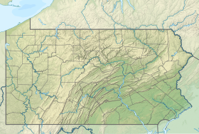
| Géolocalisation sur la carte : États-Unis
Géolocalisation sur la carte : États-Unis
Géolocalisation sur la carte : Pennsylvanie
| ||||
| Liens | ||||
| Site web | Site officiel | |||
| modifier |
||||
Démographie
Lors du recensement de 2010, le township comptait une population de 1 277 habitants. Elle est estimée, en 2017, à 1 275 habitants.
| Historique des recensements | |||
| Ann. | Pop. | %± | |
|---|---|---|---|
| 1930 | 682 | — | |
| 1940 | 845 | ▲ +23,9 % | |
| 1950 | 944 | ▲ +11,72 % | |
| 1960 | 948 | ▲ +0,42 % | |
| 1970 | 1 092 | ▲ +15,19 % | |
| 1980 | 1 242 | ▲ +13,74 % | |
| 1990 | 1 378 | ▲ +10,95 % | |
| 2000 | 1 408 | ▲ +2,18 % | |
| 2010 | 1 277 | ▼ −9,3 % | |
| Est. 2016 | 1 275 | ▼ −0,16 % | |
Références
- (en) « Bridgeton Township, Bucks, Missouri (IL) detailed profile » [« Données sur Bridgeton Township, comté de Bucks, Pennsylvanie »], sur city-data.com (consulté le ).
- (en) « Bridgeton Township (Pennsylvanie) », Geographic Names Information System
Voir aussi
Articles connexes
- Pennsylvanie
- Comtés du Commonwealth de Pennsylvanie
Liens externes
- Site officiel
- Ressource relative à la géographie :
Source de la traduction
- (en) Cet article est partiellement ou en totalité issu de l’article de Wikipédia en anglais intitulé « Bridgeton Township, Bucks County, Pennsylvania » (voir la liste des auteurs).
- Portail de la Pennsylvanie
На других языках
[en] Bridgeton Township, Bucks County, Pennsylvania
Bridgeton Township is a township in Bucks County, Pennsylvania, United States. The population was 1,277 at the 2010 census. The township was originally a part of adjacent Nockamixon Township, but a division was arranged and signed on May 24, 1890.[3] This accord split an area of Nockamixon which ran west from the banks of the Delaware River to about one third the breadth of the original township. This smaller area was unsurprisingly named "Bridgeton", as it was the site of Upper Black Eddy-Milford Bridge covered wooden truss bridge built in 1842, which connected the towns of Upper Black Eddy and Milford, New Jersey. The original covered bridge was replaced by a truss bridge in 1933. The township originally contained several tiny hamlets, such as the aforementioned Upper Black Eddy, Narrowsville, and Rupletown.[4] Upper Black's Eddy, as it was originally called, and Raubsville were named for notable landholders, while Narrowsville was named for a particularly thin portion of the Delaware River. With the construction of a centralized post office in Upper Black Eddy, the usage of separate names for the smaller towns ceased in an official capacity, and the everyday errands of residents became centered on the largest of the towns. What little commercial trade exists in the township is now centered solely in Upper Black Eddy, with any evidence of there being any distinctive, smaller villages existing only on outdated road-signs and maps. Ringing Rocks Park is located within the township, as well as state game hunting lands. Bridgeton Township is also home to the Homestead General Store, the oldest continually operating general store on the Delaware Canal.- [fr] Bridgeton Township (Pennsylvanie)
Текст в блоке "Читать" взят с сайта "Википедия" и доступен по лицензии Creative Commons Attribution-ShareAlike; в отдельных случаях могут действовать дополнительные условия.
Другой контент может иметь иную лицензию. Перед использованием материалов сайта WikiSort.org внимательно изучите правила лицензирования конкретных элементов наполнения сайта.
Другой контент может иметь иную лицензию. Перед использованием материалов сайта WikiSort.org внимательно изучите правила лицензирования конкретных элементов наполнения сайта.
2019-2025
WikiSort.org - проект по пересортировке и дополнению контента Википедии
WikiSort.org - проект по пересортировке и дополнению контента Википедии


